Old Maps of O'Fallon, Missouri for Academic Research
Study the evolution of O'Fallon with 43 high-resolution historic maps. Whether you're teaching, researching, or modeling changes in land use, these maps provide essential visual documentation of urban, environmental, and geographic change.
- Analyze long-term change: Track patterns in development, transportation, and natural features.
- Ideal for environmental or urban studies: Support academic projects with primary historical map data.
- Use in the classroom or lab: Educators and researchers rely on these maps to bring historical context to life.
These maps are a powerful tool for teaching, research, and visualizing how O'Fallon has changed over the decades.
O'Fallon, MO maps
(43)- 1903 Map of O'Fallon
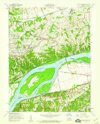
 1903 O'Fallon1903 Print · USGSSt. Charles County at the turn of the century is a labyrinth of river islands and rail lines at the confluence of the Missouri and Mississippi. Researchers can trace old river landings like Cap Au Gris Landing and family-named settlements from Moscow Mills to New Melle.5 unique versions available
 - 1931 Map of Brussels
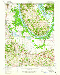
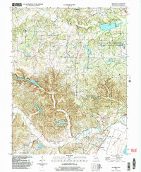
 1931 Brussels1931 Print · USGSThe peninsula between the Illinois and Mississippi Rivers is captured here in the early 1930s, showcasing a network of river landings and ridge-top settlements. Genealogists can trace family roots through numerous local landmarks like Golden Eagle, Point Pleasant, and Nichols Sch.2 unique versions available
 - 1937 Map of Weldon Spring
 1937 Weldon Spring1937 Print · USGSThe Missouri River bottoms and the rising hills of St. Charles County are shown here in the late thirties, just as industrial and parkland developments began to reshape the region. Genealogists can locate several family burial grounds like Wolf Cem and Howell Cem, alongside rural centers such as Centaur Station and Toonerville.
 - 1939 Map of Brussels, 1955 Print
 1939 Brussels1955 Print · USGSThe confluence of the Illinois and Mississippi rivers defines this pre-war era, where river landings and ferries still anchored local life. Genealogists can trace family footprints at Old Rock Ch, numerous rural schools like Black Jack Sch, and the West Point Ferry.
 - 1940 Map of Weldon Spring
 1940 Weldon Spring1940 Print · USGSThe Missouri River bottoms and St. Charles County uplands are captured here just before the Second World War. Researchers can trace family history through several rural landmarks, including Pitman Cem, Antioch Ch, and the lost river community of Hamburg.
 - 1941 Map of Troy, 1964 Print
 1941 Troy1964 Print · USGSLincoln and St. Charles Counties are captured here in the early 1940s as the rail-and-river economy shaped local life. Researchers can trace dozens of rural schoolhouses and family landmarks like Pond Fort Sch, Shiloh Ch, and the Wabash RR junction at Wentzville.2 unique versions available
 - 1943 Map of Brussels
 1943 Brussels1943 Print · USGSThe river bottomlands near the Missouri and Illinois border come alive in the 1940s, showing a network of ferries, landings, and rail lines. Trace family history through local landmarks like Lone Tree Indian Mound, Boones Lick Road, and St Peters.2 unique versions available
 - 1945 Map of Troy
 1945 Troy1945 Print · USGSLincoln and St. Charles counties are shown in the 1940s, revealing a landscape of small farming hamlets and a high density of rural schoolhouses. Researchers can trace the paths of the Wabash RR and locate ancestral landmarks like Owen Station Sch or Oak Grove Cem.2 unique versions available
 - 1948 Map of Augusta, 1963 Print
 1948 Augusta1963 Print · USGSEastern Missouri river country at mid-century shows a landscape of small farming hamlets and essential riverside industries. Genealogists and historians can locate rural landmarks like Emmaus Sanitarium, the Tavern Rock Quarry, and numerous local schools such as Wide Awake Sch.2 unique versions available
 - 1949 Map of Saint Louis
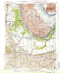
 1949 Saint Louis1949 Print · USGSGreater St. Louis and its surrounding river valleys are captured here just after the war, showing the metropolitan core and the rural Ozark fringe. Researchers can trace the sprawling rail network of the Wabash RR or locate landmarks like Meramec Caverns Airport and Scott Air Force Base.2 unique versions available
 - 1949 Map of Augusta
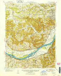 1949 Augusta1949 Print · USGSMid-century St. Charles and Franklin Counties are seen here along the Missouri River as the post-war rural landscape began to shift. Genealogists and local historians can trace family locations through numerous rural schoolhouses like Wide Awake Sch, or locate industrial sites like the Weldon Spring Ordnance Works.2 unique versions available
 - 1954 Map of O'Fallon, 1959 Print
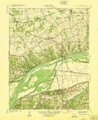
 1954 O'Fallon1959 Print · USGSSt. Charles County undergoes post-war transformation in the mid-fifties as railroads and river floodplains dictate the local geography. Researchers can trace the development of O'Fallon and St Peters, or locate landmarks like Fort Zumwalt and the St Marys Institute.4 unique versions available
 - 1954 Map of Weldon Spring, 1959 Print
 1954 Weldon Spring1959 Print · USGSMid-century St. Charles County is captured here during a period of industrial and institutional growth along the Missouri River. Genealogists can locate family landmarks like Pitman Cem and Cottleville Cem, or trace the path of Boones Lick Road and the Chicago Rock Island and Pacific railroad.5 unique versions available
 - 1954 Map of Brussels, 1960 Print
 1954 Brussels1960 Print · USGSThe confluence of the Mississippi and Illinois Rivers comes alive in the mid-1950s, showing a landscape shaped by river transport and rail. Trace the routes of the Wabash Railroad or find family history at All Saints Village and Dardenne Cem.2 unique versions available
 - 1962 Map of St. Louis
 1962 St. Louis1962 Print · USGSThe mid-century gateway to the west shows the metropolitan expansion of St Louis alongside its critical river confluences. Genealogists and historians can trace the rail corridors of the Missouri Pacific RR and settlements from Fulton to De Soto.
 - 1963 Map of St. Louis, 1970 Print
 1963 St. Louis1970 Print · USGSSt. Louis and its surrounding river valleys are captured here during the peak of mid-century suburban expansion and industrial activity. Trace the historic rail routes of the Norfolk and Western Ry or locate the St Louis Ordnance Plant and early stretches of US Highway 66.4 unique versions available
 - 1966 Map of St. Louis
 1966 St. Louis1966 Print · USGSThe St. Louis metropolitan area and its surrounding river valleys are captured here during the mid-sixties era of suburban growth and industrial strength. Genealogists and historians can trace the foundations of local communities through sites like Old Pioneer Cem, Parks College, and the Jefferson Barracks Military Reservation.
 - 1972 Map of Defiance, 1973 Print
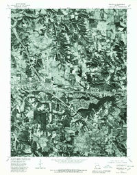
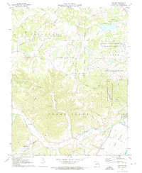 1972 Defiance1973 Print · USGSSt. Charles County in the early seventies shows a landscape balancing historic river settlements and massive post-war conservation and utility tracts. Genealogists and researchers can trace local roots at the Daniel Boone Home, Schluersburg, and the Journey Cem.3 unique versions available
 - 1972 Map of Wentzville, 1973 Print
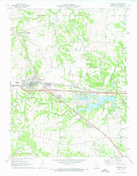 1972 Wentzville1973 Print · USGSWentzville and its surrounding St. Charles County townships are captured here during a period of suburban growth in the early seventies. Genealogists and local historians can trace family-named routes and old communities like Flint Hill, Gilmore, and the historic Weldon Spring Ch.2 unique versions available
 - 1979 Map of Wentzville, 1980 Print
 1979 Wentzville1980 Print · USGSSt. Charles County undergoes a visible transformation in the late seventies as residential growth meets rural Missouri farmland. Trace the development of Lake St Louis and examine the early footprints of Wentzville, Josephville, and Gilmore.
 - 1979 Map of Weldon Spring, 1981 Print
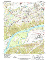
 1979 Weldon Spring1981 Print · USGSSt. Charles County in the late seventies is seen here from above, showing the area as a landscape of rural fields and new infrastructure. Trace the early layout of Weldon Spring and Cottleville along the banks of the Missouri River.
 - 1985 Map of St Louis
 1985 St Louis1985 Print · USGSThe St. Louis metropolitan area and its river confluences are captured here during a period of significant suburban expansion in the 1980s. Genealogists and historians can trace the development of older neighborhoods and landmarks like Jefferson Barracks, Cahokia Mounds State Park, and Washington University.3 unique versions available
 - 1994 Map of O'Fallon, 1995 Print
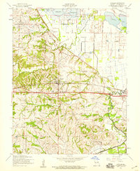
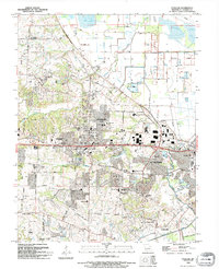 1994 O'Fallon1995 Print · USGSThe rapid expansion of O'Fallon and St. Peters is on full display in the mid-1990s as suburban growth meets established rural landmarks. Researchers can trace local history through sites like Assumption Cemetery, St Marys College, and the Waldmeister Landing Strip.
 - 1994 Map of Weldon Spring, 1995 Print
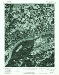
 1994 Weldon Spring1995 Print · USGSThe Missouri River corridor near Chesterfield and Weldon Spring is shown here in the mid-1990s as suburban development meets extensive wildlife preserves. Researchers can trace historic family burial sites like Pitman Cem and Wolf Cem or locate regional landmarks such as Spirit of St Louis Airport and the Katy Trail State Park.
 - 2000 Map of Defiance, 2003 Print
 2000 Defiance2003 Print · USGSSouthern St. Charles County at the turn of the millennium shows a landscape defined by the Missouri River floodplain and significant state conservation lands. Genealogists and local historians can locate Journey Cem, the village of Schluersburg, and the rural road network including Matson Hill Road.
Showing maps 1-25 of 43
Top cities near O'Fallon
- Saint Charles historical maps
- Saint Peters historical maps
- Chesterfield historical maps
- Wentzville historical maps
- Wildwood historical maps
- Ballwin historical maps
See more
Frequently asked questions
- What are the different types of historical maps available for O'Fallon?
- What is the oldest map of O'Fallon?
- Where can I purchase historical maps of O'Fallon for my home or office?
- Where can I download high-res historical maps of O'Fallon?
- Are there historical topographic maps available for O'Fallon?
- Is there historical aerial imagery available for O'Fallon?
- Where are historical maps of O'Fallon sourced from?