2020s Maps of Schuyler County, Missouri
Explore 12 historic maps of Schuyler County from the 2020s. These maps offer a rare glimpse into what life looked like during the 2020s — showing old roads, neighborhoods, homes, and landmarks that have changed or disappeared over time.
Whether you're researching your family's past, planning a metal detecting trip, or studying how Schuyler County's landscape evolved across the 2020s, these high-resolution maps are a powerful tool for exploring the history of this region.
- Focus on a specific era: All maps on this page are from the 2020s, giving you a focused view of this time period.
- See what’s changed: Compare century-old streets, trails, and buildings to today's modern landscape using overlays and satellite layers.
- Research with precision: Use these maps for genealogy, historical research, land use analysis, or educational projects.
- View, download, or print: Maps are fully viewable online in high resolution, and can be downloaded or printed for your own records.
Start exploring Schuyler County's history through authentic maps from the 2020s. This is your window into the past.
Schuyler County, MO maps
(12)- 2021 Map of Coatsville, 2021 Print
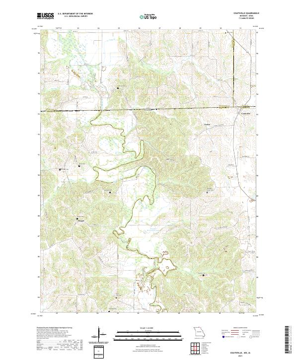 2021 Coatsville2021 Print · USGSThe Missouri-Iowa border comes to life in this survey of the northern Schuyler County countryside. Genealogists can trace family roots through a high concentration of burial sites, including Pleasant Grove Cem, Bratcher Cem, and Dean Cem.
 - 2021 Map of Downing NW, 2021 Print
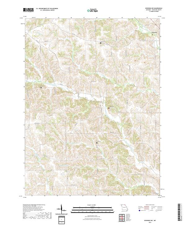 2021 Downing NW2021 Print · USGSSchuyler County's agricultural landscape is seen here in the 2020s, centered on the community of Downing and the winding river forks. Researchers can locate family heritage sites like Webster Cem and Brushy Cem or trace the drainage of the N Fork Middle Fabius River.
 - 2021 Map of Kilwinning, 2021 Print
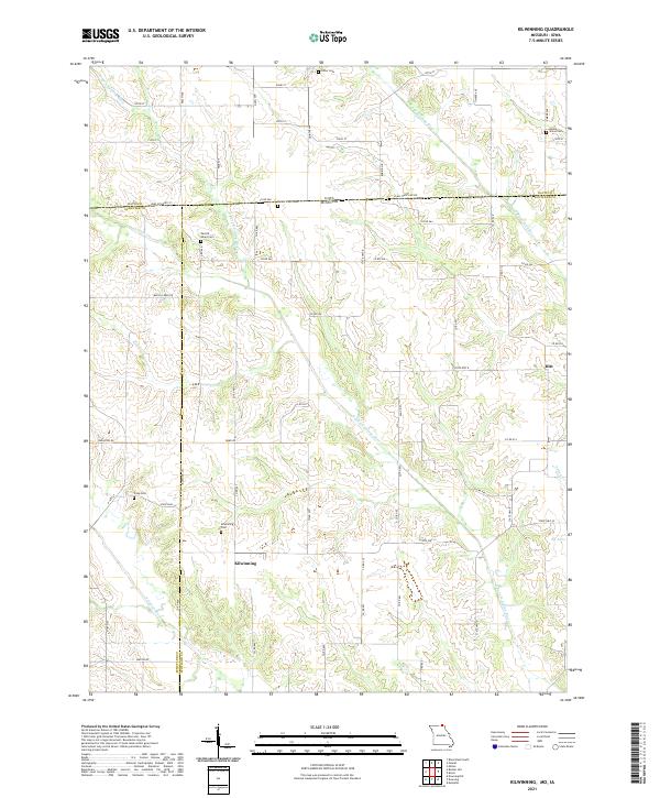 2021 Kilwinning2021 Print · USGSThe borderlands of Missouri and Iowa come into focus during the early twenty-first century, showing a landscape of quiet farming towns and river valleys. Researchers can trace ancestral roots through several rural burial sites like Lister Cem and Round Grove Cem near the crossroads of Hitt.
 - 2021 Map of Willmathsville, 2021 Print
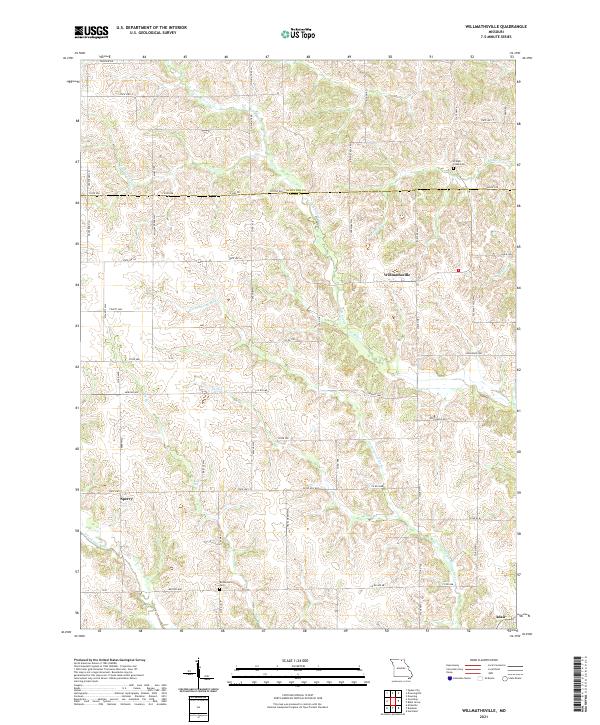 2021 Willmathsville2021 Print · USGSThe rural borderlands of Adair and Schuyler counties are captured here in the early 2020s, revealing a landscape deeply tied to the Fabius and Salt River watersheds. Researchers can pinpoint ancestral sites like Richardson Cem and Bridge Creek Cem or trace the early paths of Willmathsville and Sperry.
 - 2021 Map of Downing, 2021 Print
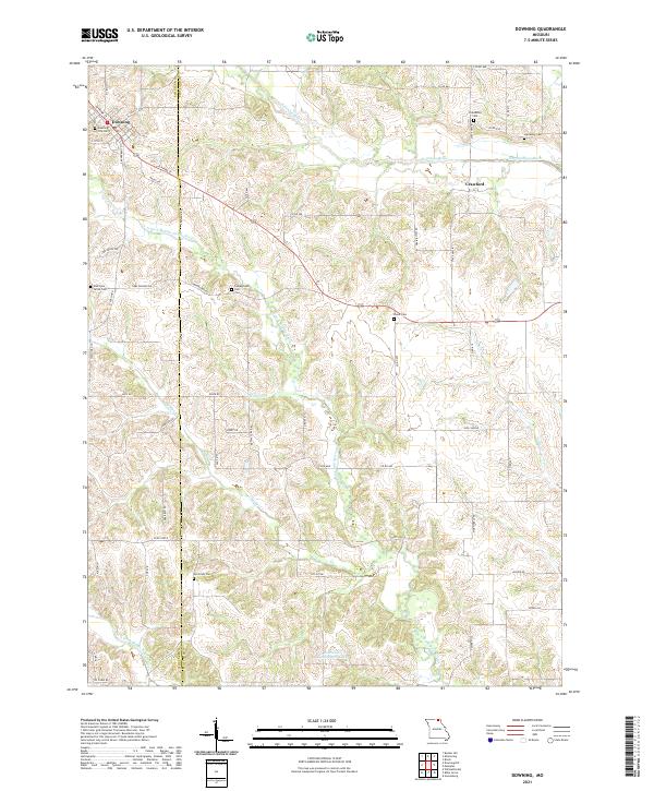 2021 Downing2021 Print · USGSSchuyler and Scotland counties appear here during the early 2020s, showing a well-established rural landscape shaped by the Fabius River forks. Genealogists can trace family heritage through a high density of sites like Friendship Cem, Mc Grady Cem, and Campground Cem.
 - 2021 Map of Livonia, 2021 Print
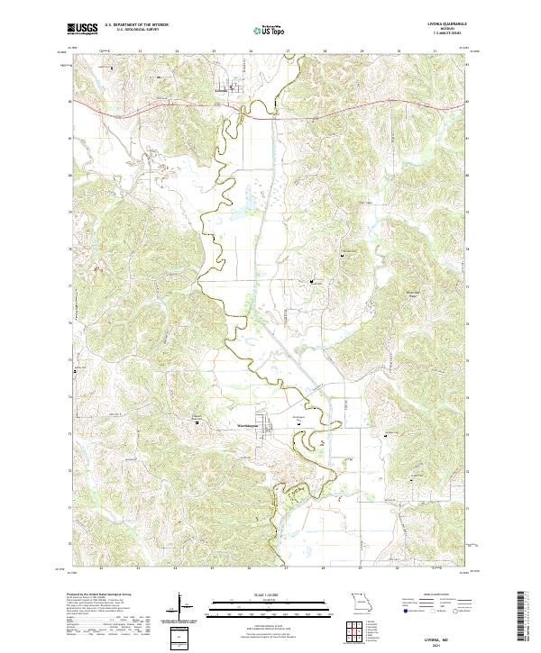 2021 Livonia2021 Print · USGSUpper Missouri's river hills are captured here in the early twenty-first century, centered on the historic settlements of Livonia and Worthington. Researchers can locate numerous local burial sites like Jimtown Cem and Gillespie Cem while tracing the winding path of the Chariton River.
 - 2021 Map of Queen City, 2021 Print
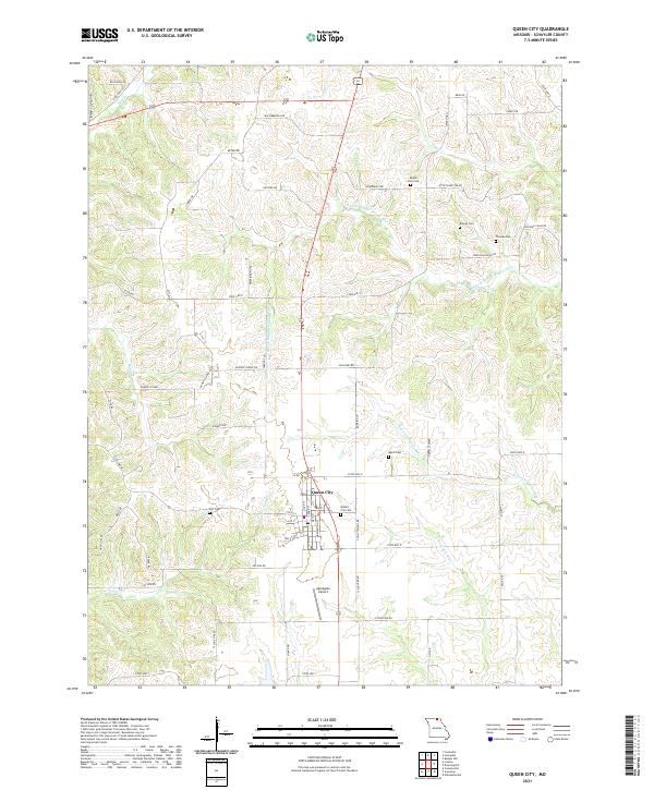 2021 Queen City2021 Print · USGSQueen City and the rural uplands of Schuyler County are shown in this contemporary study of Missouri's northern landscape. Genealogists can trace family heritage at Queen City Cem, Barnes Cem, and Thomas Cem near the winding river forks.
 - 2021 Map of Greentop, 2021 Print
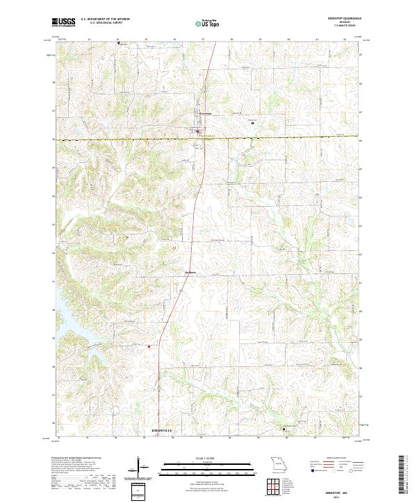 2021 Greentop2021 Print · USGSGreentop and the northern reaches of Adair County are captured here in the early 2020s, showing a landscape of rural farmsteads and creek-fed valleys. Genealogists and local historians can trace family ties through Fugate Cem or follow the course of the N Fork Salt River and Little Hazel Creek.
 - 2021 Map of Bunker Hill, 2021 Print
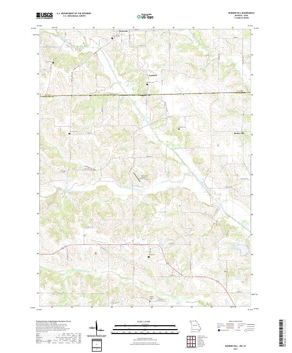 2021 Bunker Hill2021 Print · USGSSchuyler County, Missouri, sits along the Iowa border in this recent survey of a rural landscape defined by the Fabius River. Researchers can locate numerous local landmarks including New Zion Cem, Walker Chapel Cem, and Punkin Hill.
 - 2021 Map of Connelsville, 2021 Print
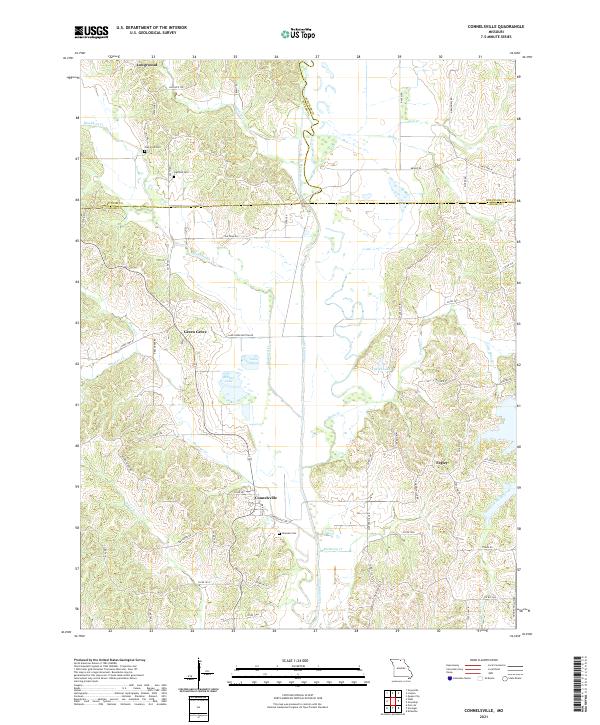 2021 Connelsville2021 Print · USGSThe Chariton River valley in northern Missouri is shown here in the contemporary era as it winds through Adair and Putnam counties. Researchers can trace rural lineages through the Nineveh Cem, Hatfield Cem, and the old settlement at Connelsville.
 - 2021 Map of Lancaster, 2021 Print
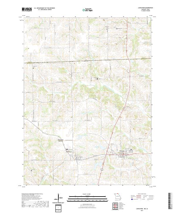 2021 Lancaster2021 Print · USGSThe Missouri-Iowa borderlands near Lancaster come into focus here during the early twenty-first century. Genealogists and local historians can trace family ties through several rural burial grounds, including Glenwood Cem and Biles Cem, alongside the prominent Schuyler County Courthouse.
 - 2021 Map of Bible Grove, 2021 Print
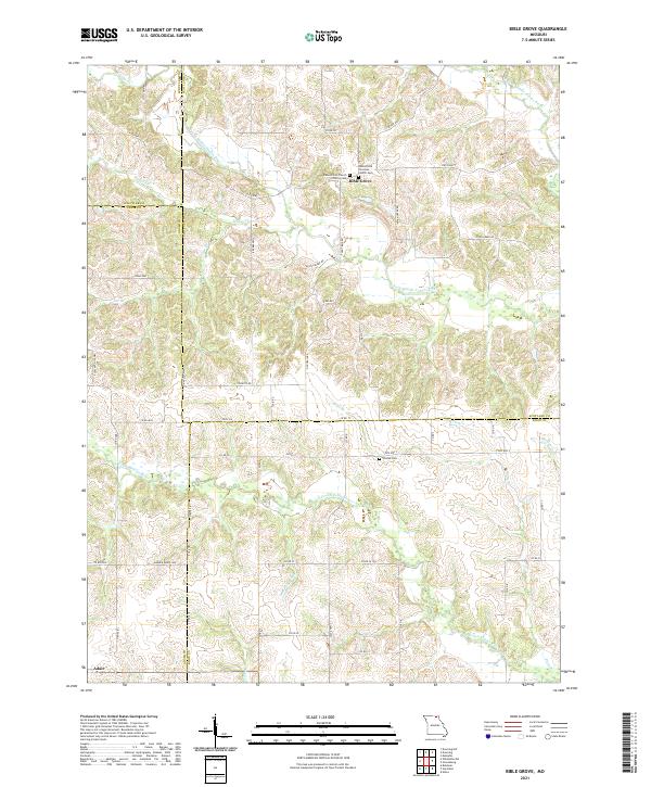 2021 Bible Grove2021 Print · USGSThe rural borders of Scotland and Adair counties come into focus in this contemporary survey of the Missouri uplands. Genealogists can locate family sites at Bible Grove Christian Church Cem or trace the winding S Fork Middle Fabius River.
End of results
Showing maps 1-12 of 12
Top cities of Schuyler County
Frequently asked questions
- What are the different types of historical maps available for Schuyler County?
- What is the oldest map of Schuyler County?
- Where can I purchase historical maps of Schuyler County for my home or office?
- Where can I download high-res historical maps of Schuyler County?
- Are there historical topographic maps available for Schuyler County?
- Is there historical aerial imagery available for Schuyler County?
- Where are historical maps of Schuyler County sourced from?