Old Maps of Shelby County, Missouri for Genealogy
Trace your family roots with 97 historic maps of Shelby County. These high-res maps reveal old neighborhoods, homesites, landmarks, and streets — helping you uncover where your ancestors lived and how the area evolved over time.
- Explore historic neighborhoods: Identify where your relatives may have lived in the 1800s or 1900s.
- Compare maps over time: Trace the changes in streets, buildings, and landmarks for multi-generational research.
- Perfect for genealogy & ancestry research: Used by family historians and researchers to map out lineage and migration.
These maps are an incredible resource for exploring your personal connection to Shelby County's past.
Shelby County, MO maps
(97)- 1903 Map of Palmyra
 1903 Palmyra1903 Print · USGSNortheast Missouri at the start of the twentieth century was a landscape of river-valley farming and critical rail junctions. Researchers can trace early rural life through features like Sharp Mills, St. Pauls Ch., and the crossing of the Hannibal and St. Joseph R. R.2 unique versions available
 - 1908 Map of Atlanta
 1908 Atlanta1908 Print · USGSMacon County is characterized by its early twentieth-century rail and river networks, anchored by the WABASH RR. Genealogists can trace family roots through numerous rural landmarks like Sue City, Mt Tabor Church, and La Porte School.2 unique versions available
 - 1908 Map of Macon, 1965 Print
 1908 Macon1965 Print · USGSMacon County and its neighbors are seen here in the early twentieth century, as rail lines and river forks defined the local economy. Genealogists can locate family landmarks among dozens of rural schoolhouses and churches like Bethlehem Church and Prairie Dale School.
 - 1910 Map of Macon
 1910 Macon1910 Print · USGSMacon County's rural landscape is captured here in the decade before the Great War, showing a territory defined by railroad towns and isolated river mills. Genealogists can trace family roots through numerous country landmarks like Blees Military Academy, Levick Mill, and the Bear Thicket School.
 - 1948 Map of Quincy
 1948 Quincy1948 Print · USGSThe Mississippi and Illinois River valleys are captured at a post-war crossroads as rail and river travel met the expanding highway system. Genealogists can trace family settlements from Quincy to Hannibal and smaller towns like Vandalia and Jerseyville.2 unique versions available
 - 1953 Map of Moberly
 1953 Moberly1953 Print · USGSMid-century north-central Missouri is documented here as a bustling intersection of river commerce and heavy rail. Researchers can trace historic family-named landmarks and transport hubs from the Missouri River corridor to the rail yards of Moberly, Chillicothe, and Macon.
 - 1954 Map of Moberly, 1969 Print
 1954 Moberly1969 Print · USGSMid-century Missouri is captured here during a period of transition for its river towns and rail hubs. Genealogists and historians can trace the paths of the Wabash railroad through Moberly or explore the riverside layout of Lexington and Brunswick.3 unique versions available
 - 1956 Map of Quincy, 1967 Print
 1956 Quincy1967 Print · USGSThe river and rail corridors of the Illinois-Missouri border are documented here during the mid-1950s. Researchers can trace historic river landings and regional transit hubs from Quincy and Hannibal to smaller settlements like Meredosia and Roodhouse.3 unique versions available
 - 1957 Map of Moberly
 1957 Moberly1957 Print · USGSNorth-central Missouri in the late nineteen-forties and fifties remains a landscape defined by its great rivers and a dense network of steam and diesel rail lines. Genealogists and historians can trace the paths of the Wabash RR and Santa Fe RR through historic junctions like Moberly, Brookfield, and Macon.
 - 1958 Map of Lentner, 1960 Print
 1958 Lentner1960 Print · USGSShelby and Monroe counties are captured here in the late fifties, centered on the railroad hub of Lentner. Genealogists and researchers can trace the locations of the Oak Ridge Sch, the Fairview Sch, and the rural community of Maud.2 unique versions available
 - 1959 Map of Shelbina, 1960 Print
 1959 Shelbina1960 Print · USGSShelby County in the late fifties is defined by the busy rail corridor of the Chicago Burlington and Quincy and the growth of Shelbina. Genealogists and local historians can locate rural landmarks like Lowman Chapel, Moreman Sch, and several old burial grounds.2 unique versions available
 - 1959 Map of Lakenan, 1960 Print
 1959 Lakenan1960 Print · USGSShelby and Monroe counties appear here in the late fifties, showcasing a rural Missouri landscape defined by meandering river forks and early school districts. Genealogists can trace family connections through sites like Beatley Sch, Givan Sch, and Hunnewell Cem.3 unique versions available
 - 1959 Map of Woodlawn, 1960 Print
 1959 Woodlawn1960 Print · USGSMonroe and Shelby Counties are captured here in the late fifties, showing a rural landscape defined by the winding Middle Fork Salt River. Genealogists can locate family-named sites like Atterberry Cem, Milner Cem, and Oak Grove Ch.
 - 1959 Map of Hunnewell, 1961 Print
 1959 Hunnewell1961 Print · USGSThe Hunnewell area at the end of the fifties reveals a landscape shaped by the Chicago Burlington and Quincy railroad and the newly established Hunnewell Lake. Genealogists can locate family landmarks like the How Cem, Union Chapel, and several local schoolhouses including Buckman Sch.2 unique versions available
 - 1960 Map of Moberly
 1960 Moberly1960 Print · USGSCentral Missouri comes alive in the mid-twentieth century as a bustling network of river towns and significant rail corridors. Genealogists and historians can trace the paths of the Wabash RR through Moberly or explore the riverfronts of Lexington and Brunswick.
 - 1963 Map of Leonard, 1965 Print
 1963 Leonard1965 Print · USGSNortheast Missouri farm life is preserved here during the early sixties, showing the rural communities along the Salt River. Genealogists can locate several family burial sites like Antioch Cemetery and trace the road network around Leonard and Cherry Box.
 - 1964 Map of Hagers Grove, 1965 Print
 1964 Hagers Grove1965 Print · USGSShelby County farmland and the river valleys of the North Fork Salt River are captured here in the mid-1960s. Genealogists can trace rural roots through landmarks like St Michael Ch Cem, Hagers Grove, and the Bacon Chapel.
 - 1964 Map of Emden, 1965 Print
 1964 Emden1965 Print · USGSMarion and Shelby counties are captured in the mid-1960s, showing a traditional Missouri landscape of river-bottom farms and quiet crossroads. Researchers can locate the Emden Sch, trace the winding North River, and find family sites near Andrew Chapel and Ebenezer Cem.2 unique versions available
 - 1964 Map of Newark, 1965 Print
 1964 Newark1965 Print · USGSNorthern Missouri farm country and the winding South Fabius River define this area in the mid-1960s. Genealogists can locate family landmarks like the Nelson Cem, Shilo Ch, and the small settlement of Steffenville.
 - 1964 Map of Burksville, 1965 Print
 1964 Burksville1965 Print · USGSThe rural landscape of Shelby County is shown in the mid-sixties, dominated by winding river forks and country congregations. Genealogists can locate family sites near Old Brick Ch, Fairview Cem, and the small settlement of Burksville.
 - 1964 Map of Bethel, 1965 Print
 1964 Bethel1965 Print · USGSNorthern Shelby County is documented here in the mid-1960s, showing the agricultural landscape around the Little Fabius River. Genealogists can locate several family cemeteries and churches, including Hebron Cem and Mount Salem Ch.2 unique versions available
 - 1964 Map of Shelbyville, 1965 Print
 1964 Shelbyville1965 Print · USGSShelbyville and the surrounding rural townships of Shelby County are captured here in the mid-1960s. Genealogists and local historians can trace family locations near Forest Grove Cem, the settlement of Kirby, and the original campus of North Shelby High Sch.2 unique versions available
 - 1964 Map of Nelsonville, 1965 Print
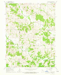 1964 Nelsonville1965 Print · USGSMarion County farming communities thrived in the mid-1960s along the winding banks of the South Fabius River. Genealogists and local historians can trace family locations near the settlement of Nelsonville and rural landmarks like Asbury Chapel or the Methodist Cem.
 - 1971 Map of Clarence, 1972 Print
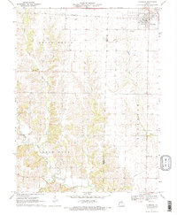 1971 Clarence1972 Print · USGSShelby and Macon counties are shown in the early seventies as small farming communities thrived along the Burlington Northern rail line. Genealogists can locate family landmarks such as Bethlehem Cem, Graves Chapel, and the settlement of Enterprise.2 unique versions available
 - 1971 Map of Duncans Bridge, 1972 Print
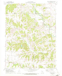 1971 Duncans Bridge1972 Print · USGSNorth-central Missouri's river valleys and county corners are preserved here in the early seventies, just as the local rural landscape was beginning to shift. Genealogists and historians can trace the precise locations of Levick Mill, Salem Ch, and Duncans Bridge.
Showing maps 1-25 of 97
Top cities of Shelby County
- Shelbina historical maps
- Clarence historical maps
- Shelbyville historical maps
- Hunnewell historical maps
- Bethel historical maps
- Leonard historical maps
Frequently asked questions
- What are the different types of historical maps available for Shelby County?
- What is the oldest map of Shelby County?
- Where can I purchase historical maps of Shelby County for my home or office?
- Where can I download high-res historical maps of Shelby County?
- Are there historical topographic maps available for Shelby County?
- Is there historical aerial imagery available for Shelby County?
- Where are historical maps of Shelby County sourced from?