Old Maps of Lowry City, Missouri for Genealogy
Trace your family roots with 15 historic maps of Lowry City. These high-res maps reveal old neighborhoods, homesites, landmarks, and streets — helping you uncover where your ancestors lived and how the area evolved over time.
- Explore historic neighborhoods: Identify where your relatives may have lived in the 1800s or 1900s.
- Compare maps over time: Trace the changes in streets, buildings, and landmarks for multi-generational research.
- Perfect for genealogy & ancestry research: Used by family historians and researchers to map out lineage and migration.
These maps are an incredible resource for exploring your personal connection to Lowry City's past.
Lowry City, MO maps
(15)- 1887 Map of Clinton
 1887 Clinton1887 Print · USGSWest-Central Missouri is captured during a period of rapid railroad expansion in the 1880s, centered on the growing junction at Clinton. Researchers can trace early township developments and find established settlements like Chalk Level, Iconium, and Brownington along the winding Osage River.
 - 1894 Map of Clinton
 1894 Clinton1894 Print · USGSHenry County and St. Clair County thrive during the peak of the railroad era in the 1890s. Genealogists and historians can trace the early rail stops at Clinton and Brownington, or locate vanished post offices like Chalk Level and Huntingdale.4 unique versions available
 - 1941 Map of Lowry City, 1965 Print
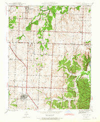 1941 Lowry City1965 Print · USGSLowry City and Brownington are captured at the start of the 1940s, showing a Missouri landscape defined by the St Louis San Francisco RR and family farms. Genealogists can locate numerous rural schools and landmarks like Diamond Point Sch, Mount Zion Ch, and Park Grove Cem.3 unique versions available
 - 1945 Map of Lowry City
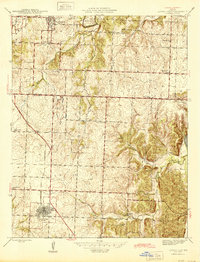 1945 Lowry City1945 Print · USGSMissouri's rural heartland comes alive in the mid-forties, showing the dense network of schools and churches between the Grand River and the rail lines. Genealogists can trace family roots through several landmarks like Denny Cem, Park Grove Ch, and the St Louis San Francisco railroad.
 - 1947 Map of Jefferson City, 1949 Print
 1947 Jefferson City1949 Print · USGSCentral Missouri and the northern Ozarks come into focus in this late 1940s survey of the river-and-rail landscape. Genealogists and historians can trace the growth of Jefferson City and Sedalia or locate family roots near Bagnell Dam and the Lake of the Ozarks.
 - 1954 Map of Jefferson City
 1954 Jefferson City1954 Print · USGSCentral Missouri in the early postwar years showcases a landscape defined by the winding Lake of the Ozarks and the state capital at Jefferson City. Researchers can trace the mid-century rail networks of the Missouri Pacific RR and locate rural communities like Tuscumbia, St Elizabeth, and St Anthony.2 unique versions available
 - 1955 Map of Jefferson City, 1967 Print
 1955 Jefferson City1967 Print · USGSCentral Missouri in the mid-fifties is defined by the winding Missouri River and the expanding reach of Lake of the Ozarks. Researchers can trace the rail corridors of the Missouri Pacific or locate the early footprint of Whiteman AFB and Jefferson City.4 unique versions available
 - 1958 Map of Jefferson City
 1958 Jefferson City1958 Print · USGSCentral Missouri in the late fifties shows a region transforming through the growth of Whiteman Air Force Base and the Lake of the Ozarks. Researchers can trace rail lines like the Missouri Pacific or find family roots at Enloe Cemetery and Mount Pleasant Cem.
 - 1959 Map of Jefferson City
 1959 Jefferson City1959 Print · USGSCentral Missouri is captured during the mid-fifties as the river economy and rail networks like the Missouri Pacific met the rise of the automobile. Local researchers can trace family landmarks and rural infrastructure from the Lake of the Ozarks up to Providence Cemetery and Knob Noster State Park.
 - 1983 Map of Harry S Truman Reservoir, 1984 Print
 1983 Harry S Truman Reservoir1984 Print · USGSBenton and Henry counties center on the vast Harry S Truman Reservoir in the early 1980s as the landscape adapted to its new shoreline. Genealogists and historians can trace old river crossings like Bledsoe Ferry, local landmarks like Mt Zion Ch, and unique settlements such as Tightwad.
 - 1991 Map of Lowry City, 1992 Print
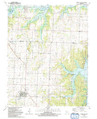 1991 Lowry City1992 Print · USGSThe shorelines of the Truman Reservoir met the rolling Missouri prairie in the early nineties, reshaping the area around Lowry City and Brownington. Genealogists and historians can trace defunct transport lines like the Old Railroad Grade and locate local landmarks such as Park Grove Ch and Maplewood Cemetery.
 - 2011 Map of Lowry City, 2011 Print
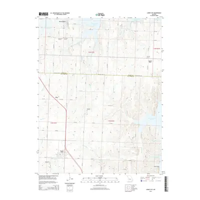
 2011 Lowry City2011 Print · USGSCovers Lowry City, including Brownington, Chloe, and other nearby areas
 - 2014 Map of Lowry City, 2014 Print
 2014 Lowry City2014 Print · USGSCovers Lowry City, including Brownington, Chloe, and other nearby areas
 - 2017 Map of Lowry City, 2017 Print
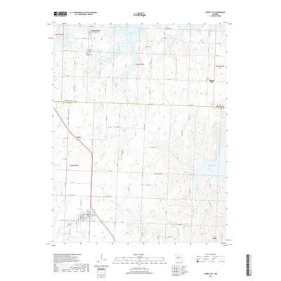 2017 Lowry City2017 Print · USGSCovers Lowry City, including Brownington, Chloe, and other nearby areas
 - 2021 Map of Lowry City, 2021 Print
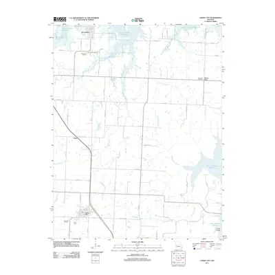
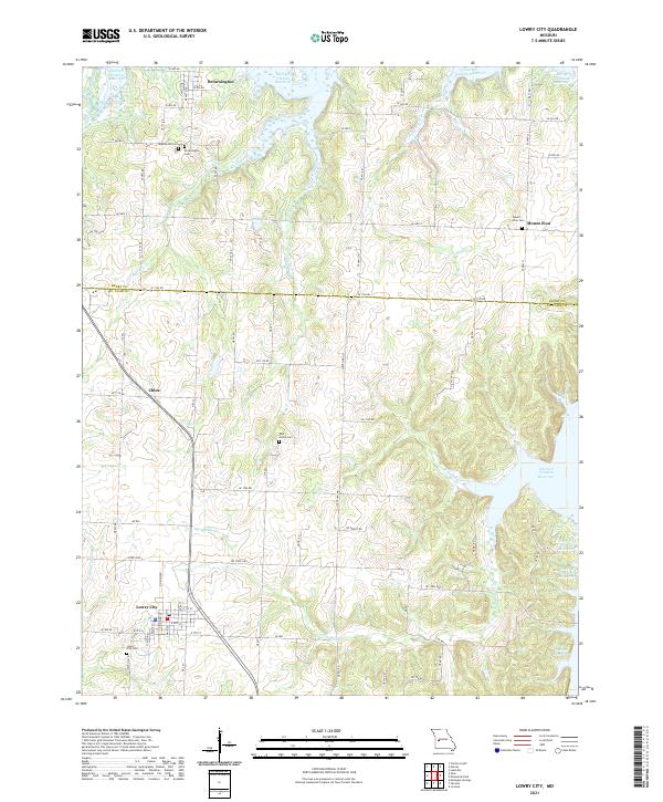 2021 Lowry City2021 Print · USGSThe transition from traditional creek-bottom farmland to the shores of the reservoir is captured here in the early twenty-first century. Researchers can locate several historic burial sites, including Park Grove and Maplewood Cem, alongside the small communities of Chloe and Brownington.
End of results
Showing maps 1-15 of 15
Top cities near Lowry City
- Clinton historical maps
- Leesville historical maps
- Osceola historical maps
- Deepwater historical maps
- Collins historical maps
- Brownington historical maps
See more
Frequently asked questions
- What are the different types of historical maps available for Lowry City?
- What is the oldest map of Lowry City?
- Where can I purchase historical maps of Lowry City for my home or office?
- Where can I download high-res historical maps of Lowry City?
- Are there historical topographic maps available for Lowry City?
- Is there historical aerial imagery available for Lowry City?
- Where are historical maps of Lowry City sourced from?