Old Maps of Bloomfield, Missouri for Academic Research
Study the evolution of Bloomfield with 16 high-resolution historic maps. Whether you're teaching, researching, or modeling changes in land use, these maps provide essential visual documentation of urban, environmental, and geographic change.
- Analyze long-term change: Track patterns in development, transportation, and natural features.
- Ideal for environmental or urban studies: Support academic projects with primary historical map data.
- Use in the classroom or lab: Educators and researchers rely on these maps to bring historical context to life.
These maps are a powerful tool for teaching, research, and visualizing how Bloomfield has changed over the decades.
Bloomfield, MO maps
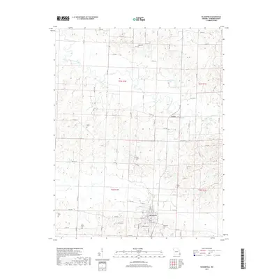
(16)- 1934 Map of Bloomfield
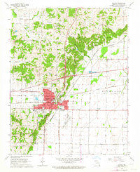
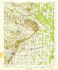 1934 Bloomfield1934 Print · USGSStoddard County in the early 1930s shows a landscape defined by industrial drainage projects and a robust network of rural schools. Genealogists can trace family footprints at Dowdy Cem or identify old community centers like Walker Ch and Philadelphia Ch.3 unique versions available
 - 1939 Map of Bloomfield
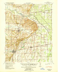 1939 Bloomfield1939 Print · USGSBefore the full consolidation of modern school districts, this 1930s landscape was dotted with local anchors like Gravel Hill Sch and Beech Grove Sch. You can trace the complex drainage networks of Ditch No 33 and Panther Creek that transformed these Missouri bottomlands near Bloomfield.
 - 1949 Map of Bloomfield, 1958 Print
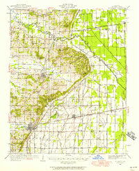 1949 Bloomfield1958 Print · USGSStoddard County is documented here during the post-war years as its agricultural drainage systems and rail networks reached their peak. Local historians can trace family roots through numerous rural landmarks like Dowdy Cem, Holly Ch, and the Walnut Ridge Sch.
 - 1956 Map of Dyersburg, 1960 Print
 1956 Dyersburg1960 Print · USGSThe Four Rivers region comes alive in the mid-fifties, capturing the intricate borderlands of Tennessee, Kentucky, and Missouri. Genealogists and historians can trace the rail-and-river networks connecting Dyersburg, Caruthersville, and the shoreline of Reelfoot Lake.4 unique versions available
 - 1963 Map of Bloomfield, 1964 Print
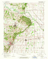
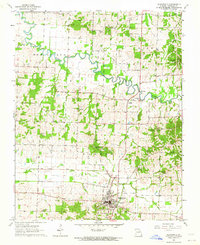 1963 Bloomfield1964 Print · USGSBloomfield and the surrounding Missouri lowlands appear here in the early sixties as a landscape of rural cemeteries, country churches, and evolving drainage systems. Researchers can trace the path of the Old Railroad Grade and locate family sites like Walker Cem or the Philadelphia Ch.3 unique versions available
 - 1963 Map of Dexter, 1964 Print
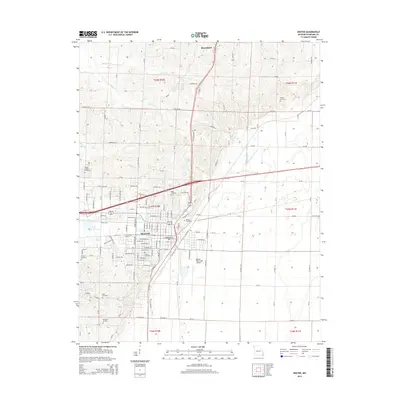
 1963 Dexter1964 Print · USGSThe town of Dexter was a bustling rail and regional hub in the early 1960s. Genealogists and local historians can trace family sites from Gilead Hills Ch to Sadlers Cem and the Dexter Municipal Airport.3 unique versions available
 - 1963 Map of Bloomfield, 1967 Print
 1963 Bloomfield1967 Print · USGSStoddard County in the early sixties showcases the managed landscapes of the Missouri Bootheel as the area transitioned into an agricultural powerhouse. Genealogists and historians can trace family locations near Dexter, identify rural landmarks like St Joe Ch, or locate the St Louis Southwestern Railroad tracks.
 - 1985 Map of Sikeston, 1986 Print
 1985 Sikeston1986 Print · USGSThe Missouri Bootheel and the four-state river convergence are captured in the mid-eighties as the modern agricultural and rail networks matured. Researchers can locate regional landmarks like the Towosahgy State Historic Site, Oak Grove Cem, and towns along the St Louis Southwestern Railroad.2 unique versions available
 - 2012 Map of Bloomfield, 2012 Print
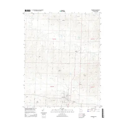
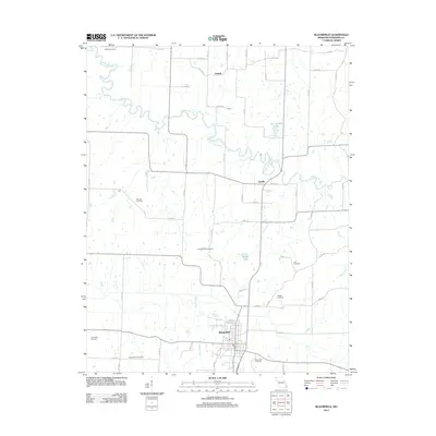 2012 Bloomfield2012 Print · USGSCovers Bloomfield, including Aquilla, Zadock, and other nearby areas
 - 2012 Map of Dexter, 2012 Print
 2012 Dexter2012 Print · USGSCovers Bloomfield, including Dexter, Stoddard County, and other nearby areas
 - 2015 Map of Bloomfield, 2015 Print
 2015 Bloomfield2015 Print · USGSCovers Bloomfield, including Aquilla, Zadock, and other nearby areas
 - 2015 Map of Dexter, 2015 Print
 2015 Dexter2015 Print · USGSCovers Bloomfield, including Dexter, Stoddard County, and other nearby areas
 - 2017 Map of Bloomfield, 2017 Print
 2017 Bloomfield2017 Print · USGSCovers Bloomfield, including Aquilla, Zadock, and other nearby areas
 - 2017 Map of Dexter, 2017 Print
 2017 Dexter2017 Print · USGSCovers Bloomfield, including Dexter, Stoddard County, and other nearby areas
 - 2021 Map of Bloomfield, 2021 Print
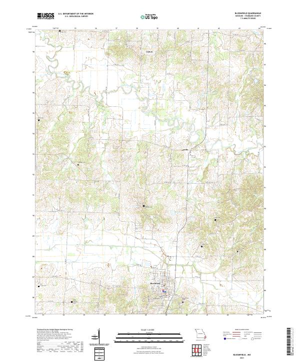 2021 Bloomfield2021 Print · USGSStoddard County's rolling river bottoms and rural uplands come into focus in this contemporary Missouri survey. Genealogists and historians can trace family locations near Bloomfield Cem, North Antioch Cem, and the small community of Zadock.
 - 2021 Map of Dexter, 2021 Print
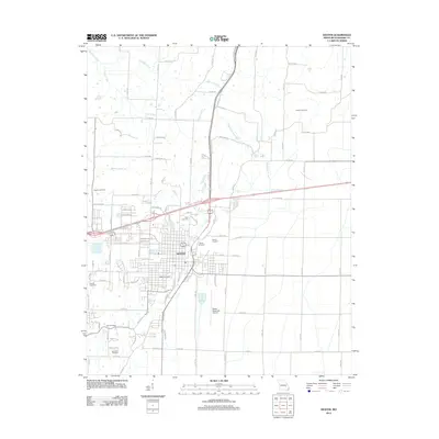
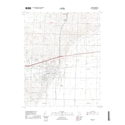
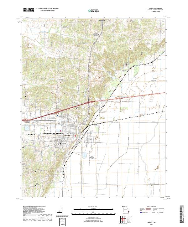 2021 Dexter2021 Print · USGSStoddard County's agricultural heartland and the growing city of Dexter are shown here in the 2020s. Genealogists can locate family burial grounds like Kinder Cem and Hagy Cem or study the grounds of the Missouri State Veterans Cem.
End of results
Showing maps 1-16 of 16
Top cities near Bloomfield
- Dexter historical maps
- Bernie historical maps
- Advance historical maps
- Puxico historical maps
- Essex historical maps
- Bell City historical maps
See more
Frequently asked questions
- What are the different types of historical maps available for Bloomfield?
- What is the oldest map of Bloomfield?
- Where can I purchase historical maps of Bloomfield for my home or office?
- Where can I download high-res historical maps of Bloomfield?
- Are there historical topographic maps available for Bloomfield?
- Is there historical aerial imagery available for Bloomfield?
- Where are historical maps of Bloomfield sourced from?