Old Maps of Sullivan, Missouri for Genealogy
Trace your family roots with 27 historic maps of Sullivan. These high-res maps reveal old neighborhoods, homesites, landmarks, and streets — helping you uncover where your ancestors lived and how the area evolved over time.
- Explore historic neighborhoods: Identify where your relatives may have lived in the 1800s or 1900s.
- Compare maps over time: Trace the changes in streets, buildings, and landmarks for multi-generational research.
- Perfect for genealogy & ancestry research: Used by family historians and researchers to map out lineage and migration.
These maps are an incredible resource for exploring your personal connection to Sullivan's past.
Sullivan, MO maps
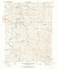
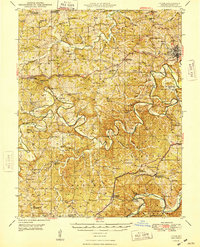
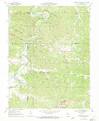
(27)- 1903 Map of Sullivan
 1903 Sullivan1903 Print · USGSFranklin and Gasconade counties are captured here at the close of the nineteenth century, as the St. Louis and San Francisco railroad spurred growth in timber and mining. Genealogists can trace early homesteads and river crossings like Hughes Ford, Spring Bluff, and Anthonies Mill.3 unique versions available
 - 1934 Map of Meramec State Park, 1962 Print
 1934 Meramec State Park1962 Print · USGSThe Meramec River valley in the mid-1930s reveals a region transitioning from isolated settlements to a destination for early 20th-century tourism. Genealogists and historians can trace defunct school districts like Pea Ridge Sch and Zion Sch, locate the CCC Camp, or find old river crossings at Hamilton Ford.2 unique versions available
 - 1937 Map of Meramec State Park
 1937 Meramec State Park1937 Print · USGSThe Missouri Ozarks are captured here in the mid-1930s, showing the early infrastructure of Meramec State Park and its surrounding river communities. Genealogists and hikers can trace old homesteads and local landmarks like Reedville Ch, the CCC Camp, and the historic Sappington Bridge river crossing.
 - 1946 Map of Union, 1958 Print
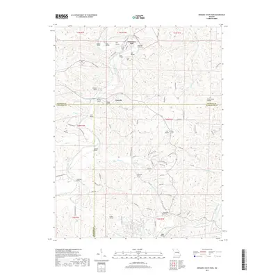
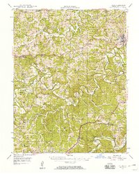 1946 Union1958 Print · USGSFranklin County just after the war shows a landscape of river-valley settlements and rural school districts. Genealogists and researchers can trace family landmarks like Moser Mill, locate the Old Acid Mine, or find early sites such as Benson Tourist City and Morrellton PO.2 unique versions available
 - 1947 Map of Sullivan
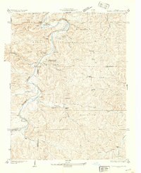
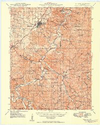
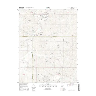
 1947 Sullivan1947 Print · USGSIn the Missouri Ozarks during the late 1940s, this area shows the growth of river tourism and the railroad corridor. You can trace family roots through numerous local landmarks like Anthonies Mill, Pea Ridge Sch, and Reeds Defeat Cem.3 unique versions available
 - 1948 Map of Union
 1948 Union1948 Print · USGSFranklin County in the late nineteen-forties centers on the river bends of the Meramec and Bourbeuse. Local historians can trace old homesteads via the Moser Mill, the Old Acid Mine, and numerous fords like Smith Ford.
 - 1949 Map of Saint Louis
 1949 Saint Louis1949 Print · USGSGreater St. Louis and its surrounding river valleys are captured here just after the war, showing the metropolitan core and the rural Ozark fringe. Researchers can trace the sprawling rail network of the Wabash RR or locate landmarks like Meramec Caverns Airport and Scott Air Force Base.2 unique versions available
 - 1949 Map of Sullivan
 1949 Sullivan1949 Print · USGSSullivan and Bourbon emerge as key railroad towns in the northern Ozarks during this post-war era. Researchers can locate numerous vanished rural schools like Reeds Defeat Sch and explore the historic cave network including Onondaga Cave and Fisher Cave.
 - 1962 Map of St. Louis
 1962 St. Louis1962 Print · USGSThe mid-century gateway to the west shows the metropolitan expansion of St Louis alongside its critical river confluences. Genealogists and historians can trace the rail corridors of the Missouri Pacific RR and settlements from Fulton to De Soto.
 - 1963 Map of St. Louis, 1970 Print
 1963 St. Louis1970 Print · USGSSt. Louis and its surrounding river valleys are captured here during the peak of mid-century suburban expansion and industrial activity. Trace the historic rail routes of the Norfolk and Western Ry or locate the St Louis Ordnance Plant and early stretches of US Highway 66.4 unique versions available
 - 1966 Map of St. Louis
 1966 St. Louis1966 Print · USGSThe St. Louis metropolitan area and its surrounding river valleys are captured here during the mid-sixties era of suburban growth and industrial strength. Genealogists and historians can trace the foundations of local communities through sites like Old Pioneer Cem, Parks College, and the Jefferson Barracks Military Reservation.
 - 1966 Map of Spring Bluff, 1967 Print
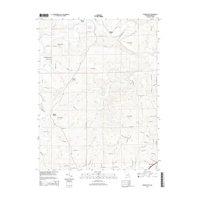
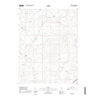
 1966 Spring Bluff1967 Print · USGSFranklin County in the mid-sixties reveals a river-driven landscape where the winding Bourbeuse River dictated the placement of historic crossings. Genealogists and local historians can trace family ties at Laubinger Memorial Cem, School No 15, and the Rueppele Mine.3 unique versions available
 - 1969 Map of Sullivan, 1971 Print
 1969 Sullivan1971 Print · USGSSullivan and Bourbon sit along the St Louis - San Francisco rail line during a period of mid-century growth. Genealogists can locate family landmarks like Turner Cem, Wesleyan Ch, and the old settlements of Oak Grove and St Cloud.2 unique versions available
 - 1969 Map of Meramec State Park, 1971 Print
 1969 Meramec State Park1971 Print · USGSThe Meramec River valley in the late sixties reveals a landscape of subterranean wonders and heavy industry. Genealogists and historians can locate rural landmarks like Caseyville and the Pea Ridge Sch or trace the industrial footprint of the Pea Ridge Mine.6 unique versions available
 - 1985 Map of Sullivan
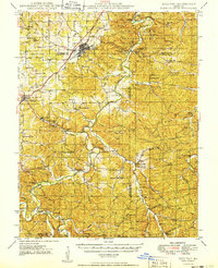
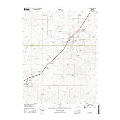
 1985 Sullivan1985 Print · USGSMid-1980s Missouri comes into focus here as the Ozark landscape balances industrial mining with river recreation. Genealogists and historians can trace the St Louis-San Francisco RR through Sullivan and locate landmarks like Pea Ridge Mine or St Cloud Church.3 unique versions available
 - 2012 Map of Spring Bluff, 2012 Print
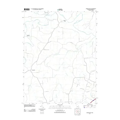 2012 Spring Bluff2012 Print · USGSCovers Sullivan, including Spring Bluff, Laubinger Ford, and other nearby areas
 - 2012 Map of Sullivan, 2012 Print
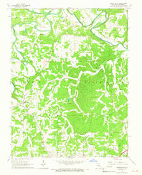
 2012 Sullivan2012 Print · USGSCovers Sullivan, including Bourbon, Oak Grove Village, and other nearby areas
 - 2012 Map of Meramec State Park, 2012 Print
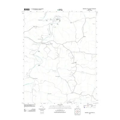 2012 Meramec State Park2012 Print · USGSCovers Sullivan, including Miramiguoa Park, Monday, and other nearby areas
 - 2015 Map of Spring Bluff, 2015 Print
 2015 Spring Bluff2015 Print · USGSCovers Sullivan, including Spring Bluff, Laubinger Ford, and other nearby areas
 - 2015 Map of Meramec State Park, 2015 Print
 2015 Meramec State Park2015 Print · USGSCovers Sullivan, including Miramiguoa Park, Monday, and other nearby areas
 - 2015 Map of Sullivan, 2015 Print
 2015 Sullivan2015 Print · USGSCovers Sullivan, including Bourbon, Oak Grove Village, and other nearby areas
 - 2017 Map of Sullivan, 2017 Print
 2017 Sullivan2017 Print · USGSCovers Sullivan, including Bourbon, Oak Grove Village, and other nearby areas
 - 2017 Map of Spring Bluff, 2017 Print
 2017 Spring Bluff2017 Print · USGSCovers Sullivan, including Spring Bluff, Laubinger Ford, and other nearby areas
 - 2017 Map of Meramec State Park, 2017 Print
 2017 Meramec State Park2017 Print · USGSCovers Sullivan, including Miramiguoa Park, Monday, and other nearby areas
 - 2021 Map of Sullivan, 2021 Print
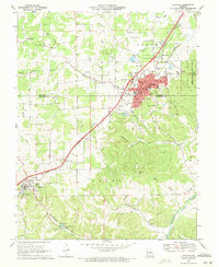
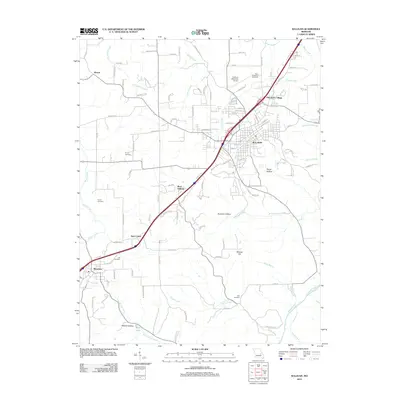
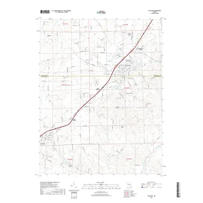
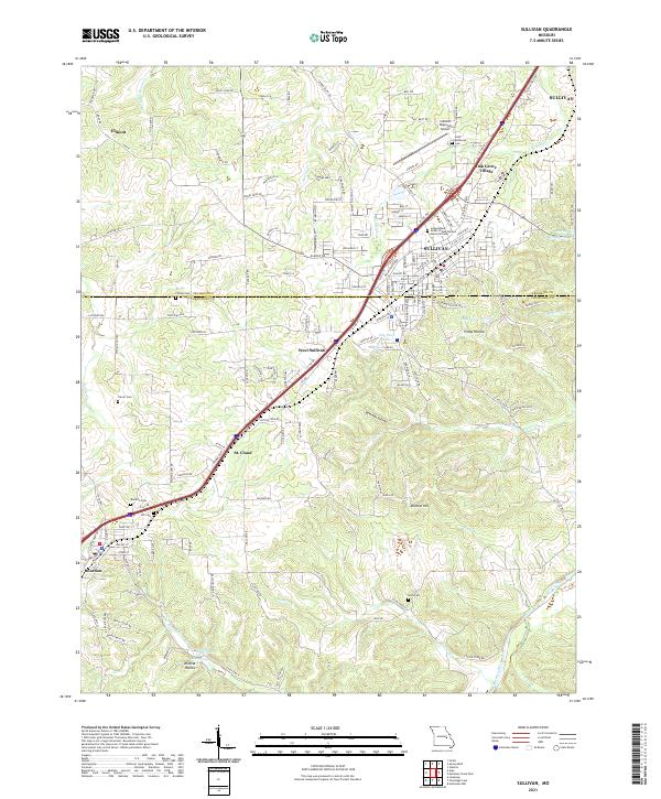 2021 Sullivan2021 Print · USGSSullivan and the surrounding Missouri countryside appear in this modern survey during a period of steady growth along the BNSF Railway. Researchers can trace family history through numerous burial grounds like Turner Cemetery and Hill Cemetery, or explore the terrain near Bluff Lake.
Showing maps 1-25 of 27
Top cities near Sullivan
- Union historical maps
- Saint Clair historical maps
- Cuba historical maps
- Bourbon historical maps
- Gerald historical maps
- Oak Grove Village historical maps
See more
Frequently asked questions
- What are the different types of historical maps available for Sullivan?
- What is the oldest map of Sullivan?
- Where can I purchase historical maps of Sullivan for my home or office?
- Where can I download high-res historical maps of Sullivan?
- Are there historical topographic maps available for Sullivan?
- Is there historical aerial imagery available for Sullivan?
- Where are historical maps of Sullivan sourced from?