2020s Maps of Nevada, Missouri
Explore 3 historic maps of Nevada from the 2020s. These maps offer a rare glimpse into what life looked like during the 2020s — showing old roads, neighborhoods, homes, and landmarks that have changed or disappeared over time.
Whether you're researching your family's past, planning a metal detecting trip, or studying how Nevada's landscape evolved across the 2020s, these high-resolution maps are a powerful tool for exploring the history of this region.
- Focus on a specific era: All maps on this page are from the 2020s, giving you a focused view of this time period.
- See what’s changed: Compare century-old streets, trails, and buildings to today's modern landscape using overlays and satellite layers.
- Research with precision: Use these maps for genealogy, historical research, land use analysis, or educational projects.
- View, download, or print: Maps are fully viewable online in high resolution, and can be downloaded or printed for your own records.
Start exploring Nevada's history through authentic maps from the 2020s. This is your window into the past.
Nevada, MO maps
(3)- 2021 Map of Nevada, 2021 Print
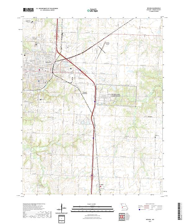 2021 Nevada2021 Print · USGSThe county seat of Nevada and its surrounding Vernon County prairies are captured here in the early twenty-first century. Genealogists and researchers can locate several burial sites, including Deepwood Cem and Marvin Chapel Cem, alongside landmarks like Cottey College.
 - 2021 Map of Moundville, 2021 Print
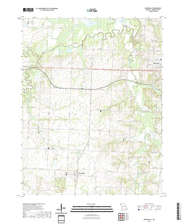 2021 Moundville2021 Print · USGSVernon County farmland and the meandering Marmaton River corridor are captured here in the early twenty-first century. Genealogists and local historians can locate numerous rural burial grounds, including Moundville Cem, Welborn Cem, and Hackberry Cem.
 - 2021 Map of Horton, 2021 Print
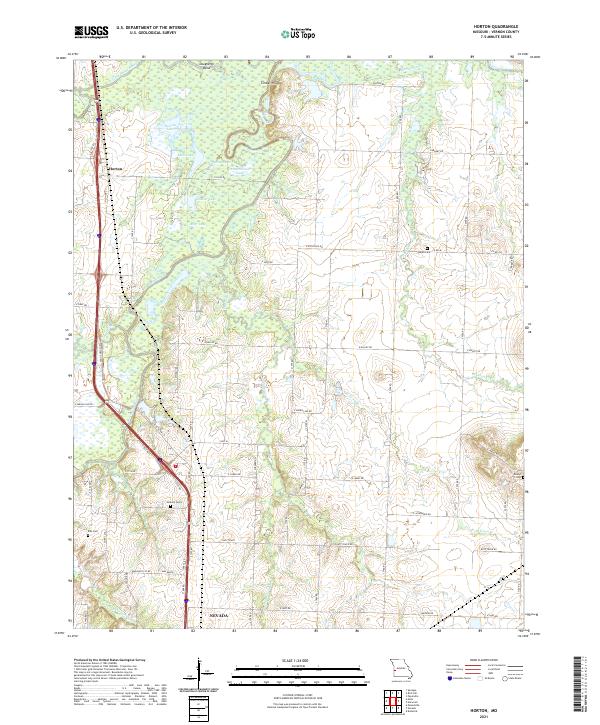 2021 Horton2021 Print · USGSVernon County farmland meets the winding waters of the Marmaton and Little Osage Rivers in this recent survey. Local historians can trace family roots through markers like Antioch Cemetery and Ellis Cemetery or locate the old community of Horton.
End of results
Showing maps 1-3 of 3
Top cities near Nevada
- Sheldon historical maps
- Schell City historical maps
- Walker historical maps
- Bronaugh historical maps
- Moundville historical maps
- Richards historical maps
See more
Frequently asked questions
- What are the different types of historical maps available for Nevada?
- What is the oldest map of Nevada?
- Where can I purchase historical maps of Nevada for my home or office?
- Where can I download high-res historical maps of Nevada?
- Are there historical topographic maps available for Nevada?
- Is there historical aerial imagery available for Nevada?
- Where are historical maps of Nevada sourced from?