1980s Maps of Worth County, Missouri
Explore 12 historic maps of Worth County from the 1980s. These maps offer a rare glimpse into what life looked like during the 1980s — showing old roads, neighborhoods, homes, and landmarks that have changed or disappeared over time.
Whether you're researching your family's past, planning a metal detecting trip, or studying how Worth County's landscape evolved across the 1980s, these high-resolution maps are a powerful tool for exploring the history of this region.
- Focus on a specific era: All maps on this page are from the 1980s, giving you a focused view of this time period.
- See what’s changed: Compare century-old streets, trails, and buildings to today's modern landscape using overlays and satellite layers.
- Research with precision: Use these maps for genealogy, historical research, land use analysis, or educational projects.
- View, download, or print: Maps are fully viewable online in high resolution, and can be downloaded or printed for your own records.
Start exploring Worth County's history through authentic maps from the 1980s. This is your window into the past.
Worth County, MO maps
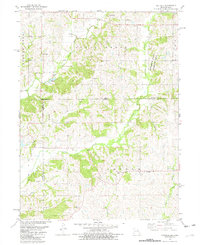
(12)- 1980 Map of Sheridan, 1981 Print
 1980 Sheridan1981 Print · USGSThe Missouri-Iowa borderlands are captured here in the late seventies, showing the rural landscape around Sheridan and Isadora. Researchers can trace the Chicago and North Western rail corridor and locate family sites at Sheridan Cem or Athelstan Cem.
 - 1980 Map of Bedford SW, 1981 Print
 1980 Bedford SW1981 Print · USGSThis rural borderland between Iowa and Missouri was mapped in the late 1970s, showing a landscape of traditional farmsteads and township boundaries. Genealogists can locate several remote burial sites and community centers, including Berea Ch, New Hope Cem, and Brethren Cem.
 - 1981 Map of Blockton SE
 1981 Blockton SE1981 Print · USGSThe Iowa-Missouri borderlands are captured here in the early eighties as rural life centered on the river forks and country parishes. Researchers can trace ancestral sites through several family-named landmarks including Clark Allen Cem, Hickory Grove Ch, and Crim Cem.
 - 1981 Map of Blockton
 1981 Blockton1981 Print · USGSThe Iowa-Missouri borderlands come into focus in the early 1980s, showcasing the agricultural communities of Taylor and Ringgold counties. Trace the paths of the Chicago and North Western and an Old Railroad Grade past landmarks like Tent Chapel and Rosehill Cem.
 - 1981 Map of Hatfield, 1982 Print
 1981 Hatfield1982 Print · USGSThe Missouri-Iowa borderlands near Hatfield were still deeply rural in the early eighties, characterized by small settlements and family farms. Genealogists can locate several remote burial sites such as Lincoln Center Cem and Petty Cem, or trace the winding course of the East Fork Grand River.
 - 1984 Map of Parnell East, 1985 Print
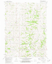
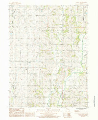
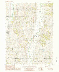 1984 Parnell East1985 Print · USGSNorthern Missouri agriculture and river networks define this landscape in the mid-1980s. Researchers can trace the rural layouts of Parnell and Oxford, or explore the northern edges of the Worth County Community Lake State Recreation Area.
 - 1984 Map of Allendale, 1985 Print
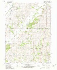
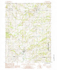 1984 Allendale1985 Print · USGSWorth and Gentry counties are captured here in the mid-1980s, centered on the river-fed communities of Allendale and Denver. Genealogists and local historians can trace family locations along Lotts Creek or near the Emmett and Leah Seat Memorial State Wildlife Area.
 - 1984 Map of Washington Center, 1985 Print
 1984 Washington Center1985 Print · USGSHarrison County farmland and conservation areas are captured here in the mid-eighties as a network of creek-fed townships. Local researchers can trace the rural layout of Washington Center or the boundaries of the Emmett and Leah Seat Memorial Wildlife Area.
 - 1984 Map of Grant City, 1985 Print
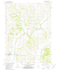
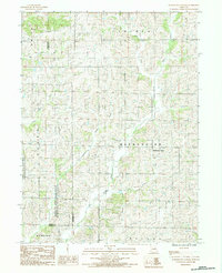
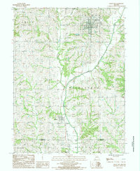 1984 Grant City1985 Print · USGSGrant City and the surrounding rural townships of Worth County are captured in the mid-1980s just as the regional rail landscape was shifting. Genealogists and historians can trace an Old Railroad Grade and find family plots at several local Cem sites near Worth.
 - 1985 Map of Mount Ayr
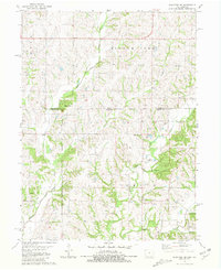
 1985 Mount Ayr1985 Print · USGSThe Iowa-Missouri borderlands are captured here in the mid-eighties, showing a landscape defined by the branching forks of the Platte River and Grand River. Researchers can trace the heritage of rural communities and conservation sites like Lake of Three Fires State Park and Rose Hill Cemetery.2 unique versions available
 - 1985 Map of Parnell West
 1985 Parnell West1985 Print · USGSNodaway County agriculture and river drainage are documented here in the mid-1980s, before modern landscape changes. Local researchers can trace the rural layouts of Gaynor, Orrsburg, and Parnell, or locate landmarks like the Rock Quarry and Keever Bridge Acess Area.
 - 1986 Map of Maryville
 1986 Maryville1986 Print · USGSNorthwest Missouri's agricultural heartland is documented here in the mid-1980s, from the campus at Northwest Missouri State University to the Grand River valley. Genealogists can trace family footprints across dozens of local burial grounds like Alanthus Grove Cem and Brooklyn Cem.2 unique versions available
End of results
Showing maps 1-12 of 12
Top cities of Worth County
- Grant City historical maps
- Sheridan historical maps
- Worth historical maps
- Allendale historical maps
- Denver historical maps
- Irena historical maps
Frequently asked questions
- What are the different types of historical maps available for Worth County?
- What is the oldest map of Worth County?
- Where can I purchase historical maps of Worth County for my home or office?
- Where can I download high-res historical maps of Worth County?
- Are there historical topographic maps available for Worth County?
- Is there historical aerial imagery available for Worth County?
- Where are historical maps of Worth County sourced from?