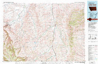
Old Maps of Busby District, Montana
Explore 75 old maps of Busby District, spanning from 1894 to today. These high-resolution historic maps reveal how streets, neighborhoods, landmarks, and natural features evolved over time — perfect for genealogy, metal detecting, research, and local history exploration.
What you can do with these maps:
- See how Busby District changed over time: Compare historical maps to modern-day views to trace roads, homesites, rail lines & more.
- View detailed metadata: Each map includes creators, publishers, year, scale, and archive source.
- Overlay maps with satellite & LiDAR: Visualize the past alongside modern tools to explore terrain & human change.
- Trusted historical sources: Maps sourced from the USGS, Library of Congress, and other archives.
- Access maps your way: View online, download high-res files, or order prints for personal or research use.
Start exploring old maps of Busby District to uncover forgotten places, hidden landmarks, and the deep history beneath your feet.
Busby District, MT maps
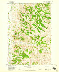
(75)- 1894 Map of Rosebud
 1894 Rosebud1894 Print · USGSThe Big Horn Basin and the Crow Indian Reservation are captured in the late nineteenth century as early cattle outposts began to dot the river valleys. Genealogists and local historians can trace early holdings like Forty Mile Ranch, Hams Ranch, and the Sand Hills Ranch.
 - 1901 Map of Rosebud
 1901 Rosebud1901 Print · USGSSouthern Montana ranching and rail life are documented here during the final decade of the nineteenth century. Genealogists and historians can trace early holdings like Yellow Weasel Ranch and Sand Hills Ranch along the Burlington and Missouri River R. R.4 unique versions available
 - 1954 Map of Hardin, 1964 Print
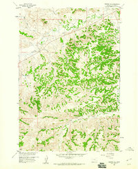
 1954 Hardin1964 Print · USGSSoutheastern Montana is documented here during the mid-fifties, showing the vast tribal lands and historic battle sites before modern highway expansion. Researchers can trace the Chicago Burlington and Quincy rail line through Hardin or locate the Custer National Cemetery and Museum.2 unique versions available
 - 1957 Map of Hardin
 1957 Hardin1957 Print · USGSSoutheastern Montana in the mid-fifties reveals a landscape shaped by tribal lands and the historic Bighorn river valleys. Researchers can trace the Chicago Burlington and Quincy RR through Hardin and locate the National Cemetery and Custer Battlefield Monument.
 - 1958 Map of Hardin
 1958 Hardin1958 Print · USGSSoutheastern Montana in the mid-fifties presents a landscape defined by significant tribal lands and national monuments. Researchers can trace the geography of the Little Bighorn at Custer Battlefield National Monument and locate settlements like Lame Deer and Birney.
 - 1958 Map of Chalky Point, 1960 Print
 1958 Chalky Point1960 Print · USGSBig Horn and Rosebud counties are captured in the late fifties, dominated by the ridge-lines of the Little Wolf Mountains. Researchers can trace the Northern Cheyenne Indian Reservation Boundary and map old water sources like Williams Spring and Water Hole Creek.
 - 1958 Map of Painted Hill, 1960 Print
 1958 Painted Hill1960 Print · USGSBig Horn County's high-plateau drainages are meticulously detailed in the late fifties as ranching and water management shaped the land. Researchers can trace remote routes like the Jeep Trail system connecting Two Moon Reservoir, Muddy Springs, and Painted Hill.2 unique versions available
 - 1958 Map of Bull Creek Lookout, 1960 Print
 1958 Bull Creek Lookout1960 Print · USGSBig Horn County ranching and rugged drainages are captured here in the late fifties. Researchers can trace remote water sources and early access routes near Bull Creek Lookout, Brown Camp, and the distinctive Hardrobe Water Gap.2 unique versions available
 - 1958 Map of Busby, 1960 Print
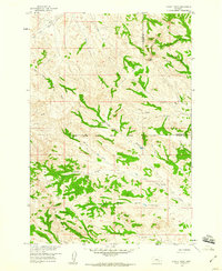
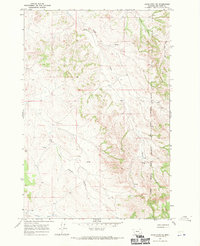
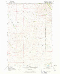
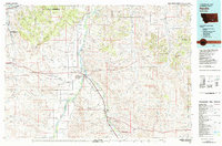
 1958 Busby1960 Print · USGSBig Horn County comes into focus during the late fifties, centered on the community of Busby within the Northern Cheyenne Indian Reservation. Genealogists and historians can locate the Busby Boarding Sch, the Historical Monument (Indian Chief Two Moons), and family sites near Rosebud Creek.3 unique versions available
 - 1958 Map of Birdseye Spring, 1960 Print
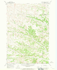
 1958 Birdseye Spring1960 Print · USGSBig Horn County ranch lands are documented here in the late fifties, showing the rural drainage systems of the Missouri River Basin. Genealogists and researchers can trace local landmarks like Birdseye Spring, Rosebud Creek, and Skunk Creek.2 unique versions available
 - 1967 Map of Jeans Fork NE, 1970 Print
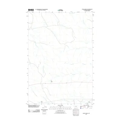
 1967 Jeans Fork NE1970 Print · USGSBig Horn County in the late sixties shows the intersection of tribal lands and essential water networks. Genealogists and historians can trace the Northern Cheyenne Indian Reservation Boundary and reliable water sources like Sarpy Creek and Jeans Fork.
 - 1967 Map of Kirby, 1971 Print
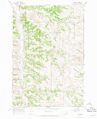 1967 Kirby1971 Print · USGSBig Horn County ranching and reservation lands are documented here during the late sixties. Genealogists and local historians can trace landmarks like St Francis Ch, the Log Sch, and the winding path of Rosebud Creek through the settlement of Kirby.2 unique versions available
 - 1967 Map of Taintor Desert, 1971 Print
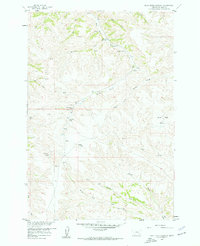
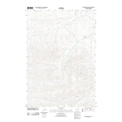
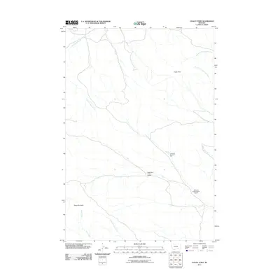
 1967 Taintor Desert1971 Print · USGSThe high plains of Big Horn and Rosebud counties are captured here in the late sixties, where the Northern Cheyenne Indian Reservation Boundary meets the Taintor Desert. Researchers can trace isolated outposts like Jordan Ranch, Brewster Camp, and Hosford Camp.
 - 1967 Map of Jeans Fork SE, 1971 Print
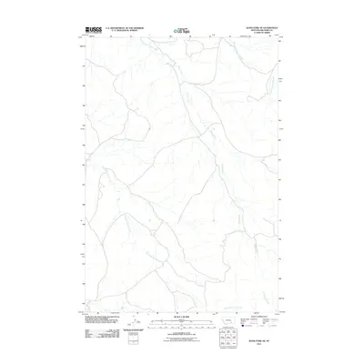
 1967 Jeans Fork SE1971 Print · USGSBig Horn County, Montana, is shown here in the late 1960s as a landscape of isolated water sources and reservation borders. Researchers can trace family-named water features and early aviation markers like the Landing Strip and the Northern Cheyenne Indian Reservation Boundary.
 - 1967 Map of Thompson Creek, 1971 Print
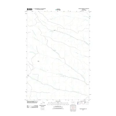
 1967 Thompson Creek1971 Print · USGSBig Horn County ranchlands and tribal territories are captured here in the late sixties, showing a landscape defined by water and isolation. Researchers can trace the boundary of the Northern Cheyenne Indian Reservation and locate remote sites like Spear Ranch and the local Landing Strip.2 unique versions available
 - 1967 Map of Spring Creek Ranch, 1971 Print
 1967 Spring Creek Ranch1971 Print · USGSBig Horn County ranchlands and tribal boundaries are captured in the late sixties as the high plains landscape supported remote operations. Researchers can trace historic water rights and landmarks like Spring Creek Ranch, Commissary Springs, and the Lower Indian Creek Reservoir.2 unique versions available
 - 1980 Map of Lame Deer
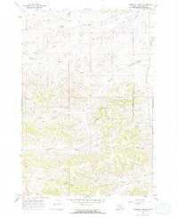
 1980 Lame Deer1980 Print · USGSHigh plains ranching and coal mining define this corner of Montana as the eighties began. Researchers can trace the rail lines of the Burlington Northern and locate sites like Colstrip, Jimtown, and the Big Sky Strip Mine.
 - 1980 Map of Birney
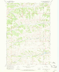
 1980 Birney1980 Print · USGSSoutheastern Montana enters a period of intensive energy development in the early 1980s as coal mines expand across the Big Horn County line. Researchers can trace the industrial footprints of the Spring Creek Mine and West Decker Mine or locate rural landmarks like the Birney Day School.
 - 1980 Map of Lodge Grass, 1981 Print
 1980 Lodge Grass1981 Print · USGSThe Crow Indian Reservation and the Montana-Wyoming borderlands are captured here in the early eighties. Researchers can trace the Burlington Northern rail line through valley settlements like Lodge Grass, Wyola, and Aberdeen.2 unique versions available
 - 1981 Map of Hardin
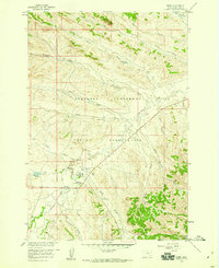
 1981 Hardin1981 Print · USGSBig Horn County at the start of the eighties shows a landscape shaped by the Bighorn River and deep historical ties. Researchers can trace the grounds of Custer Battlefield National Monument or find small rail points like Toluca and Crow Agency.
 - 2011 Map of Jeans Fork SE, 2011 Print
 2011 Jeans Fork SE2011 Print · USGSCovers Busby District, including Busby, Big Horn County, and other nearby areas
 - 2011 Map of Thompson Creek, 2011 Print
 2011 Thompson Creek2011 Print · USGSCovers Busby District, including Busby, Big Horn County, and other nearby areas
 - 2011 Map of Jeans Fork NE, 2011 Print
 2011 Jeans Fork NE2011 Print · USGSCovers Busby District, including Big Horn County, United States, and other nearby areas
 - 2011 Map of Chalky Point, 2011 Print
 2011 Chalky Point2011 Print · USGSCovers Busby District, including Muddy District, Rosebud County, and other nearby areas
 - 2011 Map of Taintor Desert, 2011 Print
 2011 Taintor Desert2011 Print · USGSCovers Busby District, including Muddy District, Rosebud County, and other nearby areas
Showing maps 1-25 of 75
Top cities near Busby District
Top neighborhoods of Busby District
Frequently asked questions
- What are the different types of historical maps available for Busby District?
- What is the oldest map of Busby District?
- Where can I purchase historical maps of Busby District for my home or office?
- Where can I download high-res historical maps of Busby District?
- Are there historical topographic maps available for Busby District?
- Is there historical aerial imagery available for Busby District?
- Where are historical maps of Busby District sourced from?