Old Maps of Carter County, Montana
Explore 510 old maps of Carter County, spanning from 1901 to today. These high-resolution historic maps reveal how streets, neighborhoods, landmarks, and natural features evolved over time — perfect for genealogy, metal detecting, research, and local history exploration.
What you can do with these maps:
- See how Carter County changed over time: Compare historical maps to modern-day views to trace roads, homesites, rail lines & more.
- View detailed metadata: Each map includes creators, publishers, year, scale, and archive source.
- Overlay maps with satellite & LiDAR: Visualize the past alongside modern tools to explore terrain & human change.
- Trusted historical sources: Maps sourced from the USGS, Library of Congress, and other archives.
- Access maps your way: View online, download high-res files, or order prints for personal or research use.
Start exploring old maps of Carter County to uncover forgotten places, hidden landmarks, and the deep history beneath your feet.
Carter County, MT maps
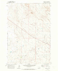
(510)- 1901 Map of Aladdin, 1954 Print
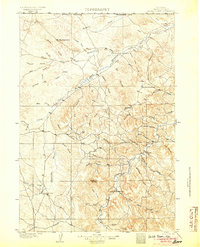
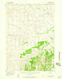
 1901 Aladdin1954 Print · USGSCrook County ranching and rail life at the turn of the century is preserved here, from the mountain slopes to the river valleys. Genealogists can trace early homesteads and shipping points like Aladdin, Beulah, and the VVV Ranch.
 - 1903 Map of Aladdin
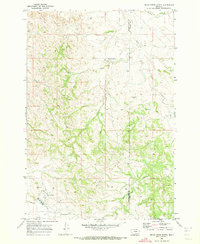
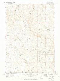
 1903 Aladdin1903 Print · USGSThe northern Black Hills region at the turn of the century reveals a landscape defined by the arrival of the Wyoming and Missouri River R.R. and expansive cattle ranching. Researchers can trace the early footprints of settlements like Aladdin and Beulah, alongside established landmarks like the VVV Ranch and Schoolmarm Butte.3 unique versions available
 - 1905 Map of Devils Tower
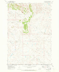
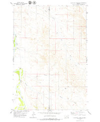
 1905 Devils Tower1905 Print · USGSCrook County ranching and the northern Black Hills landscape are captured here in the early 1900s. Genealogists can trace early homesteading era holdings like Hulett Ranch and Yeasts Ranch near the landmark of Devils Tower.2 unique versions available
 - 1953 Map of Miles City, 1966 Print
 1953 Miles City1966 Print · USGSEastern Montana and the North Dakota borderlands come alive in this mid-century survey of the Yellowstone River valley. Genealogists and historians can trace the rural network of the era through sites like Fertile Prairie School, St Johns Church, and the rail lines serving Ismay and Plevna.4 unique versions available
 - 1954 Map of Ekalaka, 1966 Print
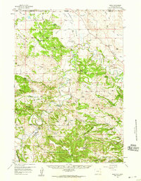
 1954 Ekalaka1966 Print · USGSSoutheastern Montana and its borderlands with the Dakotas and Wyoming appear here in the mid-fifties, showing a remote ranching landscape. Genealogists can trace family roots through numerous rural landmarks like the Sherwin School, St Marys Ch, and Powderville.3 unique versions available
 - 1954 Map of Gillette, 1975 Print
 1954 Gillette1975 Print · USGSGillette and the northeast Wyoming ranching country are captured here in the mid-1950s as coal and bentonite mining shaped the local economy. Genealogists can trace family landmarks like the Bethlehem Church, Wellman School, and early settlements along the Chicago Burlington and Quincy RR.
 - 1955 Map of Gillette, 1976 Print
 1955 Gillette1976 Print · USGSNortheastern Wyoming in the mid-twentieth century is captured here as the energy and ranching landscape began to shift. Genealogists and historians can trace the foundations of local communities through sites like Wyodak, the Pleasantdale Community Building, and landmarks like Devils Tower National Monument.
 - 1956 Map of Ekalaka
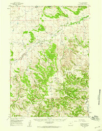
 1956 Ekalaka1956 Print · USGSSoutheast Montana and the Wyoming borderlands are shown here in the mid-fifties, capturing a landscape of remote ranching outposts and isolated country schools. Genealogists can trace family roots through landmarks like Boyes, Alzada, and Peabody School.
 - 1957 Map of Miles City
 1957 Miles City1957 Print · USGSEastern Montana and the North Dakota borderlands come alive in the mid-fifties as the rail and ranching economy peaks along the Yellowstone River. Genealogists and historians can trace numerous rural landmarks like St Phillips Church, Fertile Prairie School, and the Ostendorf Ranch.
 - 1957 Map of Mona, 1959 Print
 1957 Mona1959 Print · USGSThe ranching country of Crook County is captured here in the late fifties as family homesteads dotted the landscape between the state lines. Genealogists can trace legacy properties like Edsall Ranch and Svoboda Ranch or find old school sites like Robinson Sch.2 unique versions available
 - 1957 Map of Seely, 1959 Print
 1957 Seely1959 Print · USGSThe ranchlands of Crook County and the Montana border come alive in this mid-century survey of the upper Little Missouri River. Genealogists and historians can trace family homesteads like Ballou Ranch and Madden Ranch alongside rural landmarks like Seely and Johnson Sch.2 unique versions available
 - 1957 Map of Colony, 1959 Print
 1957 Colony1959 Print · USGSNortheastern Wyoming ranching and mining land near the tri-state border are captured here in the late fifties. Genealogists can locate family landmarks like the Sloan Brothers Ranch while tracing the Bentonite Spur and Colony clay industry.3 unique versions available
 - 1957 Map of Cedar Ridge, 1959 Print
 1957 Cedar Ridge1959 Print · USGSThe Wyoming-Montana borderlands are captured here in the late 1950s, showing a ranching landscape at the headwaters of the Little Missouri River. Genealogists and historians can locate rural schoolhouses like Storm Sch and Hulett Creek Sch alongside family landmarks like Leonard Ranch.2 unique versions available
 - 1958 Map of Miles City
 1958 Miles City1958 Print · USGSEastern Montana ranching and rail life are documented here during the late fifties, centered on the confluence of the Yellowstone River and Powder River. Researchers can trace rural school locations like St Phillips Church and Chimney Creek School alongside dozens of named family ranches.
 - 1958 Map of Gillette
 1958 Gillette1958 Print · USGSNortheastern Wyoming and the Black Hills are captured here in the late fifties, showcasing a landscape of high-plains ranching and emerging energy production. Researchers can trace the rail-side growth of Gillette and find historic rural landmarks like the Wyodak Coal Mine, Bethlehem Church, and Devils Tower National Monument.2 unique versions available
 - 1958 Map of Ekalaka
 1958 Ekalaka1958 Print · USGSSoutheast Montana in the mid-fifties remains a landscape of isolated ranching outposts and scattered schoolhouses. Genealogists and researchers can trace rural life through landmarks like Belltower, the McClary Ranger Station, and numerous family-named schools such as Davidson School.
 - 1962 Map of Gillette
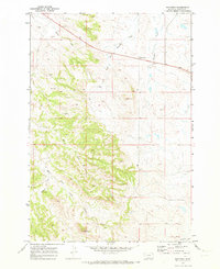
 1962 Gillette1962 Print · USGSHigh plains ranching and coal mining dominate the Powder River Basin in the early sixties. Genealogists can trace rural communities through landmarks like the Bethlehem Church, Lake School, and settlements such as Moorcroft and Sundance.
 - 1965 Map of Ekalaka
 1965 Ekalaka1965 Print · USGSThe High Plains of Montana and Wyoming appear here in the mid-1950s, as a sprawling landscape of remote ranchlands and rural school districts. Researchers can trace the locations of many small landmarks like Mitchell School, Broadus, and the Humbolt Hills.
 - 1970 Map of Belle Creek North, 1973 Print
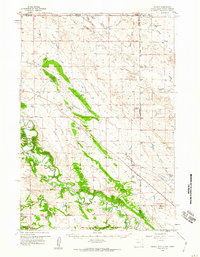
 1970 Belle Creek North1973 Print · USGSSoutheastern Montana is shown during a period of industrial growth in the early 1970s, as energy extraction transformed the high plains. Researchers can trace the development of Belle Creek and its remote Landing Strip alongside the Duncan Creek Sch.
 - 1970 Map of Belle Creek South, 1973 Print
 1970 Belle Creek South1973 Print · USGSThe Montana-Wyoming borderlands at the start of the 1970s reveal a landscape in transition from ranching to energy. Researchers can locate the Walloth Sch, the Belle Creek Oil Field, and the Ridge Cem among the high plains.
 - 1970 Map of Stack Rocks, 1973 Print
 1970 Stack Rocks1973 Print · USGSThe Montana-Wyoming borderlands at the start of the 1970s show a remote landscape of high plains and geological landmarks. Genealogists and historians can trace the paths of Thompson Creek and locate notable features like Stack Rocks and the Rock Wall.
 - 1970 Map of Hammond, 1973 Print
 1970 Hammond1973 Print · USGSCarter County ranching and river drainage are documented here in the early 1970s. Trace family connections near the Little Powder River, Belcher Mountain, and the small settlement of Hammond.
 - 1970 Map of Greasy Hill, 1973 Print
 1970 Greasy Hill1973 Print · USGSCarter County in the early seventies shows a remote ranching landscape shaped by high-plains watercourses. Local historians can trace the paths of Wolf Creek and Willow Creek alongside early energy infrastructure like the regional Pipeline.
 - 1970 Map of Hammond SE, 1973 Print
 1970 Hammond SE1973 Print · USGSThe Montana-Wyoming borderlands are captured here in the early 1970s, showing a landscape of high plains drainage and ranching infrastructure. Researchers can trace the courses of Deadman Creek and North Thompson Creek or locate early resource exploration sites marked by Drill Holes.
 - 1979 Map of Blacktail Creek NW
 1979 Blacktail Creek NW1979 Print · USGSSoutheast Montana rangeland meets the Powder River in the late seventies, showing a landscape defined by its vital water sources and remote boundaries. Genealogists and researchers can trace local land use through flowing wells, scattered jeep trails, and the convergence of Blacktail Creek and Alkali Creek.
Showing maps 1-25 of 510
Top cities of Carter County
Frequently asked questions
- What are the different types of historical maps available for Carter County?
- What is the oldest map of Carter County?
- Where can I purchase historical maps of Carter County for my home or office?
- Where can I download high-res historical maps of Carter County?
- Are there historical topographic maps available for Carter County?
- Is there historical aerial imagery available for Carter County?
- Where are historical maps of Carter County sourced from?