1990s Maps of Carter County, Montana
Explore 14 historic maps of Carter County from the 1990s. These maps offer a rare glimpse into what life looked like during the 1990s — showing old roads, neighborhoods, homes, and landmarks that have changed or disappeared over time.
Whether you're researching your family's past, planning a metal detecting trip, or studying how Carter County's landscape evolved across the 1990s, these high-resolution maps are a powerful tool for exploring the history of this region.
- Focus on a specific era: All maps on this page are from the 1990s, giving you a focused view of this time period.
- See what’s changed: Compare century-old streets, trails, and buildings to today's modern landscape using overlays and satellite layers.
- Research with precision: Use these maps for genealogy, historical research, land use analysis, or educational projects.
- View, download, or print: Maps are fully viewable online in high resolution, and can be downloaded or printed for your own records.
Start exploring Carter County's history through authentic maps from the 1990s. This is your window into the past.
Carter County, MT maps
(14)- 1993 Map of Belltower, 1996 Print
 1993 Belltower1996 Print · USGSEastern Montana ranch lands and the edge of the national forest are captured here in the early nineties. Genealogists and researchers can trace family-named sites like Summers Ranch and Kennedy Ranch or the isolated community at Belltower.
 - 1993 Map of Terrell Creek, 1996 Print
 1993 Terrell Creek1996 Print · USGSSoutheastern Montana ranching and forest lands are captured here in the early nineties, showing a landscape defined by high hills and vital water sources. Researchers can locate family landmarks like the J. LaBree Ranch or trace terrain features including Chimney Rock and Red Hill.
 - 1993 Map of Lampkin Gulch, 1996 Print
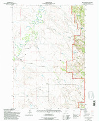
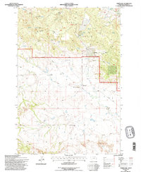
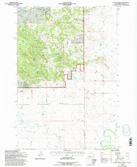
 1993 Lampkin Gulch1996 Print · USGSCarter County ranching and the eastern edge of the national forest are documented here during the early nineties. Researchers can trace land use through features like the Ness Ranch, the winding Boxelder Creek, and the historic Base Line.
 - 1993 Map of Stagville Draw, 1996 Print
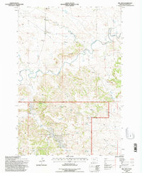
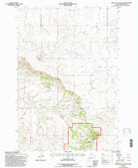
 1993 Stagville Draw1996 Print · USGSEastern Montana's high plains and timbered breaks are documented here in the early nineties, showing a landscape defined by the Custer National Forest. Researchers can locate legacy homestead sites like the Pierce Ranch and Peabody Ranch or trace the route of the Powderville Road.
 - 1993 Map of Belltower Butte, 1996 Print
 1993 Belltower Butte1996 Print · USGSSoutheast Montana ranchlands and forest boundaries are captured here in the early nineties, showing a landscape defined by high-plains geography. Researchers can trace family-named sites like the J Yates Ranch, the local Belltower Church, and a lone Grave.
 - 1993 Map of Timber Hill, 1996 Print
 1993 Timber Hill1996 Print · USGSSoutheast Montana ranching country is captured here in the early nineties, showing the interface of national forest and private range. Researchers can trace rural landmarks like the Plainview School, the Pioneer Cem, and isolated outposts such as Basler Ranch.
 - 1993 Map of Mill Iron, 1996 Print
 1993 Mill Iron1996 Print · USGSSoutheastern Montana's ranching country and the Custer National Forest are surveyed here in the early 1990s. Trace local genealogy and land use through the Young Ranch, the Community Hall, and rural schoolhouses like Coal Creek Sch.
 - 1993 Map of Camp Needmore, 1996 Print
 1993 Camp Needmore1996 Print · USGSCarter County ranching and forest lands are captured here during the 1990s, showcasing the remote homesteads and rugged drainages of southeastern Montana. Genealogists and local historians can trace family-named sites like the Burch Ranch or L Carroll Ranch and locate the historic Rodeo Ground.
 - 1993 Map of Ekalaka, 1996 Print
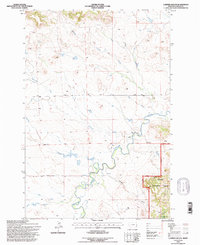
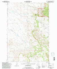
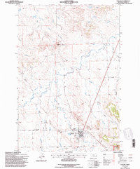 1993 Ekalaka1996 Print · USGSThe ranchlands of Carter County are documented here in the early nineties, centered on the community of Ekalaka. Researchers can trace old travel routes like the Miles City Cutoff Road and locate landmarks from Wilder Butte to the local Cemetery.
 - 1993 Map of North Slick Creek, 1996 Print
 1993 North Slick Creek1996 Print · USGSThe Montana and South Dakota borderlands meet in this late twentieth-century survey of the high plains. Genealogists and local historians can trace land use through the D Turbiville Ranch and water sources like Brown Jug Spring or the Section 21 Reservoir.
 - 1993 Map of Rustler Divide, 1996 Print
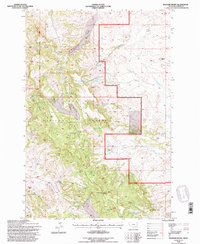 1993 Rustler Divide1996 Print · USGSSoutheast Montana in the early 1990s remained a terrain of isolated ranchlands and forest reserves near the Carter County line. Researchers can trace land markers like the Guide Meridian and find remote sites like Halbert or the Tri Point Lookout.
 - 1993 Map of Chalk Buttes, 1996 Print
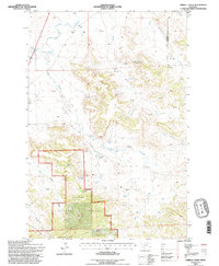
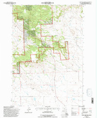
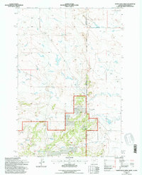
 1993 Chalk Buttes1996 Print · USGSSouthern Carter County ranching country is shown here in the early nineties, centered on the high timber of the Custer National Forest. Genealogists and local historians can locate remote family sites like Marshall Ranch or E Elmore Ranch and geographic landmarks like Trenk Pass.
 - 1993 Map of Capitol Rock, 1996 Print
 1993 Capitol Rock1996 Print · USGSThe Montana-South Dakota borderlands come into focus in the 1990s, revealing a landscape of remote ranching outposts and national forest land. Researchers can trace family-named landmarks like B Paddock Ranch and the C Odell Ranch or locate the site of the Plainview Sch.
 - 1993 Map of Beaver Flats South, 1996 Print
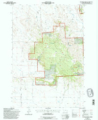
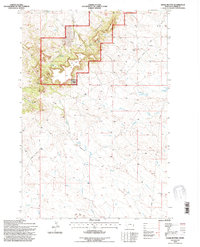
 1993 Beaver Flats South1996 Print · USGSCarter County ranching and forest lands are captured here in the early nineties, centered on the Custer National Forest. Researchers can locate the Parks Ranch and trace the paths of Little Beaver Creek past the prominent Chalk Buttes.
End of results
Showing maps 1-14 of 14
Top cities of Carter County
Frequently asked questions
- What are the different types of historical maps available for Carter County?
- What is the oldest map of Carter County?
- Where can I purchase historical maps of Carter County for my home or office?
- Where can I download high-res historical maps of Carter County?
- Are there historical topographic maps available for Carter County?
- Is there historical aerial imagery available for Carter County?
- Where are historical maps of Carter County sourced from?