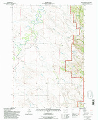
1993 Map of Belltower
USGS Topo · Published 1996About this map
Belltower and the high plains of Carter County are documented here in the early 1990s, revealing a landscape defined by cattle ranching and carefully managed water resources. The terrain is marked by family-run operations such as Gross Ranch, Summers Ranch, and Kennedy Ranch, which utilized a network of small reservoirs like Devils Canyon Reservoir and Horse Killer Reservoir to sustain life in the arid drainage basins of Boxelder Creek and Maverick Creek.
Find a feature on this map
28 named features on this map. Tap any name to fly to it.
Don’t see what you’re looking for? This feature index may not catch every label — zoom into the map to look around manually.
Map Details
Editions of this 1993 Belltower Map
This is the sole edition of this map. No revisions or reprints were ever made.
Other maps of this area

1954 · Ekalaka
USGS Topo · 1:250,000

1956 · Ekalaka
USGS Topo · 1:250,000

1958 · Ekalaka
USGS Topo · 1:250,000

1965 · Ekalaka
USGS Topo · 1:250,000

1980 · Taylor Hills
USGS Topo · 1:24,000

1980 · Belltower
USGS Topo · 1:24,000
1980 · Rustler Divide
USGS Topo · 1:24,000

1980 · Belltower Butte
USGS Topo · 1:24,000

1980 · Camp Needmore
USGS Topo · 1:24,000
1980 · School Section Creek
USGS Topo · 1:24,000