
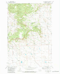
1980 Map of Camp Needmore
USGS Topo · Published 1980About this map
The Ekalaka Unit Custer National Forest defines the northern reaches of this landscape, where the wooded terrain breaks sharply at the Rimrock escarpment. This 1980 map details a rural Carter County environment shaped by the management of the forest and the open rangelands to the south. The presence of Camp Needmore and the adjacent Camp Needmore Campground indicate the area's role as a recreational hub within the national forest, while the Rodeo Ground near the western boundary reflects local ranching culture.
Find a feature on this map
28 named features on this map. Tap any name to fly to it.
Don’t see what you’re looking for? This feature index may not catch every label — zoom into the map to look around manually.
Map Details
Editions of this 1980 Camp Needmore Map
2 editions found
Other maps of this area

1954 · Ekalaka
USGS Topo · 1:250,000

1956 · Ekalaka
USGS Topo · 1:250,000

1958 · Ekalaka
USGS Topo · 1:250,000

1965 · Ekalaka
USGS Topo · 1:250,000

1979 · Dead Boy Divide
USGS Topo · 1:24,000

1979 · Ekalaka
USGS Topo · 1:24,000

1980 · Taylor Hills
USGS Topo · 1:24,000

1980 · Belltower
USGS Topo · 1:24,000

1980 · Dutchmans Hill
USGS Topo · 1:24,000
1980 · Lampkin Gulch
USGS Topo · 1:24,000