Old Maps of Armington Junction, Montana for Genealogy
Trace your family roots with 14 historic maps of Armington Junction. These high-res maps reveal old neighborhoods, homesites, landmarks, and streets — helping you uncover where your ancestors lived and how the area evolved over time.
- Explore historic neighborhoods: Identify where your relatives may have lived in the 1800s or 1900s.
- Compare maps over time: Trace the changes in streets, buildings, and landmarks for multi-generational research.
- Perfect for genealogy & ancestry research: Used by family historians and researchers to map out lineage and migration.
These maps are an incredible resource for exploring your personal connection to Armington Junction's past.
Armington Junction, MT maps
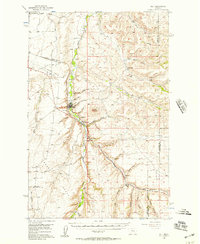
(14)- 1890 Map of Fort Benton
 1890 Fort Benton1890 Print · USGSUpper Missouri river country was transforming in the late nineteenth century as rail lines and ranching settlements expanded across the plains. Genealogists and historians can trace early land routes between Fort Benton, Stanford, and the mining district around Clendenin.
 - 1892 Map of Fort Benton
 1892 Fort Benton1892 Print · USGSUpper Missouri River country in the late nineteenth century shows the transition from river commerce to the iron horse. Genealogists and historians can trace early settlements like Stanford and Fort Benton alongside the St Paul Minneapolis and Manitoba Railroad.
 - 1897 Map of Fort Benton
 1897 Fort Benton1897 Print · USGSUpper Missouri River territory is charted here during its transition from a river-based economy to a rail-and-ranching frontier. Researchers can trace the early layouts of Fort Benton and Stanford, or locate remote sites like Barker Mtn and Riceville.4 unique versions available
 - 1954 Map of Great Falls
 1954 Great Falls1954 Print · USGSThe Missouri River valley in the mid-1950s is shown at a time of significant industrial and military growth. Genealogists and historians can locate early schools and rail stops like Tiger Butte Community Center, Fort Benton, and the Anaconda Wire Plant.4 unique versions available
 - 1956 Map of Belt, 1957 Print
 1956 Belt1957 Print · USGSCentral Montana in the mid-fifties reveals a landscape defined by the Great Northern railroad and rural school districts. Researchers can trace the legacy of mining and homesteading through sites like the Orr East Belt Mine, Pleasant View Cemetery, and Belt Butte.
 - 1957 Map of Great Falls
 1957 Great Falls1957 Print · USGSMontana's central plains and mountain foothills are captured here in the mid-fifties, showing the hub of Great Falls and the surrounding grain-shipping towns. Genealogists can trace family roots through the rail sidings of the Great Northern and small rural communities like Sand Coulee or Fort Benton.
 - 1975 Map of Belt SW
 1975 Belt SW1975 Print · USGSCentral Montana ranching and river geography are captured in this mid-seventies aerial study of the plateau above the Highwood Mountains. Genealogists and researchers can trace the agricultural landscape surrounding Armington and the deep valleys of Belt Creek and Neel Creek.
 - 1982 Map of Armington, 1983 Print
 1982 Armington1983 Print · USGSCascade County in the early eighties shows a landscape of deep creek valleys and high agricultural plateaus. Researchers can trace rural life through the Tiger Butte Community Center, Pleasant View Cemetery, and the rail lines of the Burlington Northern.
 - 1984 Map of Belt
 1984 Belt1984 Print · USGSCentral Montana's high peaks and ranching benches are captured here in the early 1980s, documenting the region's mining and rail heritage. Genealogists and historians can locate remote mining outposts like Hughesville and Barker, or trace the Burlington Northern Railroad through Belt and Stanford.
 - 2011 Map of Armington, 2011 Print
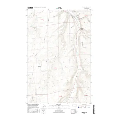
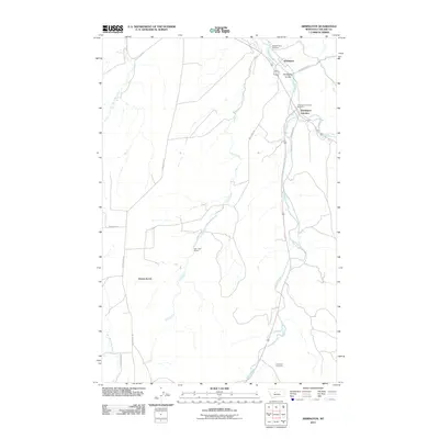 2011 Armington2011 Print · USGSCovers Armington Junction, including Armington, Cascade County, and other nearby areas
 - 2014 Map of Armington, 2014 Print
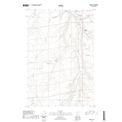
 2014 Armington2014 Print · USGSCovers Armington Junction, including Armington, Cascade County, and other nearby areas
 - 2017 Map of Armington, 2017 Print
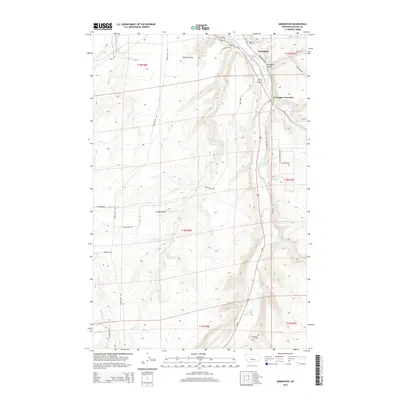
 2017 Armington2017 Print · USGSCovers Armington Junction, including Armington, Cascade County, and other nearby areas
 - 2020 Map of Armington, 2020 Print
 2020 Armington2020 Print · USGSCovers Armington Junction, including Armington, Cascade County, and other nearby areas
 - 2024 Map of Armington, 2024 Print
 2024 Armington2024 Print · USGSThe confluence of Belt Creek and Big Otter Creek defines the landscape of this Montana region in the early twenty-first century. Local researchers can trace rural burial grounds like Pleasant View Cem and the upland plateau of Swede Bench.
End of results
Showing maps 1-14 of 14
Top cities near Armington Junction
Frequently asked questions
- What are the different types of historical maps available for Armington Junction?
- What is the oldest map of Armington Junction?
- Where can I purchase historical maps of Armington Junction for my home or office?
- Where can I download high-res historical maps of Armington Junction?
- Are there historical topographic maps available for Armington Junction?
- Is there historical aerial imagery available for Armington Junction?
- Where are historical maps of Armington Junction sourced from?