Old Maps of Grass Land Hutterite Colony, Montana for Hiking & Exploration
Hike through history with 11 historic maps of Grass Land Hutterite Colony. Explore old trails, ghost towns, and forgotten backroads — perfect for outdoor adventurers and local explorers.
- Rediscover forgotten places: Map out old mining camps, roads, and footpaths that no longer exist on modern maps.
- Layer with modern tools: Combine with LiDAR or satellite views to plan hikes through historical terrain.
- Made for exploration: Popular among hikers, overlanders, and local history lovers.
Use these maps to find adventure and explore the hidden past of Grass Land Hutterite Colony.
Grass Land Hutterite Colony, MT maps
(11)- 1886 Map of Great Falls
 1886 Great Falls1886 Print · USGSCentral Montana in the mid-1880s is defined by its great river systems and the early footprints of frontier outposts. Researchers can trace the early development of Great Falls, find the site of St. Peter's Mission, and locate river settlements like Truly and Fort Shaw.4 unique versions available
 - 1954 Map of Great Falls
 1954 Great Falls1954 Print · USGSThe Missouri River valley in the mid-1950s is shown at a time of significant industrial and military growth. Genealogists and historians can locate early schools and rail stops like Tiger Butte Community Center, Fort Benton, and the Anaconda Wire Plant.4 unique versions available
 - 1955 Map of Gore Hill, 1957 Print
 1955 Gore Hill1957 Print · USGSThe area around Great Falls in the mid-1950s shows a landscape of river-carved benches and burgeoning aviation infrastructure. Researchers can locate family landmarks like Truly Sch, Red Butte Sch, and the Mount Olivet Cemetery.
 - 1957 Map of Great Falls
 1957 Great Falls1957 Print · USGSMontana's central plains and mountain foothills are captured here in the mid-fifties, showing the hub of Great Falls and the surrounding grain-shipping towns. Genealogists can trace family roots through the rail sidings of the Great Northern and small rural communities like Sand Coulee or Fort Benton.
 - 1965 Map of Eden, 1967 Print
 1965 Eden1967 Print · USGSCascade County cattle country is shown here in the mid-1960s, where flat benches give way to complex badlands. Genealogists and historians can locate the Eden settlement, Red Butte Sch, and Red Butte Cem among the coulees.
 - 1976 Map of Great Falls South, 1994 Print
 1976 Great Falls South1994 Print · USGSCascade County in the mid-seventies reveals a landscape defined by the winding Missouri River and the high peaks of the Little Belt Mountains. Researchers can trace the heritage of mining settlements like Centerville, Stockett, and Number Seven or explore the boundaries of the Lewis and Clark National Forest.
 - 2011 Map of Eden, 2011 Print
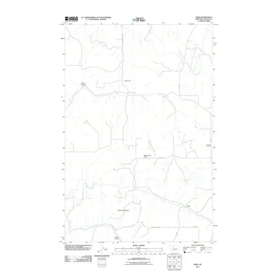 2011 Eden2011 Print · USGSCovers Grass Land Hutterite Colony, including Eden, Cascade County, and other nearby areas
 - 2014 Map of Eden, 2014 Print
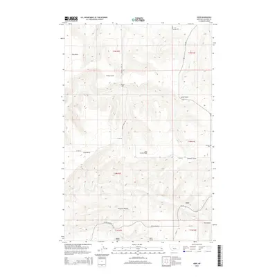 2014 Eden2014 Print · USGSCovers Grass Land Hutterite Colony, including Eden, Cascade County, and other nearby areas
 - 2017 Map of Eden, 2017 Print
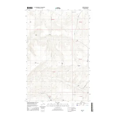 2017 Eden2017 Print · USGSCovers Grass Land Hutterite Colony, including Eden, Cascade County, and other nearby areas
 - 2020 Map of Eden, 2020 Print
 2020 Eden2020 Print · USGSCovers Grass Land Hutterite Colony, including Eden, Cascade County, and other nearby areas
 - 2024 Map of Eden, 2024 Print
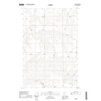
 2024 Eden2024 Print · USGSCascade County's ranching country remains centered on the small settlement of Eden in this recent survey of the Missouri River highlands. Researchers can locate family landmarks like Iverson Hill and the Red Butte Cem tucked between Truly Bench and the deep cut of Ming Coulee.
End of results
Showing maps 1-11 of 11
Top cities near Grass Land Hutterite Colony
Frequently asked questions
- What are the different types of historical maps available for Grass Land Hutterite Colony?
- What is the oldest map of Grass Land Hutterite Colony?
- Where can I purchase historical maps of Grass Land Hutterite Colony for my home or office?
- Where can I download high-res historical maps of Grass Land Hutterite Colony?
- Are there historical topographic maps available for Grass Land Hutterite Colony?
- Is there historical aerial imagery available for Grass Land Hutterite Colony?
- Where are historical maps of Grass Land Hutterite Colony sourced from?