1970s Maps of Dawson County, Montana
Explore 14 historic maps of Dawson County from the 1970s. These maps offer a rare glimpse into what life looked like during the 1970s — showing old roads, neighborhoods, homes, and landmarks that have changed or disappeared over time.
Whether you're researching your family's past, planning a metal detecting trip, or studying how Dawson County's landscape evolved across the 1970s, these high-resolution maps are a powerful tool for exploring the history of this region.
- Focus on a specific era: All maps on this page are from the 1970s, giving you a focused view of this time period.
- See what’s changed: Compare century-old streets, trails, and buildings to today's modern landscape using overlays and satellite layers.
- Research with precision: Use these maps for genealogy, historical research, land use analysis, or educational projects.
- View, download, or print: Maps are fully viewable online in high resolution, and can be downloaded or printed for your own records.
Start exploring Dawson County's history through authentic maps from the 1970s. This is your window into the past.
Dawson County, MT maps
(14)- 1972 Map of Red Top, 1975 Print
 1972 Red Top1975 Print · USGSDawson County ranching country is captured here in the early 1970s, showing a landscape defined by seasonal creek beds and section lines. Researchers can locate the Red Top settlement and nearby Cem, or trace the winding North Fork Thirteenmile Creek across the range.
 - 1972 Map of Butler Table, 1975 Print
 1972 Butler Table1975 Print · USGSDawson and Richland counties are captured in the early 1970s, showcasing a landscape of high plateaus and carved coulees. Researchers can trace the rugged drainage patterns of North Fork Burns Creek or the prominent elevation of Butler Table.
 - 1972 Map of Morgan Creek School, 1975 Print
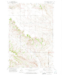
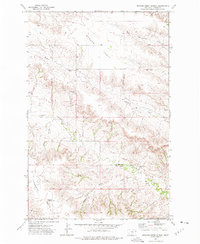 1972 Morgan Creek School1975 Print · USGSDawson County ranching country is captured here in the early 1970s, showing a landscape of high plateaus and schoolhouse hubs. Genealogists and historians can locate rural centers like the Morgan Creek School and Lower Sevenmile Sch near Morgan Table.
 - 1972 Map of Clay Butte, 1975 Print
 1972 Clay Butte1975 Print · USGSDawson and Richland counties in the early 1970s remained a landscape of wide-open rangeland and intricate drainage basins. Researchers can trace the winding paths of South Fork Lisk Creek and North Fork Buffalo Creek as they wrap around the slopes of Clay Butte.
 - 1972 Map of Hendrickson Coulee, 1975 Print
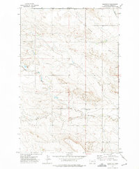
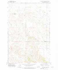 1972 Hendrickson Coulee1975 Print · USGSThe high plains of the Dawson and Prairie County border are captured here in the early seventies, showcasing a landscape of complex natural drainages. Researchers can trace family-named landmarks and water sources like Hendrickson Coulee, Dickhoff Coulee, and Bad Route Creek.
 - 1972 Map of Pleasant View, 1975 Print
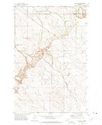
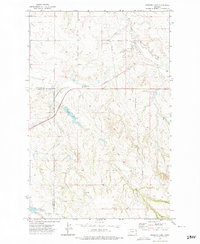
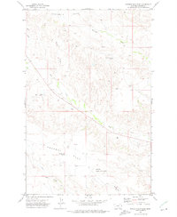
 1972 Pleasant View1975 Print · USGSDawson County in the early 1970s shows a classic Big Sky landscape of high flats and winding coulees. Researchers can locate the Foster School, trace the Burlington Northern railroad line, and find rural landmarks like Pleasant View and Whoopup Creek.
 - 1972 Map of Poverty Flat West, 1975 Print
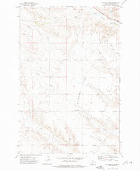
 1972 Poverty Flat West1975 Print · USGSDawson County, Montana, was a landscape of remote ranching and energy exploration in the early seventies. Genealogists and local historians can trace the Burlington Northern railroad route past the Green School and Elevenmile Springs.
 - 1972 Map of Enid SE, 1975 Print
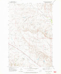
 1972 Enid SE1975 Print · USGSThe high plains along the Richland and Dawson county line appear here in the early seventies, showing a landscape defined by prairie watercourses. Researchers can locate remote community landmarks like Kiempel Cem, Bethlehem Ch, and the Eastern Montana Bible Camp.
 - 1972 Map of Kuester Lake, 1975 Print
 1972 Kuester Lake1975 Print · USGSRichland and Dawson Counties meet in the Montana plains during the early seventies, where rail lines and energy infrastructure define the land. Researchers can trace the Burlington Northern route and locate water features like Kuester Lake and Redwater Creek.
 - 1972 Map of Bloomfield, 1975 Print
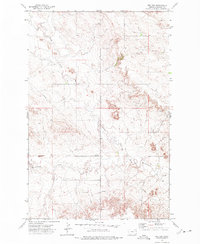
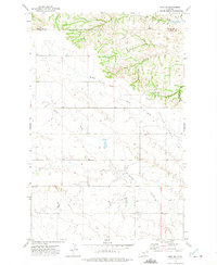
 1972 Bloomfield1975 Print · USGSDawson County agriculture and resource development are on display in this mid-1970s survey of the eastern Montana plains. Genealogists and researchers can locate the settlement of Bloomfield and trace landmarks like Thirteenmile Creek and a local Mine.
 - 1972 Map of Mc Cone Heights, 1975 Print
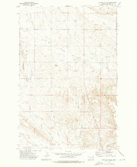
 1972 Mc Cone Heights1975 Print · USGSEastern Montana ranching country is shown in detail during the early 1970s as it straddles the Richland and Dawson county lines. Researchers can trace the rugged drainage of North Fork Burns Creek or locate landmarks like Chimney Rock and Butler Table.
 - 1972 Map of Diamond G Creek, 1975 Print
 1972 Diamond G Creek1975 Print · USGSPrairie and Dawson counties meet here in the early 1970s across an expanse of Montana ranch land and coulees. Researchers can trace water development and family-named landmarks like Spade Well, McQuoid Coulee, and Diamond G Creek.
 - 1972 Map of Poverty Flat East, 1975 Print
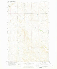
 1972 Poverty Flat East1975 Print · USGSDawson County ranching country is captured here in the early seventies, showing a landscape of high tablelands and remote schoolhouses. You can trace the footprint of the Lower Threemile School, Poverty Flat School, and the local Garnost Mine amidst the coulees.
 - 1972 Map of Stinking Coulee, 1976 Print
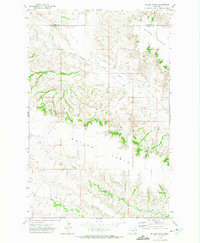
 1972 Stinking Coulee1976 Print · USGSDawson County in the early seventies shows a landscape shaped by drainage and ranching infrastructure. Trace the network of prairie waterways like Stinking Coulee and Morgan Creek, and locate local landmarks such as Dickerson Dam and Twin Buttes.
End of results
Showing maps 1-14 of 14
Top cities of Dawson County
Frequently asked questions
- What are the different types of historical maps available for Dawson County?
- What is the oldest map of Dawson County?
- Where can I purchase historical maps of Dawson County for my home or office?
- Where can I download high-res historical maps of Dawson County?
- Are there historical topographic maps available for Dawson County?
- Is there historical aerial imagery available for Dawson County?
- Where are historical maps of Dawson County sourced from?