Old Maps of Dawson County, Montana for Hiking & Exploration
Hike through history with 407 historic maps of Dawson County. Explore old trails, ghost towns, and forgotten backroads — perfect for outdoor adventurers and local explorers.
- Rediscover forgotten places: Map out old mining camps, roads, and footpaths that no longer exist on modern maps.
- Layer with modern tools: Combine with LiDAR or satellite views to plan hikes through historical terrain.
- Made for exploration: Popular among hikers, overlanders, and local history lovers.
Use these maps to find adventure and explore the hidden past of Dawson County.
Dawson County, MT maps
(407)- 1909 Map of Glendive
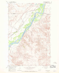
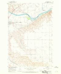
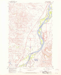
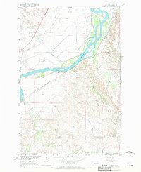
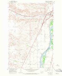
 1909 Glendive1909 Print · USGSThe confluence of the Missouri and Yellowstone rivers in the first decade of the twentieth century shows a region of scattered ranches and emerging river towns. Genealogists can trace family landmarks like Cavanaughs Ranch or Nortons Ranch and find early resource sites like the Coal Mine.
 - 1953 Map of Miles City, 1966 Print
 1953 Miles City1966 Print · USGSEastern Montana and the North Dakota borderlands come alive in this mid-century survey of the Yellowstone River valley. Genealogists and historians can trace the rural network of the era through sites like Fertile Prairie School, St Johns Church, and the rail lines serving Ismay and Plevna.4 unique versions available
 - 1954 Map of Glendive, 1967 Print
 1954 Glendive1967 Print · USGSEastern Montana at mid-century shows a landscape of river-valley commerce and remote prairie ranching. Researchers can trace the legacy of rural education and transport through sites like Prairie Elk School, the Great Northern rail lines, and Circle.2 unique versions available
 - 1957 Map of Miles City
 1957 Miles City1957 Print · USGSEastern Montana and the North Dakota borderlands come alive in the mid-fifties as the rail and ranching economy peaks along the Yellowstone River. Genealogists and historians can trace numerous rural landmarks like St Phillips Church, Fertile Prairie School, and the Ostendorf Ranch.
 - 1957 Map of Glendive
 1957 Glendive1957 Print · USGSEastern Montana in the mid-1950s is defined by its deep river valleys and a sprawling network of rural school districts. You can trace the path of the Great Northern railroad and locate vanished local landmarks like Breezy Flat School and Newton Junction.
 - 1958 Map of Miles City
 1958 Miles City1958 Print · USGSEastern Montana ranching and rail life are documented here during the late fifties, centered on the confluence of the Yellowstone River and Powder River. Researchers can trace rural school locations like St Phillips Church and Chimney Creek School alongside dozens of named family ranches.
 - 1958 Map of Glendive
 1958 Glendive1958 Print · USGSEastern Montana and the North Dakota borderlands come alive in the late fifties, showing the agricultural heart of the Yellowstone valley. Trace the legacy of rural education through Kimmel School and Ridgelawn School or locate rail hubs in Glendive and Sidney.
 - 1966 Map of Kolberg Ranch, 1970 Print
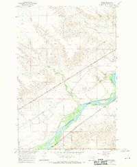
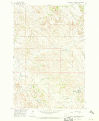
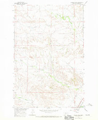 1966 Kolberg Ranch1970 Print · USGSDawson County ranching country meets the river valley in the mid-1960s, showing a landscape defined by livestock operations and energy transit. Researchers can trace the path of the Lewis and Clark Trail and the Northern Pacific railroad near the Yellowstone River.
 - 1966 Map of Savage SE, 1970 Print
 1966 Savage SE1970 Print · USGSEastern Montana's high plains and deep coulees are captured in this mid-century survey of Wibaux County. Researchers can trace the rugged drainage patterns of Dry Creek and Devils Canyon or locate local landmarks like Valentine Flat.
 - 1966 Map of Savage SW, 1970 Print
 1966 Savage SW1970 Print · USGSThe Yellowstone River corridor in eastern Montana is captured here in the mid-1960s, showing the intersection of Dawson and Richland counties. Trace the historic Lewis and Clark Trail, the Northern Pacific railroad, and the Main Pacific Canal.
 - 1966 Map of Intake, 1970 Print
 1966 Intake1970 Print · USGSThe Yellowstone River valley in the mid-1960s shows a landscape of coordinated irrigation and rail transport. Researchers can trace the Lewis and Clark Trail past the Diversion Dam and the settlement of Intake.
 - 1966 Map of Fallon, 1970 Print
 1966 Fallon1970 Print · USGSPrairie County in the mid-sixties was a critical rail junction defined by the Yellowstone River and the high plains. Genealogists can locate the Community Cem and trace the historic Lewis and Clark Trail near the settlement of Fallon.3 unique versions available
 - 1966 Map of Intake NW, 1970 Print
 1966 Intake NW1970 Print · USGSDawson County ranching country comes into focus in the mid-1960s, showing the scattered schools and churches of a rural Montana community. Genealogists can locate family landmarks such as Pleasant Plains Sch, East Pleasant Plains Sch, and the Lutheran Ch Cem.2 unique versions available
 - 1966 Map of Marsh SW, 1970 Print
 1966 Marsh SW1970 Print · USGSThe Yellowstone River valley in the mid-1960s highlights the vital corridor where the Northern Pacific railroad meets the rugged Montana breaks. Researchers can trace the sprawling Fallon Flat, locate a remote Cem, and follow the seasonal flow of Spring Creek.
 - 1966 Map of Allard Ranch, 1971 Print
 1966 Allard Ranch1971 Print · USGSEastern Montana rangeland near the Dawson and Richland county line is captured here in the mid-sixties. Researchers can trace the development of Allard Ranch and locate specific water sources like Burns Creek and various Spring sites.
 - 1967 Map of Stipek, 1970 Print
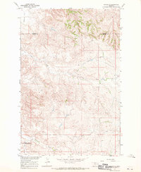
 1967 Stipek1970 Print · USGSDawson County in the late sixties shows the Yellowstone River valley as it transitions from the industrial edge of Glendive to quiet rural reaches. Genealogists and historians can trace the Northern Pacific tracks past Stipek or locate the Deer Creek Sch and the high vantage of Custers Lookout.
 - 1967 Map of Marsh, 1970 Print
 1967 Marsh1970 Print · USGSDawson County, Montana, is captured here in the late sixties as a landscape of river-valley ranching and historic travel corridors. Researchers can trace the Northern Pacific rail line near Marsh, locate the Yale Sch, and follow the Lewis and Clark Trail.2 unique versions available
 - 1967 Map of Allard, 1970 Print
 1967 Allard1970 Print · USGSDawson County ranching and mining country is captured here in the late sixties, centered on the Northern Pacific line. Trace the rail-side life of Allard and Curry or locate the historic Burning Coal Mine and local water sources like Griffith Creek.
 - 1967 Map of Belle Prairie, 1970 Print
 1967 Belle Prairie1970 Print · USGSDawson County agriculture and industry meet along the Yellowstone River in the late sixties. Researchers can trace land use through the sprawling Belle Prairie or locate the site of the Burning Coal Mine and local Gravel Pits.
 - 1967 Map of Hoyt, 1970 Print
 1967 Hoyt1970 Print · USGSDawson County in the late sixties was a landscape where the river-and-rail economy met the energy boom. Trace the Northern Pacific tracks through Hoyt or locate the various Oil Wells scattered near the Glendive Oil Field.2 unique versions available
 - 1967 Map of Glendive, 1970 Print
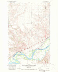
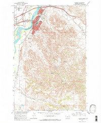 1967 Glendive1970 Print · USGSThe Yellowstone River Valley and the city of Glendive are captured here during the late 1960s. Researchers can trace local development through the Lincoln Sch, the Courthouse, and the rail infrastructure of the Northern Pacific.2 unique versions available
 - 1967 Map of Upper Magpie Reservoir, 1970 Print
 1967 Upper Magpie Reservoir1970 Print · USGSDawson County, Montana, is shown here during the peak of mid-century energy development and prairie water management. Researchers can trace the industrial layout of the Gas City Oil Field and locate localized landmarks like Dead Horse Dam and Prairie Goat Reservoir.
 - 1967 Map of Twin Forks Reservoir, 1970 Print
 1967 Twin Forks Reservoir1970 Print · USGSDawson County rangeland in the late sixties shows a landscape shaped by water management and Missouri River Basin development projects. Researchers can trace the path of the Labell Ditch and locate specific water sources like Gagena Res and Twin Forks Reservoir.
 - 1967 Map of Forest Park, 1971 Print
 1967 Forest Park1971 Print · USGSDawson County in the late sixties reveals a landscape shaped by the Yellowstone River and the burgeoning energy industry. Researchers can trace the layout of Forest Park, locate the Glendive Field oil wells, or find landmarks like the Drive-in Theater.
 - 1967 Map of Fallon NE, 1971 Print
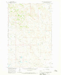
 1967 Fallon NE1971 Print · USGSEastern Montana rangeland at the end of the sixties reveals a landscape of deep coulees and historical corridors. Trace the Lewis and Clark Trail and the complex drainage of Bad Route Creek and Hatchet Creek.2 unique versions available
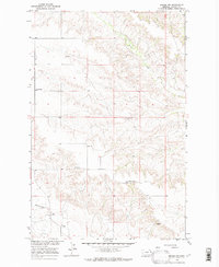
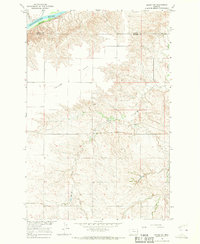
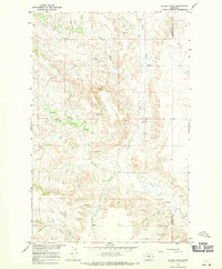
Showing maps 1-25 of 407
Top cities of Dawson County
Frequently asked questions
- What are the different types of historical maps available for Dawson County?
- What is the oldest map of Dawson County?
- Where can I purchase historical maps of Dawson County for my home or office?
- Where can I download high-res historical maps of Dawson County?
- Are there historical topographic maps available for Dawson County?
- Is there historical aerial imagery available for Dawson County?
- Where are historical maps of Dawson County sourced from?