1990s Maps of Crackerville, Montana
Explore 2 historic maps of Crackerville from the 1990s. These maps offer a rare glimpse into what life looked like during the 1990s — showing old roads, neighborhoods, homes, and landmarks that have changed or disappeared over time.
Whether you're researching your family's past, planning a metal detecting trip, or studying how Crackerville's landscape evolved across the 1990s, these high-resolution maps are a powerful tool for exploring the history of this region.
- Focus on a specific era: All maps on this page are from the 1990s, giving you a focused view of this time period.
- See what’s changed: Compare century-old streets, trails, and buildings to today's modern landscape using overlays and satellite layers.
- Research with precision: Use these maps for genealogy, historical research, land use analysis, or educational projects.
- View, download, or print: Maps are fully viewable online in high resolution, and can be downloaded or printed for your own records.
Start exploring Crackerville's history through authentic maps from the 1990s. This is your window into the past.
Crackerville, MT maps
(2)- 1994 Map of Butte North
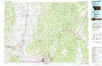 1994 Butte North1994 Print · USGSWestern Montana in the nineties was a landscape defined by ranching legacy and high-altitude mining. Genealogists and historians can trace institutional history at the Deer Lodge Prison Farm or locate old claims like the Saratoga Mine and Morning Glory Mine.
 - 1996 Map of Opportunity, 1998 Print
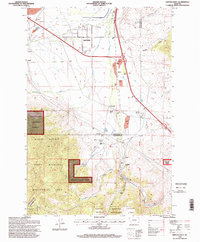 1996 Opportunity1998 Print · USGSNear the boundary of Silver Bow and Deer Lodge counties in the 1990s, this area reflects a mix of mountain wilderness and roadside settlements. Researchers can trace the layout of Fairmont Hot Springs Resort and the tracks through Crackerville, Stuart, and Gregson.
End of results
Showing maps 1-2 of 2
Top cities near Crackerville
Frequently asked questions
- What are the different types of historical maps available for Crackerville?
- What is the oldest map of Crackerville?
- Where can I purchase historical maps of Crackerville for my home or office?
- Where can I download high-res historical maps of Crackerville?
- Are there historical topographic maps available for Crackerville?
- Is there historical aerial imagery available for Crackerville?
- Where are historical maps of Crackerville sourced from?