Old Maps of Reserve, Fort Kipp District for Genealogy
Trace your family roots with 9 historic maps of Reserve. These high-res maps reveal old neighborhoods, homesites, landmarks, and streets — helping you uncover where your ancestors lived and how the area evolved over time.
- Explore historic neighborhoods: Identify where your relatives may have lived in the 1800s or 1900s.
- Compare maps over time: Trace the changes in streets, buildings, and landmarks for multi-generational research.
- Perfect for genealogy & ancestry research: Used by family historians and researchers to map out lineage and migration.
These maps are an incredible resource for exploring your personal connection to Reserve's past.
Reserve, Fort Kipp District maps
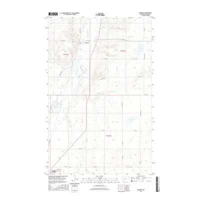
(9)- 1948 Map of Reserve, 1976 Print
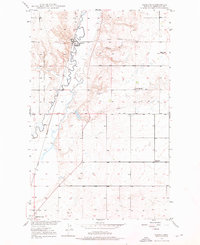 1948 Reserve1976 Print · USGSSheridan County's high plains are documented here in the late 1940s as the rail-side economy of Reserve thrived along the Great Northern line. Genealogists can trace early homestead-era landmarks like the Cem, Eden Valley Sch, and the local Coal Mine.2 unique versions available
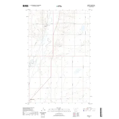
 - 1949 Map of Reserve
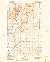 1949 Reserve1949 Print · USGSSheridan County and the northeastern corner of the Fort Peck Indian Reservation are captured here just after the war. Local historians can trace the Great Northern rail corridor through Reserve or locate school sites like Eden Valley Sch and Smith Sch (Aban'd).
 - 1954 Map of Wolf Point, 1967 Print
 1954 Wolf Point1967 Print · USGSNortheastern Montana and the North Dakota borderlands are shown here in the mid-fifties, dominated by the Missouri River and the Fort Peck Indian Reservation. Genealogists and historians can trace the Great Northern rail line through river towns like Poplar and Culbertson or locate northern border outposts like the U S Custom Office at Raymond.2 unique versions available
 - 1958 Map of Wolf Point
 1958 Wolf Point1958 Print · USGSNortheastern Montana is shown during the mid-fifties, featuring the extensive Fort Peck Indian Reservation and the Missouri River valley. Researchers can trace the Great Northern railroad through Wolf Point or locate sites like Slab Crossing and the Coal Mine near Medicine Lake.
 - 2011 Map of Reserve, 2011 Print
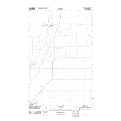 2011 Reserve2011 Print · USGSCovers Reserve, including Medicine Lake, Fort Kipp District, and other nearby areas
 - 2014 Map of Reserve, 2014 Print
 2014 Reserve2014 Print · USGSCovers Reserve, including Medicine Lake, Fort Kipp District, and other nearby areas
 - 2017 Map of Reserve, 2017 Print
 2017 Reserve2017 Print · USGSCovers Reserve, including Medicine Lake, Fort Kipp District, and other nearby areas
 - 2020 Map of Reserve, 2020 Print
 2020 Reserve2020 Print · USGSCovers Reserve, including Medicine Lake, Fort Kipp District, and other nearby areas
 - 2024 Map of Reserve, 2024 Print
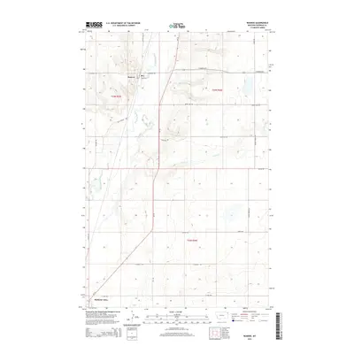
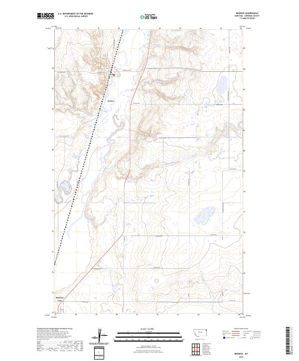 2024 Reserve2024 Print · USGSSheridan County's agricultural heartland is mapped here in the early twenty-first century, centered on the settlement of Reserve. Genealogists and historians can trace local travel corridors like Whiskey Rd and Burma Trl near the waters of Big Muddy Creek.
End of results
Showing maps 1-9 of 9
Top cities near Reserve
Frequently asked questions
- What are the different types of historical maps available for Reserve?
- What is the oldest map of Reserve?
- Where can I purchase historical maps of Reserve for my home or office?
- Where can I download high-res historical maps of Reserve?
- Are there historical topographic maps available for Reserve?
- Is there historical aerial imagery available for Reserve?
- Where are historical maps of Reserve sourced from?