Old Maps of Durham, Montana for Metal Detecting
Plan your next treasure hunt with 11 historic maps of Durham. Find old homesites, ghost towns, trails, and gathering spots that may be lost to time — perfect for identifying promising metal detecting locations.
- Locate forgotten sites: Uncover places like long-lost settlements, abandoned rail lines, or gathering spots.
- Plan better hunts: Use map overlays combined with LiDAR or satellite views to narrow in on historically rich areas.
- Made for detectorists: Thousands of hobbyists use these maps to discover relics, coins, and hidden history.
Use these historic maps to boost your research and find new opportunities beneath the surface of Durham.
Durham, MT maps
(11)- 1901 Map of Browning, 1959 Print
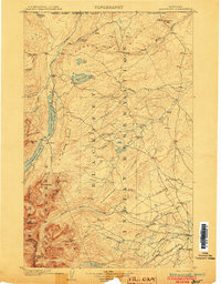
 1901 Browning1959 Print · USGSThe Blackfeet Indian Reservation and eastern Glacier National Park meet in this early twentieth-century survey. Genealogists and historians can trace old homesteads and landmarks like Galbreath Ranch, the Pontresina Sch, and the Great Northern rail corridor.
 - 1903 Map of Browning
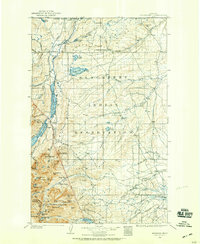
 1903 Browning1903 Print · USGSThe Blackfeet Reservation and the high peaks of northern Montana appear here shortly after the turn of the century. You can trace the path of the Great Northern R. R. through Browning or locate early settlements like St. Mary along the glacial lakes.2 unique versions available
 - 1960 Map of Cut Bank, 1968 Print
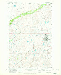
 1960 Cut Bank1968 Print · USGSThe high peaks of the Rockies meet the eastern plains in the 1960s, showing the intersection of federal lands and the Blackfeet Indian Reservation. Trace the path of the Great Northern railway and find local landmarks like the Blackfoot Boarding School and Family Mission Cem.3 unique versions available
 - 1963 Map of Cut Bank
 1963 Cut Bank1963 Print · USGSNorthern Montana’s mountain passes and high plains are captured here in the early 1960s. Genealogists and historians can trace the Great Northern rail stops from Browning to Ethridge or locate the remote outposts at Polebridge and Babb.
 - 1964 Map of Cut Bank
 1964 Cut Bank1964 Print · USGSGlacier National Park and the Blackfeet Indian Reservation meet in the early sixties at the triple divide of North America. Researchers can trace the Great Northern Railway through mountain passes and locate local landmarks like the Blackfoot Boarding School and Apgar Village.
 - 1968 Map of Browning, 1972 Print
 1968 Browning1972 Print · USGSBrowning and the Blackfeet Indian Reservation are captured in the late sixties, showing a community built around the railroad and tribal administration. Genealogists can trace family connections at Birdrattler Cem, Starr School, and the Blackfeet Agency.
 - 2011 Map of Browning, 2011 Print
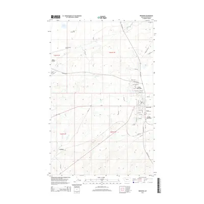
 2011 Browning2011 Print · USGSCovers Durham, including Browning, Glacier County, and other nearby areas
 - 2014 Map of Browning, 2014 Print
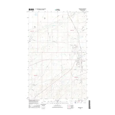
 2014 Browning2014 Print · USGSCovers Durham, including Browning, Glacier County, and other nearby areas
 - 2017 Map of Browning, 2017 Print
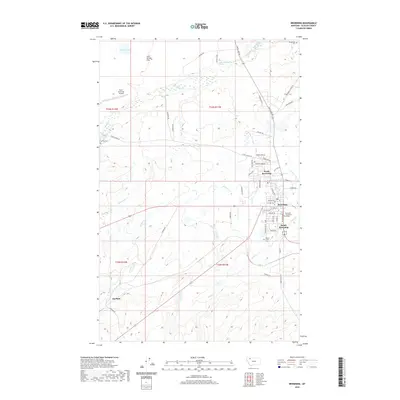
 2017 Browning2017 Print · USGSCovers Durham, including Browning, Glacier County, and other nearby areas
 - 2020 Map of Browning, 2020 Print
 2020 Browning2020 Print · USGSCovers Durham, including Browning, Glacier County, and other nearby areas
 - 2024 Map of Browning, 2024 Print
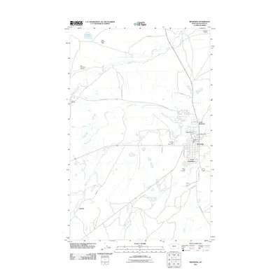
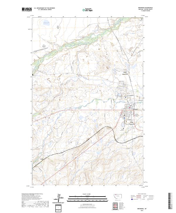 2024 Browning2024 Print · USGSBrowning and its neighboring settlements on the Blackfeet Indian Reservation are shown in high detail during the 2020s. Researchers can locate several community burial sites, including Willow Creek Cem and Birdrattler Cem, or trace the campus of Blackfeet Community College.
End of results
Showing maps 1-11 of 11
Top cities near Durham
Frequently asked questions
- What are the different types of historical maps available for Durham?
- What is the oldest map of Durham?
- Where can I purchase historical maps of Durham for my home or office?
- Where can I download high-res historical maps of Durham?
- Are there historical topographic maps available for Durham?
- Is there historical aerial imagery available for Durham?
- Where are historical maps of Durham sourced from?