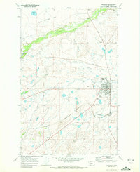
1968 Map of Browning
USGS Topo · Published 1972About this map
The Blackfeet Agency and the town of Browning serve as the focal point of this Blackfeet Indian Reservation landscape during the late 1960s. This survey detail captures the intersection of tribal government, transportation, and community life, featuring the Burlington Northern railroad corridor and its associated depot and Browning Station. Local infrastructure is well-documented, from the Rodeo Ground and Museum to the Border Patrol Hdqrs and a local landing strip.
Find a feature on this map
29 named features on this map. Tap any name to fly to it.
Don’t see what you’re looking for? This feature index may not catch every label — zoom into the map to look around manually.
Map Details
Editions of this 1968 Browning Map
This is the sole edition of this map. No revisions or reprints were ever made.
Other maps of this area

1901 · Browning
USGS Topo · 1:125,000

1903 · Browning
USGS Topo · 1:125,000

1911 · Blackfoot
USGS Topo · 1:125,000

1913 · Marias Pass
USGS Topo · 1:125,000

1914 · Heart Butte
USGS Topo · 1:125,000

1918 · Heart Butte
USGS Topo · 1:125,000

1960 · Cut Bank
USGS Topo · 1:250,000

1963 · Cut Bank
USGS Topo · 1:250,000

1964 · Cut Bank
USGS Topo · 1:250,000

1968 · Browning NE
USGS Topo · 1:24,000