1970s Maps of Golden Valley County, Montana
Explore 10 historic maps of Golden Valley County from the 1970s. These maps offer a rare glimpse into what life looked like during the 1970s — showing old roads, neighborhoods, homes, and landmarks that have changed or disappeared over time.
Whether you're researching your family's past, planning a metal detecting trip, or studying how Golden Valley County's landscape evolved across the 1970s, these high-resolution maps are a powerful tool for exploring the history of this region.
- Focus on a specific era: All maps on this page are from the 1970s, giving you a focused view of this time period.
- See what’s changed: Compare century-old streets, trails, and buildings to today's modern landscape using overlays and satellite layers.
- Research with precision: Use these maps for genealogy, historical research, land use analysis, or educational projects.
- View, download, or print: Maps are fully viewable online in high resolution, and can be downloaded or printed for your own records.
Start exploring Golden Valley County's history through authentic maps from the 1970s. This is your window into the past.
Golden Valley County, MT maps
(10)- 1970 Map of South Bench, 1973 Print
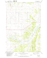
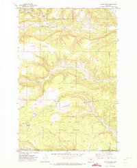 1970 South Bench1973 Print · USGSFergus and Golden Valley counties in the early seventies reveal a high-plains landscape where the Little Snowy Mountains meet the central Montana benches. Researchers can trace land use near Ashbridge Spring, locate a remote Cem, and explore the headwaters of North Fork Flatwillow Creek.
 - 1970 Map of Alaska Bench, 1973 Print
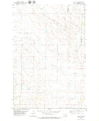
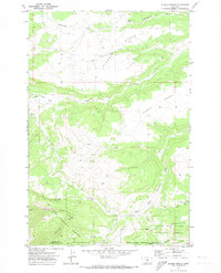 1970 Alaska Bench1973 Print · USGSFergus County in the early seventies is a landscape of high plateaus and deep canyons at the edge of the mountains. Local historians can trace the isolated settlement of Holt and the winding path of Red Hill Road through the Lewis and Clark National Forest.
 - 1970 Map of Half Moon Canyon, 1973 Print
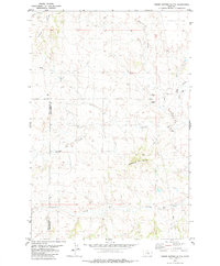
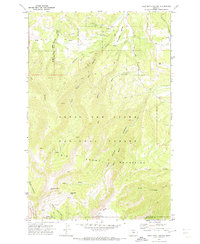 1970 Half Moon Canyon1973 Print · USGSThe Big Snowy Mountains of central Montana appear here as a remote wilderness at the start of the 1970s. Researchers can trace historic access routes and water sources like the Lewis Ranch, Half Moon Pass, and the high-altitude Greathouse Peak.2 unique versions available
 - 1970 Map of Jump Off Peak, 1974 Print
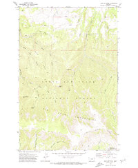 1970 Jump Off Peak1974 Print · USGSThe Big Snowy Mountains of Central Montana are shown here in the 1970s, marking a wilderness landscape defined by sharp ridges and deep canyons. Follow old Pack Trails to high-elevation landmarks like Jump off Peak, Mount Harlow, and the Crystal Cascades.
 - 1979 Map of Roundup
 1979 Roundup1979 Print · USGSCentral Montana at the close of the 1970s reveals a landscape defined by coal mining and major rail lines. Researchers can trace the industrial legacy of Roundup and Klein or locate landmarks like the Western Mine and Steamboat Butte.
 - 1979 Map of Bundy
 1979 Bundy1979 Print · USGSCentral Montana cattle and rail country is captured here in the late seventies as the river and railway define local life. Genealogists and historians can trace the irrigation systems of Glennie Ditch, the railroad siding at Bundy, and the rugged terrain of Painted Robe.
 - 1979 Map of Lavina NW
 1979 Lavina NW1979 Print · USGSGolden Valley and Musselshell Counties in the late seventies show a landscape shaped by drainage and light industry. Researchers can trace the path of a major Pipeline, locate several Gravel Pits, and follow the winding courses of Currant Creek and Twin Coulee.
 - 1979 Map of Timber Buttes South, 1980 Print
 1979 Timber Buttes South1980 Print · USGSThe Musselshell and Golden Valley county line is captured in the late seventies, showing a landscape defined by ranching and mineral potential. Trace the drainage paths of Pole Creek and Cameron Creek or locate landmarks like Timber Buttes and the local Gravel Pit.
 - 1979 Map of Lavina, 1980 Print
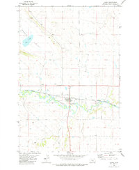 1979 Lavina1980 Print · USGSIn the late 1970s, the Musselshell River valley near Lavina remained a hub of rail and river activity. Researchers can trace the path of the Chicago Milwaukee St Paul and Pacific and local landmarks like the Rodeo Ground.
 - 1979 Map of Belmont, 1980 Print
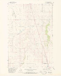 1979 Belmont1980 Print · USGSGolden Valley County in the late seventies is captured here at a time when the Burlington Northern railroad and cattle-country hydrology defined the local economy. Researchers can trace the rail corridor through the Painted Robe Tunnel and locate rural landmarks like Belmont and Alkali Pond.2 unique versions available
End of results
Showing maps 1-10 of 10
Top cities of Golden Valley County
Frequently asked questions
- What are the different types of historical maps available for Golden Valley County?
- What is the oldest map of Golden Valley County?
- Where can I purchase historical maps of Golden Valley County for my home or office?
- Where can I download high-res historical maps of Golden Valley County?
- Are there historical topographic maps available for Golden Valley County?
- Is there historical aerial imagery available for Golden Valley County?
- Where are historical maps of Golden Valley County sourced from?