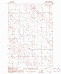
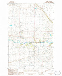
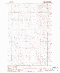
1980s Maps of Golden Valley County, Montana
Explore 26 historic maps of Golden Valley County from the 1980s. These maps offer a rare glimpse into what life looked like during the 1980s — showing old roads, neighborhoods, homes, and landmarks that have changed or disappeared over time.
Whether you're researching your family's past, planning a metal detecting trip, or studying how Golden Valley County's landscape evolved across the 1980s, these high-resolution maps are a powerful tool for exploring the history of this region.
- Focus on a specific era: All maps on this page are from the 1980s, giving you a focused view of this time period.
- See what’s changed: Compare century-old streets, trails, and buildings to today's modern landscape using overlays and satellite layers.
- Research with precision: Use these maps for genealogy, historical research, land use analysis, or educational projects.
- View, download, or print: Maps are fully viewable online in high resolution, and can be downloaded or printed for your own records.
Start exploring Golden Valley County's history through authentic maps from the 1980s. This is your window into the past.
Golden Valley County, MT maps
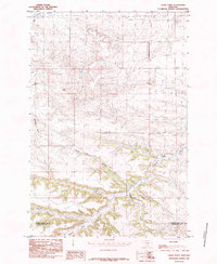
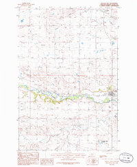
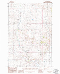
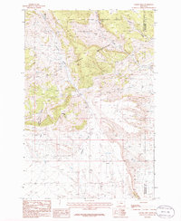
(26)- 1980 Map of Broadview NE
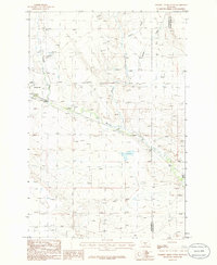
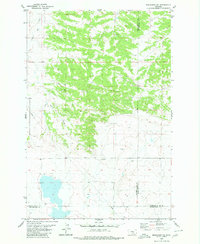 1980 Broadview NE1980 Print · USGSGolden Valley and Musselshell counties meet in this 1980 survey of the Montana high plains during a period of steady rural development. Researchers can trace land use patterns along the banks of Painted Robe Creek and Spring Creek or locate industrial markers like the Pipeline and Gravel Pit.
 - 1985 Map of Locomotive Butte
 1985 Locomotive Butte1985 Print · USGSThe rugged boundary between Golden Valley and Stillwater counties is captured here in the mid-1980s. Researchers can trace the water and utility infrastructure of the era, from a Pumping Station and Pipeline to a Flowing Well near Big Coulee Creek.
 - 1985 Map of Jim Creek
 1985 Jim Creek1985 Print · USGSThe Montana plains near the three-county corner of Wheatland, Sweet Grass, and Golden Valley are captured here during the mid-1980s. Researchers can trace the varied topography of the Cayuse Hills and the winding paths of Jim Creek and Potato Creek.
 - 1985 Map of Locomotive Butte SW
 1985 Locomotive Butte SW1985 Print · USGSThe triple-border intersection of Golden Valley, Sweet Grass, and Stillwater counties is captured here in the mid-1980s. Researchers can trace the winding paths of Sixshooter Creek and Whitney Creek or locate the prominent rise of Knob Hill.
 - 1985 Map of Mount Sinai
 1985 Mount Sinai1985 Print · USGSGolden Valley and Stillwater counties are captured in the mid-1980s, revealing a landscape of high ridges and deep drainages. Researchers can trace the rugged topography from Mount Sinai down through Big Coulee Creek and Custer Creek to find old trails and property lines.
 - 1985 Map of Eagle Point
 1985 Eagle Point1985 Print · USGSThe high plains of the Montana borderlands come into focus in the mid-1980s, revealing a landscape of dramatic buttes and winding coulees. Researchers can trace the drainages of Painted Robe Creek and locate landmarks like Antelope Butte and Stockade Gulch.
 - 1985 Map of Progress
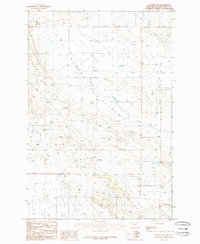
 1985 Progress1985 Print · USGSThe ranchlands of central Montana come into focus in the mid-1980s, centered on the small settlement of Progress. Researchers can trace the winding paths of Fish Creek and Simmons Creek or locate landmarks like Chinemans Hat and the local Gravel Pit.
 - 1985 Map of O'Brien Hill
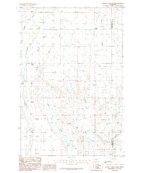
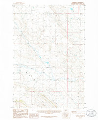
 1985 O'Brien Hill1985 Print · USGSThe high plains of Golden Valley County come into focus during the mid-eighties, showing a landscape defined by water rights and rugged topography. Researchers can trace the drainages of Fish Creek and Rock Creek or locate isolated wells and springs near O'Brien Hill.
 - 1985 Map of Gibson
 1985 Gibson1985 Print · USGSGolden Valley and Sweet Grass counties are captured in the mid-1980s, centered on the rural settlement of Gibson. Genealogists and historians can trace the intricate waterways of North Fork Big Coulee Creek and Sixshooter Creek across this high-plains landscape.
 - 1986 Map of Ryegate West
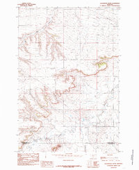
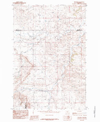
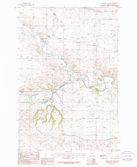
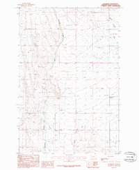
 1986 Ryegate West1986 Print · USGSGolden Valley County in the mid-1980s shows a landscape shaped by the Musselshell River and early transport routes. Genealogists and historians can trace the town of Ryegate, the settlement of Franklin, and the Old RR Grade.
 - 1986 Map of Ryegate East
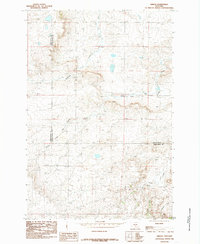
 1986 Ryegate East1986 Print · USGSGolden Valley near the mid-eighties shows a landscape defined by the winding Musselshell River and the small-town hub of Ryegate. Researchers can trace the legacy of local transport via the Old RR Grade and find landmarks like the Landing Strip.
 - 1986 Map of Patterson Canyon
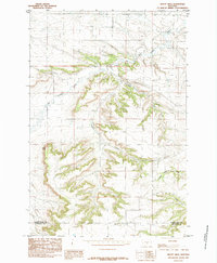
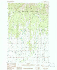
 1986 Patterson Canyon1986 Print · USGSCentral Montana's mountain-to-prairie transition is captured here in the mid-1980s, where national forest land meets remote ranching coulees. Researchers can trace historic access routes like the PACK TRAIL through the Big Snowy Mountains and locate landmarks like Mc Lean Lake and Red Hill.
 - 1986 Map of Snow Saucer Coulee
 1986 Snow Saucer Coulee1986 Print · USGSWheatland and Fergus counties meet in this 1980s survey of the high mountain front and deep coulee country. Researchers can trace historic county lines and drainage networks near Windy Point, Snow Saucer Coulee, and the headwaters of Careless Creek.
 - 1986 Map of Halbert Creek South
 1986 Halbert Creek South1986 Print · USGSWheatland and Golden Valley counties are captured here in the mid-1980s, detailing a ranching landscape defined by its creek beds. Researchers can trace the development of Hedgesville and locate rural landmarks such as Walters Coulee and Careless Creek.
 - 1986 Map of Deadmans Basin Reservoir
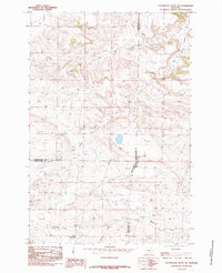
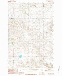
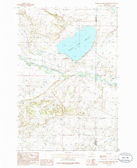 1986 Deadmans Basin Reservoir1986 Print · USGSCentral Montana water management and transport are on display in the mid-eighties near the Golden Valley line. Trace the Old Railroad Grade past Barber or locate the Gaging Station and Deadmans Basin Reservoir.
 - 1986 Map of Halbert Creek North
 1986 Halbert Creek North1986 Print · USGSThe ranchlands of the Montana plains are captured here in the mid-1980s as they span the Wheatland and Golden Valley county line. Researchers can trace the meandering paths of Careless Creek and Halbert Creek alongside a localized Gravel Pit.
 - 1986 Map of Emory School
 1986 Emory School1986 Print · USGSCentral Montana ranching country near the border of Golden Valley and Musselshell counties appears in this mid-eighties survey. Trace the landscape through landmarks like Emory School, the winding Cameron Creek, and the distinctive Steamboat Rock.
 - 1986 Map of Wallum
 1986 Wallum1986 Print · USGSGolden Valley County during the mid-eighties shows a landscape of wide rangeland and deep coulees centered on the hamlet of Wallum. Genealogists and researchers can trace the drainages of Swimming Woman Creek and Careless Creek to locate historic family ranch sites.
 - 1986 Map of Cushman NW
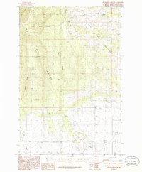
 1986 Cushman NW1986 Print · USGSGolden Valley County's high plains are captured here in the mid-1980s, showcasing a landscape of isolated springs and seasonal drainages. Researchers can trace the topography of Womans Pocket, the path of Currant Creek, and the alignment of a regional Pipeline.
 - 1986 Map of Rothiemay
 1986 Rothiemay1986 Print · USGSCentral Montana ranching country comes into focus in this mid-eighties survey of Golden Valley County. Local researchers can trace the course of Swimming Woman Creek, locate the Cem, and find old landmarks like Merrills Springs Creek.
 - 1986 Map of Cushman NE
 1986 Cushman NE1986 Print · USGSGolden Valley County in the mid-1980s reveals an expansive landscape of prairie drainages and isolated springs. Genealogists and land researchers can trace the natural boundaries of Womans Pocket and the routes of Fivemile Creek or Currant Creek.
 - 1986 Map of Sahara Hill
 1986 Sahara Hill1986 Print · USGSThe foothills of the Snowy Mountains are captured in the mid-1980s, showcasing the high-country transition from forest to prairie. Trace the rugged drainage patterns of Stonehouse Canyon and Cameron Creek or locate landmarks like Sahara Hill.
 - 1986 Map of Sahara Hill SE
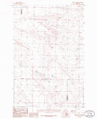
 1986 Sahara Hill SE1986 Print · USGSThe High Plains of central Montana appear here in the mid-1980s as a landscape of deep coulees and ranching infrastructure. Researchers can trace land features like Sahara Hill and utility markers including a Pipeline and Grain Bins.
 - 1986 Map of Cushman
 1986 Cushman1986 Print · USGSThe Musselshell River valley in the mid-1980s reveals a quiet landscape of rural Montana crossroads and ranching infrastructure. Researchers can trace the Old RR Grade through Cushman or locate Ninemile Spring and the Landing Strip.
 - 1986 Map of Sahara Hill SW
 1986 Sahara Hill SW1986 Print · USGSGolden Valley County ranching country is captured in the mid-1980s, showing a landscape shaped by water and wire. Genealogists and historians can trace essential landmarks like Merrills Spring Creek, the local Gravel Pit, and various Spring sites.
Showing maps 1-25 of 26
Top cities of Golden Valley County
Frequently asked questions
- What are the different types of historical maps available for Golden Valley County?
- What is the oldest map of Golden Valley County?
- Where can I purchase historical maps of Golden Valley County for my home or office?
- Where can I download high-res historical maps of Golden Valley County?
- Are there historical topographic maps available for Golden Valley County?
- Is there historical aerial imagery available for Golden Valley County?
- Where are historical maps of Golden Valley County sourced from?