Old Maps of Herron, Montana for Academic Research
Study the evolution of Herron with 12 high-resolution historic maps. Whether you're teaching, researching, or modeling changes in land use, these maps provide essential visual documentation of urban, environmental, and geographic change.
- Analyze long-term change: Track patterns in development, transportation, and natural features.
- Ideal for environmental or urban studies: Support academic projects with primary historical map data.
- Use in the classroom or lab: Educators and researchers rely on these maps to bring historical context to life.
These maps are a powerful tool for teaching, research, and visualizing how Herron has changed over the decades.
Herron, MT maps
(12)- 1904 Map of Assinniboine
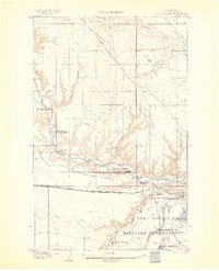 1904 Assinniboine1904 Print · USGSNorthern Montana ranching and military life are captured here at the start of the century, centered on the Milk River valley. Researchers can trace the layout of Fort Assinniboine and find family-named landmarks like Meili Ranch or Kelleys Ranch.2 unique versions available
 - 1912 Map of Thibedeau Lake
 1912 Thibedeau Lake1912 Print · USGSNorthern Montana's ranching frontier and rail corridors are captured here just after the turn of the century. Genealogists and historians can trace the early foundations of Havre and Fort Assinniboine, alongside family landmarks like Lohman's Ranch and Connolly Ranch.
 - 1953 Map of Havre, 1967 Print
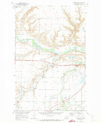
 1953 Havre1967 Print · USGSNorthern Montana’s Hi-Line comes into focus in the mid-fifties, centered on the Milk River and the critical Great Northern rail link. Genealogists can trace small sidings and settlements like Assinniboine, Laredo, and Box Elder alongside the Fort Belknap Agency.3 unique versions available
 - 1957 Map of Havre
 1957 Havre1957 Print · USGSNorth-central Montana at the mid-century is defined by the vital Great Northern rail corridor and the winding Milk River. Researchers can trace old settlements like Laredo and Savoy, or locate historic sites such as the Hays (old) Sub Agency and the Chinook No 1 mine.
 - 1958 Map of Havre
 1958 Havre1958 Print · USGSUpper Montana in the late fifties was a landscape of remote rail towns and vast high-plain ranges. Genealogists and historians can trace the Great Northern railroad through Havre, Chinook, and the Fort Belknap Indian Reservation.
 - 1970 Map of Herron Park, 1973 Print
 1970 Herron Park1973 Print · USGSNorth-central Montana in the early seventies reveals a landscape of river-valley agriculture and emerging energy fields. Researchers can trace the Agricultural Experiment Station or explore the rail hubs at Pacific Junction and Burnham.2 unique versions available
 - 1984 Map of Havre
 1984 Havre1984 Print · USGSThe Milk River valley and the northern high plains come into focus in the mid-1980s, detailing a landscape defined by rail, ranching, and water management. Trace the path of the Burlington Northern through Havre and Chinook, or locate sites like the Havre Air Force Station and Hilldale Colony.
 - 2011 Map of Herron Park, 2011 Print
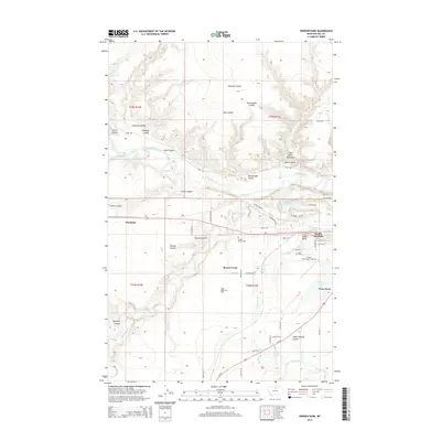
 2011 Herron Park2011 Print · USGSCovers Herron, including Beaver Creek, Hill County, and other nearby areas
 - 2014 Map of Herron Park, 2014 Print
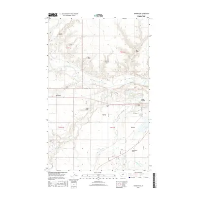
 2014 Herron Park2014 Print · USGSCovers Herron, including Beaver Creek, Hill County, and other nearby areas
 - 2017 Map of Herron Park, 2017 Print
 2017 Herron Park2017 Print · USGSCovers Herron, including Beaver Creek, Hill County, and other nearby areas
 - 2020 Map of Herron Park, 2020 Print
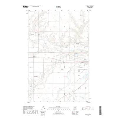 2020 Herron Park2020 Print · USGSCovers Herron, including Beaver Creek, Hill County, and other nearby areas
 - 2024 Map of Herron Park, 2024 Print
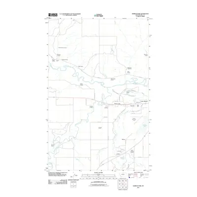
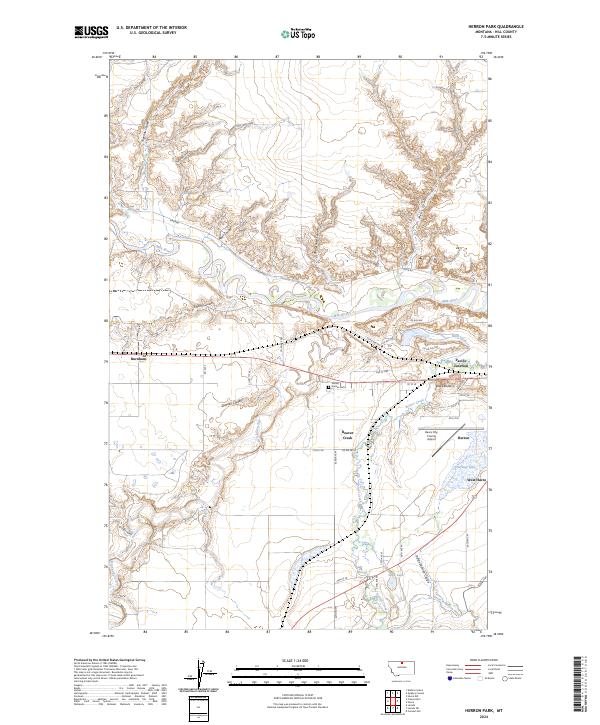 2024 Herron Park2024 Print · USGSHill County at the start of the 2020s shows a landscape shaped by the Milk River and the vital irrigation networks of the Montana high plains. Trace the historical growth of West Havre and Pacific Junction, or locate landmarks like Black Butte and the Havre City-County Airport.
End of results
Showing maps 1-12 of 12
Top cities near Herron
Frequently asked questions
- What are the different types of historical maps available for Herron?
- What is the oldest map of Herron?
- Where can I purchase historical maps of Herron for my home or office?
- Where can I download high-res historical maps of Herron?
- Are there historical topographic maps available for Herron?
- Is there historical aerial imagery available for Herron?
- Where are historical maps of Herron sourced from?