Old Maps of Salmon Prairie, Montana for Genealogy
Trace your family roots with 13 historic maps of Salmon Prairie. These high-res maps reveal old neighborhoods, homesites, landmarks, and streets — helping you uncover where your ancestors lived and how the area evolved over time.
- Explore historic neighborhoods: Identify where your relatives may have lived in the 1800s or 1900s.
- Compare maps over time: Trace the changes in streets, buildings, and landmarks for multi-generational research.
- Perfect for genealogy & ancestry research: Used by family historians and researchers to map out lineage and migration.
These maps are an incredible resource for exploring your personal connection to Salmon Prairie's past.
Salmon Prairie, MT maps
(13)- 1955 Map of Choteau, 1978 Print
 1955 Choteau1978 Print · USGSWestern Montana during the mid-fifties is captured here as a land of rugged high-country wilderness and vital eastern plains irrigation. Genealogists and historians can locate remote outposts like Condon, the communal Miller Colony, and the rail stops of the Chicago Milwaukee St Paul and Pacific.
 - 1957 Map of Choteau
 1957 Choteau1957 Print · USGSMontana's mountain front meets the eastern plains in the mid-fifties, showing the transition from forested wilderness to irrigated ranch land. Genealogists and historians can trace the rail lines of the Great Northern and find settlements like Choteau, Augusta, and Seeley Lake.
 - 1958 Map of Choteau
 1958 Choteau1958 Print · USGSMontana's front range meets the high wilderness in the late fifties, where the Great Northern railway connects ranching towns to the eastern plains. Researchers can trace the development of irrigation at Bynum Reservoir or locate remote camps like the Big Prairie District Ranger Station and Helmville.2 unique versions available
 - 1962 Map of Choteau
 1962 Choteau1962 Print · USGSThe Rocky Mountain Front meets the western plains in the early 1960s, showing a landscape defined by the Continental Divide. Genealogists and researchers can trace the tracks of the Great Northern and find settlements like Choteau, Augusta, and Bynum.
 - 1965 Map of Salmon Prairie, 1968 Print
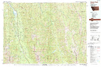
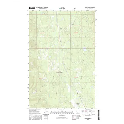
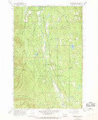 1965 Salmon Prairie1968 Print · USGSThe Swan River valley in the mid-1960s was a landscape of dense timber and quiet mountain meadows. Researchers can trace early forest management at the State Forest Hdqrs or locate backcountry routes like the Pack Trail and Jeep Trail near Salmon Prairie.3 unique versions available
 - 1976 Map of Choteau
 1976 Choteau1976 Print · USGSThe Montana Rocky Mountain Front meets the plains in the 1970s, showcasing the high-altitude wilderness and the irrigation-fed ranching country. Trace the Great Northern Railway through Choteau or locate rural landmarks like the Farmington Cemetery and Gibson Reservoir.
 - 1988 Map of Swan Peak, 1989 Print
 1988 Swan Peak1989 Print · USGSSettlement in the Swan River Valley and the Bob Marshall Wilderness are captured in this late 1980s survey. Researchers can locate remote backcountry sites like the Spotted Bear Airport, the village of Condon, and the Swan Lake shoreline.
 - 1994 Map of Salmon Prairie, 1996 Print
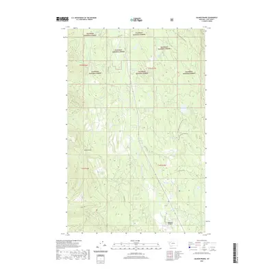
 1994 Salmon Prairie1996 Print · USGSIn the mid-1990s, the Swan River valley remained a timber-rich landscape managed by state and federal agencies. Genealogists and researchers can trace the drainages near Salmon Prairie or locate landmarks like Van Lake and the Swan Peak Scenic Overlook.
 - 2011 Map of Salmon Prairie, 2011 Print
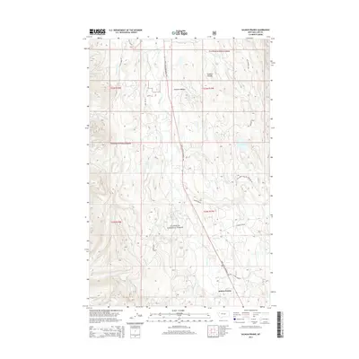
 2011 Salmon Prairie2011 Print · USGSCovers Salmon Prairie, including Lake County, United States, and other nearby areas
 - 2014 Map of Salmon Prairie, 2014 Print
 2014 Salmon Prairie2014 Print · USGSCovers Salmon Prairie, including Lake County, United States, and other nearby areas
 - 2017 Map of Salmon Prairie, 2017 Print
 2017 Salmon Prairie2017 Print · USGSCovers Salmon Prairie, including Lake County, United States, and other nearby areas
 - 2020 Map of Salmon Prairie, 2020 Print
 2020 Salmon Prairie2020 Print · USGSCovers Salmon Prairie, including Lake County, United States, and other nearby areas
 - 2024 Map of Salmon Prairie, 2024 Print
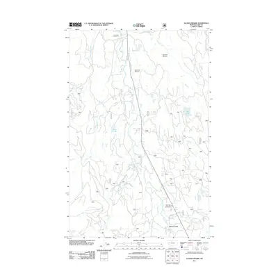
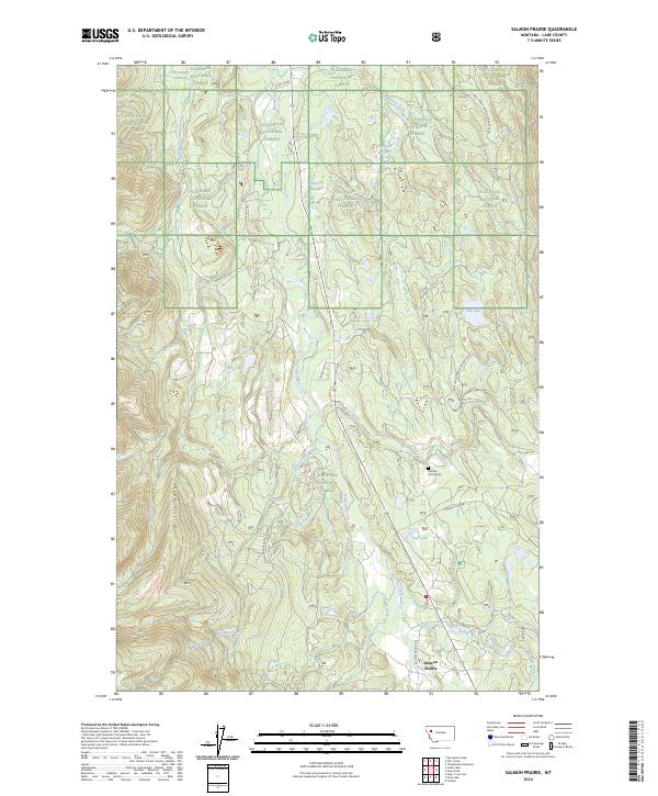 2024 Salmon Prairie2024 Print · USGSSalmon Prairie and the Swan River valley are captured in this recent survey during a period of continued forest management and recreation. Researchers can trace land use through features like the Natural Cemeteries, Squeezer Meadow, and the Mission Range foothills.
End of results
Showing maps 1-13 of 13
Frequently asked questions
- What are the different types of historical maps available for Salmon Prairie?
- What is the oldest map of Salmon Prairie?
- Where can I purchase historical maps of Salmon Prairie for my home or office?
- Where can I download high-res historical maps of Salmon Prairie?
- Are there historical topographic maps available for Salmon Prairie?
- Is there historical aerial imagery available for Salmon Prairie?
- Where are historical maps of Salmon Prairie sourced from?