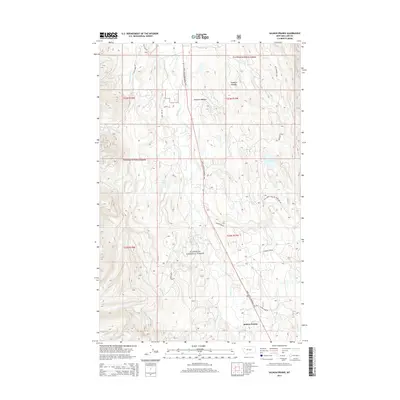
2014 Map of Salmon Prairie
USGS Topo · Published 2014About this map
Salmon Prairie serves as the primary focal point in this portion of the Swan River valley within the Flathead National Forest. The landscape is defined by its complex hydrology, with numerous named drainages such as Lion Cr, Squeezer Cr, and Fatty Cr feeding into the main river channel. Notable clearings and alpine features like Squeezer Meadow and Simmons Meadow break up the forested terrain, while several localized bodies of water including Shay Lake and Van Lake are tucked into the topography. Transportation through this region is facilitated by the Daryl Soltesz Memorial Hwy, which provides access to a network of forest development roads. The mapping of Dry Lake and various smaller creeks like Jim Cr and Alder Cr reveals the seasonal water patterns and geographical details critical for navigating this Montana back-country.
Find a feature on this map
34 named features on this map. Tap any name to fly to it.
Don’t see what you’re looking for? This feature index may not catch every label — zoom into the map to look around manually.
Map Details
Editions of this 2014 Salmon Prairie Map
This is the sole edition of this map. No revisions or reprints were ever made.
Other maps of this area

1955 · Choteau
USGS Topo · 1:250,000

1957 · Choteau
USGS Topo · 1:250,000

1958 · Choteau
USGS Topo · 1:250,000

1962 · Choteau
USGS Topo · 1:250,000

1965 · Peck Lake
USGS Topo · 1:24,000

1965 · Condon
USGS Topo · 1:24,000
1965 · Thunderbolt Mountain
USGS Topo · 1:24,000

1965 · Swan Peak
USGS Topo · 1:24,000
1965 · Piper-Crow Pass
USGS Topo · 1:24,000
1965 · Cilly Creek
USGS Topo · 1:24,000