
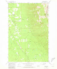
1965 Map of Condon
USGS Topo · Published 1968About this map
Condon and its surrounding mountain valley landscape are documented here during the mid-1960s, showing a remote outpost centered on forestry and light aviation. The Swan River flows through the western portion of the quadrangle, flanked by the Flathead National Forest and the Bob Marshall Wilderness Boundary to the east. This era shows a focus on fire lookout operations and forest management, evidenced by the Condon Lookout Tower and Cooney Lookout Tower, as well as the local Ranger Sta and Condon PO. A distinct Landing Strip on the Smith Creek flats suggests the importance of air access for this mountain community. Numerous drainages such as Glacier Creek, Falls Creek, and McKay Creek carve through the high elevations, while Cat Lake sits near the northern boundary. The map captures the meeting point of Lake, Missoula, and Flathead counties in a landscape defined by water and timber.
Find a feature on this map
28 named features on this map. Tap any name to fly to it.
Don’t see what you’re looking for? This feature index may not catch every label — zoom into the map to look around manually.
Map Details
Editions of this 1965 Condon Map
3 editions found
Other maps of this area

1921 · Elbow Lake
USGS Topo · 1:125,000

1955 · Choteau
USGS Topo · 1:250,000

1957 · Choteau
USGS Topo · 1:250,000

1958 · Choteau
USGS Topo · 1:250,000

1962 · Choteau
USGS Topo · 1:250,000

1965 · Peck Lake
USGS Topo · 1:24,000

1965 · Sunburst Lake
USGS Topo · 1:24,000

1965 · Holland Lake
USGS Topo · 1:24,000

1965 · Swan Peak
USGS Topo · 1:24,000
1965 · Cygnet Lake
USGS Topo · 1:24,000