
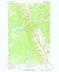
1965 Map of Holland Lake
USGS Topo · Published 1968About this map
Holland Lake serves as the focal point for this 1965 field-checked survey of the northern Swan Mountains, where the high peaks of the Bob Marshall Wilderness dominate the eastern skyline. The map details a landscape managed for both timber and recreation, spanning the boundary between the Flathead National Forest and Lolo National Forest. Public access is centered around the Holland Lake Campground and a nearby Guard Station, while a network of primitive routes like the Holland Gordon Trail and several unnamed pack trails reach into the high country.
Find a feature on this map
38 named features on this map. Tap any name to fly to it.
Don’t see what you’re looking for? This feature index may not catch every label — zoom into the map to look around manually.
Map Details
Editions of this 1965 Holland Lake Map
2 editions found
Other maps of this area

1902 · Ovando
USGS Topo · 1:125,000

1905 · Ovando
USGS Topo · 1:125,000

1921 · Elbow Lake
USGS Topo · 1:125,000

1936 · Silvertip
USGS Topo · 1:96,000

1942 · Silvertip
USGS Topo · 1:125,000

1955 · Choteau
USGS Topo · 1:250,000

1957 · Choteau
USGS Topo · 1:250,000

1958 · Choteau
USGS Topo · 1:250,000

1962 · Choteau
USGS Topo · 1:250,000

1965 · Condon
USGS Topo · 1:24,000