Old Maps of Tiber, Montana for Metal Detecting
Plan your next treasure hunt with 9 historic maps of Tiber. Find old homesites, ghost towns, trails, and gathering spots that may be lost to time — perfect for identifying promising metal detecting locations.
- Locate forgotten sites: Uncover places like long-lost settlements, abandoned rail lines, or gathering spots.
- Plan better hunts: Use map overlays combined with LiDAR or satellite views to narrow in on historically rich areas.
- Made for detectorists: Thousands of hobbyists use these maps to discover relics, coins, and hidden history.
Use these historic maps to boost your research and find new opportunities beneath the surface of Tiber.
Tiber, MT maps
(9)- 1954 Map of Shelby, 1967 Print
 1954 Shelby1967 Print · USGSNorthern Montana's Hi-Line is captured in the mid-fifties, showing a landscape shaped by the Great Northern rail and early oil development. Trace family roots in Shelby and Conrad, or locate rural landmarks like Goose Bill Butte and the Rocky Boys Indian Reservation.3 unique versions available
 - 1958 Map of Shelby
 1958 Shelby1958 Print · USGSNorthern Montana’s high plains and the Sweetgrass Hills come to life in the late fifties as the Tiber Dam begins to reshape the Marias River valley. Genealogists and historians can trace rail-town lineages along the Great Northern line and locate sites like the Hull Coal Mine or Sweet Grass.
 - 1962 Map of Tiber, 1964 Print
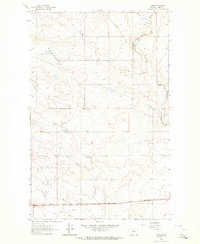 1962 Tiber1964 Print · USGSThe Montana prairie south of the Sweet Grass Hills comes into focus in the early sixties, centered on the Great Northern railway. Researchers can locate the Tiber station and trace the path of Whitlash Road as it winds near Horse Creek.
 - 1984 Map of Sweet Grass Hills
 1984 Sweet Grass Hills1984 Print · USGSThe High Plains of Toole County meet the Canadian border in the early eighties, showcasing a landscape of isolated buttes and essential water coulees. Researchers can trace the Burlington Northern line through Sunburst or locate the Mt Dermott Mine tucked into West Butte.
 - 2011 Map of Tiber, 2011 Print
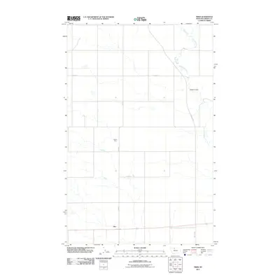 2011 Tiber2011 Print · USGSCovers Tiber, including Liberty County, United States, and other nearby areas
 - 2014 Map of Tiber, 2014 Print
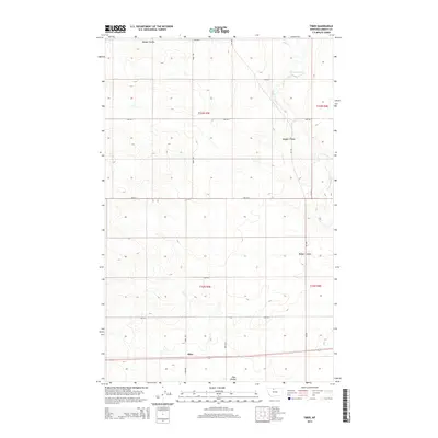 2014 Tiber2014 Print · USGSCovers Tiber, including Liberty County, United States, and other nearby areas
 - 2017 Map of Tiber, 2017 Print
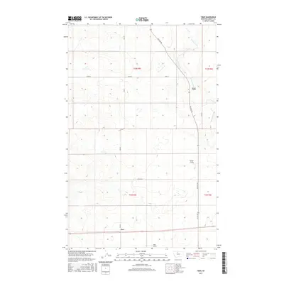 2017 Tiber2017 Print · USGSCovers Tiber, including Liberty County, United States, and other nearby areas
 - 2020 Map of Tiber, 2020 Print
 2020 Tiber2020 Print · USGSCovers Tiber, including Liberty County, United States, and other nearby areas
 - 2024 Map of Tiber, 2024 Print
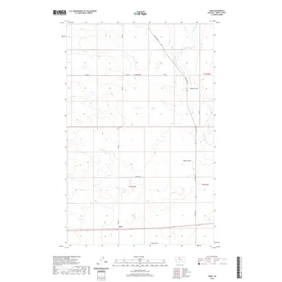
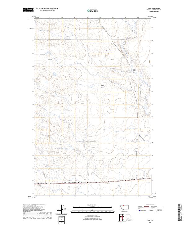 2024 Tiber2024 Print · USGSLiberty County plains are documented here in the early twenty-first century, showing the rural layout of the Montana high country. Researchers can trace the intersection of Tiber Rd and Utopia Rd near Tiber, or follow the path of Cottonwood Creek.
End of results
Showing maps 1-9 of 9
Top cities near Tiber
Frequently asked questions
- What are the different types of historical maps available for Tiber?
- What is the oldest map of Tiber?
- Where can I purchase historical maps of Tiber for my home or office?
- Where can I download high-res historical maps of Tiber?
- Are there historical topographic maps available for Tiber?
- Is there historical aerial imagery available for Tiber?
- Where are historical maps of Tiber sourced from?