Old Maps of Prairie Elk Hutterite Colony, Montana for Metal Detecting
Plan your next treasure hunt with 9 historic maps of Prairie Elk Hutterite Colony. Find old homesites, ghost towns, trails, and gathering spots that may be lost to time — perfect for identifying promising metal detecting locations.
- Locate forgotten sites: Uncover places like long-lost settlements, abandoned rail lines, or gathering spots.
- Plan better hunts: Use map overlays combined with LiDAR or satellite views to narrow in on historically rich areas.
- Made for detectorists: Thousands of hobbyists use these maps to discover relics, coins, and hidden history.
Use these historic maps to boost your research and find new opportunities beneath the surface of Prairie Elk Hutterite Colony.
Prairie Elk Hutterite Colony, MT maps
(9)- 1915 Map of Oswego
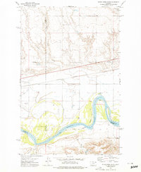
 1915 Oswego1915 Print · USGSNortheast Montana at the height of the homesteading era centers on the Oswego rail stop and the wide Missouri River. Genealogists and historians can trace early land patterns across the Fort Peck Indian Reservation and locate landmarks like Three Buttes and the Great Northern rail line.2 unique versions available
 - 1954 Map of Wolf Point, 1967 Print
 1954 Wolf Point1967 Print · USGSNortheastern Montana and the North Dakota borderlands are shown here in the mid-fifties, dominated by the Missouri River and the Fort Peck Indian Reservation. Genealogists and historians can trace the Great Northern rail line through river towns like Poplar and Culbertson or locate northern border outposts like the U S Custom Office at Raymond.2 unique versions available
 - 1958 Map of Wolf Point
 1958 Wolf Point1958 Print · USGSNortheastern Montana is shown during the mid-fifties, featuring the extensive Fort Peck Indian Reservation and the Missouri River valley. Researchers can trace the Great Northern railroad through Wolf Point or locate sites like Slab Crossing and the Coal Mine near Medicine Lake.
 - 1972 Map of Flynn Creek South, 1975 Print
 1972 Flynn Creek South1975 Print · USGSThe Missouri River valley at the Fort Peck Indian Reservation is shown here in the 1970s, as the river snakes between multiple county lines. Local researchers can locate the Oswego Ch, a local Cem, and the tracks of the Burlington Northern railroad.2 unique versions available
 - 2011 Map of Flynn Creek South, 2011 Print
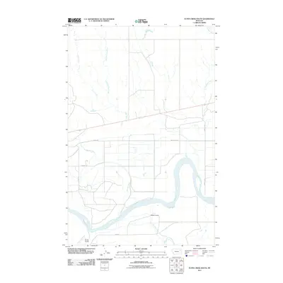 2011 Flynn Creek South2011 Print · USGSCovers Prairie Elk Hutterite Colony, including Wolf Point District, Oswego District, and other nearby areas
 - 2014 Map of Flynn Creek South, 2014 Print
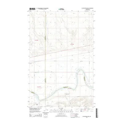 2014 Flynn Creek South2014 Print · USGSCovers Prairie Elk Hutterite Colony, including Wolf Point District, Oswego District, and other nearby areas
 - 2017 Map of Flynn Creek South, 2017 Print
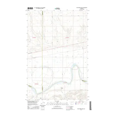 2017 Flynn Creek South2017 Print · USGSCovers Prairie Elk Hutterite Colony, including Wolf Point District, Oswego District, and other nearby areas
 - 2020 Map of Flynn Creek South, 2020 Print
 2020 Flynn Creek South2020 Print · USGSCovers Prairie Elk Hutterite Colony, including Wolf Point District, Oswego District, and other nearby areas
 - 2024 Map of Flynn Creek South, 2024 Print
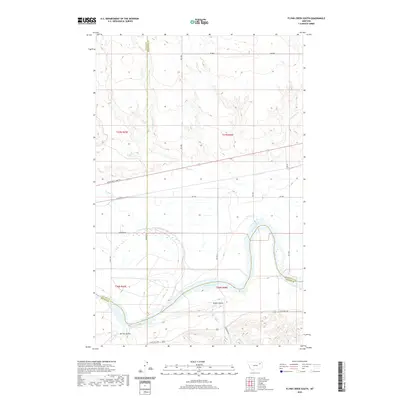
 2024 Flynn Creek South2024 Print · USGSThe Missouri River bottomlands meet the high Montana plains in this recent survey of the Roosevelt County borderlands. Genealogists can locate the Oswego Presbyterian Cem while historians trace the paths of the Lewis and Clark Trl and Indian Hwy.
End of results
Showing maps 1-9 of 9
Top cities near Prairie Elk Hutterite Colony
Frequently asked questions
- What are the different types of historical maps available for Prairie Elk Hutterite Colony?
- What is the oldest map of Prairie Elk Hutterite Colony?
- Where can I purchase historical maps of Prairie Elk Hutterite Colony for my home or office?
- Where can I download high-res historical maps of Prairie Elk Hutterite Colony?
- Are there historical topographic maps available for Prairie Elk Hutterite Colony?
- Is there historical aerial imagery available for Prairie Elk Hutterite Colony?
- Where are historical maps of Prairie Elk Hutterite Colony sourced from?