Old Maps of Poplar District, Montana
Explore 122 old maps of Poplar District, spanning from 1910 to today. These high-resolution historic maps reveal how streets, neighborhoods, landmarks, and natural features evolved over time — perfect for genealogy, metal detecting, research, and local history exploration.
What you can do with these maps:
- See how Poplar District changed over time: Compare historical maps to modern-day views to trace roads, homesites, rail lines & more.
- View detailed metadata: Each map includes creators, publishers, year, scale, and archive source.
- Overlay maps with satellite & LiDAR: Visualize the past alongside modern tools to explore terrain & human change.
- Trusted historical sources: Maps sourced from the USGS, Library of Congress, and other archives.
- Access maps your way: View online, download high-res files, or order prints for personal or research use.
Start exploring old maps of Poplar District to uncover forgotten places, hidden landmarks, and the deep history beneath your feet.
Poplar District, MT maps
(122)- 1910 Map of Cuskers, 1975 Print
 1910 Cuskers1975 Print · USGSNortheastern Montana lands are documented here during the early years of the twentieth century, showing the topography of the Fort Peck Indian Reservation. Genealogists and historians can trace the Poplar River and identify the specific site of the Cuskers House.2 unique versions available
 - 1912 Map of Chelsea
 1912 Chelsea1912 Print · USGSNortheastern Montana at the start of the twentieth century shows the intersection of the Fort Peck Indian Reservation and the Great Plains rail economy. Trace early settlements like Chelsea and Nickwall along the Missouri River and the Great Northern tracks.2 unique versions available
 - 1912 Map of Hay Creek
 1912 Hay Creek1912 Print · USGSNortheastern Montana rangeland is captured here just before the Great War, during a period of early ranching and reservation administration. Genealogists and historians can locate Kerns Ranch and trace the original course of the Poplar River and Hay creek.2 unique versions available
 - 1912 Map of Poplar
 1912 Poplar1912 Print · USGSThe High Plains of northeastern Montana are captured here just before the first World War, centered on the confluence of two major waterways. Genealogists and historians can trace early railroad siding stops like Sprole and Arthur along the Great Northern line and through the Fort Peck Indian Reservation.
 - 1915 Map of Cuskers
 1915 Cuskers1915 Print · USGSNortheastern Montana lands within the Fort Peck Indian Reservation appear here in the early twentieth century. Genealogists and researchers can trace the isolated Cuskers House and follow the natural drainages of the Poplar River and Boxelder Creek.
 - 1954 Map of Wolf Point, 1967 Print
 1954 Wolf Point1967 Print · USGSNortheastern Montana and the North Dakota borderlands are shown here in the mid-fifties, dominated by the Missouri River and the Fort Peck Indian Reservation. Genealogists and historians can trace the Great Northern rail line through river towns like Poplar and Culbertson or locate northern border outposts like the U S Custom Office at Raymond.2 unique versions available
 - 1958 Map of Wolf Point
 1958 Wolf Point1958 Print · USGSNortheastern Montana is shown during the mid-fifties, featuring the extensive Fort Peck Indian Reservation and the Missouri River valley. Researchers can trace the Great Northern railroad through Wolf Point or locate sites like Slab Crossing and the Coal Mine near Medicine Lake.
 - 1972 Map of Chelsea SW, 1975 Print
 1972 Chelsea SW1975 Print · USGSMcCone and Roosevelt counties are shown here in the early 1970s as industrial pipelines and railroads began to cross the Missouri River breaks. Genealogists and researchers can trace the Fort Peck Indian Reservation Boundary and find local landmarks like Nickwall Dam and the Burlington Northern rail line.
 - 1972 Map of Poplar, 1975 Print
 1972 Poplar1975 Print · USGSThe confluence of the Missouri and Poplar Rivers is captured in the early seventies, centered on the hub of Poplar within the reservation. Trace the Burlington Northern rail line and local landmarks like the Arthur Sch and the Poplar Airport.2 unique versions available
 - 1972 Map of Chelsea, 1975 Print
 1972 Chelsea1975 Print · USGSRoosevelt County's riverfront and reservation lands are captured in the early seventies, centered on the Chelsea settlement. Family researchers can trace St Anns Cem and Boxelder Cem along the Burlington Northern rail corridor.
 - 1972 Map of Chelsea NW, 1975 Print
 1972 Chelsea NW1975 Print · USGSNortheastern Montana lands within the Fort Peck Indian Reservation are captured here in the early seventies. Researchers can trace the rugged drainages of Tule Creek and Chelsea Creek as they converge near the Burlington Northern railroad and regional Pipeline.
 - 1972 Map of Badger Creek, 1975 Print
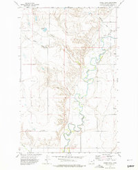 1972 Badger Creek1975 Print · USGSRoosevelt County in the early seventies shows a landscape defined by the Poplar River and the expanding East Poplar Oil Field. Researchers can trace old resource extraction sites, from several Oil Wells to the Crandall Reservoir and the Little Badger Spr.
 - 1972 Map of Nickwall, 1975 Print
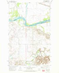 1972 Nickwall1975 Print · USGSMcCone County, Montana, was a landscape of river confluences and reservation borders in the early 1970s. Researchers can trace the settlement at Nickwall, locate the Pleasant View Cem, and study the shifting banks of the Missouri River.
 - 1973 Map of Bredette, 1976 Print
 1973 Bredette1976 Print · USGSBredette and the surrounding plains of Northeast Montana are documented here in the early 1970s within the Fort Peck Indian Reservation. Researchers can trace the meandering Poplar River, identify local Storage Bins, and locate administrative markers along the Roosevelt County line.
 - 1973 Map of Line Coulee, 1976 Print
 1973 Line Coulee1976 Print · USGSDaniels County ranch lands meet the Fort Peck Indian Reservation Boundary in this early 1970s survey. Genealogists and historians can trace the deep prairie drainages of Big Line Coulee and Line Coulee alongside rural landmarks like isolated Springs.
 - 1973 Map of Pleasant Prairie NW, 1976 Print
 1973 Pleasant Prairie NW1976 Print · USGSDaniels County is shown in the early seventies, capturing the sparsely populated prairie where the reservation meets the High Plains. Genealogists and local historians can locate Orville Cem and trace the paths of Smoke Creek and Eagle Creek.
 - 1973 Map of Nielsen Coulee, 1976 Print
 1973 Nielsen Coulee1976 Print · USGSThe high plains along the Daniels and Roosevelt County line are captured here in the early 1970s. Researchers can trace water sources and drainage patterns along the Poplar River, Nielsen Coulee, and West Fork Poplar River.
 - 1973 Map of Pleasant Prairie SW, 1976 Print
 1973 Pleasant Prairie SW1976 Print · USGSRoosevelt and Daniels counties are shown during the 1970s, featuring the open prairie landscape of the Fort Peck Indian Reservation. Researchers can trace landforms like Square Butte, Pole Hill, and the course of Out Give Creek.
 - 1973 Map of Cabarett Coulee, 1976 Print
 1973 Cabarett Coulee1976 Print · USGSDaniels County in the early seventies is mapped here along the winding Poplar River and the FORT PECK INDIAN RESERVATION BOUNDARY. Genealogists and local historians can locate Fairview Cem, Silver Star Hall, and various named coulees.
 - 1973 Map of Poplar Coulee, 1976 Print
 1973 Poplar Coulee1976 Print · USGSNortheast Montana ranching country is captured here in the early seventies, spanning a corner of the Fort Peck Indian Reservation. Trace the rugged drainage of Shipstead Coulee and locate specific water sources like Cottonwood Creek and various Springs.2 unique versions available
 - 1983 Map of Hay Creek NW
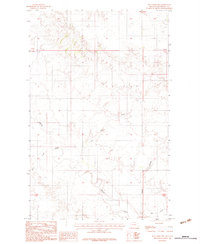 1983 Hay Creek NW1983 Print · USGSThe Fort Peck Indian Reservation landscape in the early eighties is defined by the winding Poplar River and its many tributaries. Researchers can trace the drainage patterns and land contours of Roosevelt County through features like Swank Coulee and Lone Tree Creek.
 - 1983 Map of Long Creek West
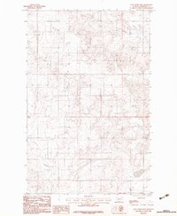 1983 Long Creek West1983 Print · USGSRoosevelt County within the Fort Peck Indian Reservation is shown here in the late seventies as a landscape shaped by remote drainage basins. Researchers can trace the winding paths of Long Creek and Boxelder Creek through the open rangeland and coulees.
 - 1983 Map of Long Creek East
 1983 Long Creek East1983 Print · USGSNortheastern Montana's high plains within the Fort Peck Indian Reservation are captured here as they appeared in the early eighties. Local historians and land researchers can trace the drainages of the Poplar River and find agricultural landmarks like Grain Bins.
 - 1983 Map of Bears Nest
 1983 Bears Nest1983 Print · USGSRoosevelt County's high plains and winding coulees are captured in the early eighties as the land remained largely open range. Genealogists and historians can trace water sources and terrain landmarks like Bears Nest, Snell Spring, and Assiniboine Creek.2 unique versions available
 - 1983 Map of Sims Spring
 1983 Sims Spring1983 Print · USGSRoosevelt County's high plains are captured here in the early eighties, showcasing the intersection of natural drainage and agricultural industry. Researchers can trace the courses of Boxelder Creek and Chelsea Creek or locate specific landmarks like the Landing Strip and Grain Bins.
Showing maps 1-25 of 122
Top cities near Poplar District
Top neighborhoods of Poplar District
Frequently asked questions
- What are the different types of historical maps available for Poplar District?
- What is the oldest map of Poplar District?
- Where can I purchase historical maps of Poplar District for my home or office?
- Where can I download high-res historical maps of Poplar District?
- Are there historical topographic maps available for Poplar District?
- Is there historical aerial imagery available for Poplar District?
- Where are historical maps of Poplar District sourced from?