
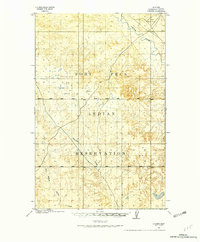
1910 Map of Cuskers
USGS Topo · Published 1975About this map
The Fort Peck Indian Reservation defines this early 20th-century landscape, surveyed at a time when the region was transitioning from open range to a more structured allotment and settlement system. The Poplar River cuts through the northeastern corner of the map, serving as a primary hydrological feature for the surrounding plains. A lone domestic landmark, Cuskers House, sits near the river's bend, providing a rare genealogical anchor for researchers studying early 1900s inhabitants of what is now Roosevelt County. The undulating terrain is further drained by Boxelder Creek and the East Branch Chelsea Creek, illustrating the natural drainage patterns of the high plains before the widespread development of modern infrastructure.
Find a feature on this map
5 named features on this map. Tap any name to fly to it.
Don’t see what you’re looking for? This feature index may not catch every label — zoom into the map to look around manually.
Map Details
Editions of this 1910 Cuskers Map
2 editions found
Other maps of this area

1912 · Chelsea
USGS Topo · 1:62,500

1912 · Hay Creek
USGS Topo · 1:62,500

1912 · Poplar
USGS Topo · 1:62,500

1915 · Tule Valley
USGS Topo · 1:62,500

1915 · Cuskers
USGS Topo · 1:62,500

1916 · Wolf Point
USGS Topo · 1:62,500

1954 · Wolf Point
USGS Topo · 1:250,000

1958 · Wolf Point
USGS Topo · 1:250,000

1972 · Chelsea
USGS Topo · 1:24,000

1972 · Chelsea NW
USGS Topo · 1:24,000