
1958 Map of Wolf Point
USGS Topo · Published 1958About this map
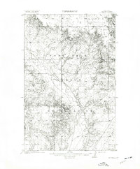
The Fort Peck Indian Reservation dominates this northeastern Montana landscape, where the wide valley of the Missouri River meets the expansive plains of Roosevelt and Sheridan counties. In the mid-1950s, the Great Northern railroad corridor serves as the primary backbone of commerce, connecting riverfront towns like Wolf Point, Poplar, and Culbertson. To the north, the Medicine Lake National Wildlife Refuge provides a distinct ecological contrast, surrounding Medicine Lake and its numerous islands.
Find a feature on this map
94 named features on this map. Tap any name to fly to it.
Don’t see what you’re looking for? This feature index may not catch every label — zoom into the map to look around manually.
Map Details
Editions of this 1958 Wolf Point Map
This is the sole edition of this map. No revisions or reprints were ever made.
Other maps of this area

1909 · Glendive
USGS Topo · 1:250,000

1909 · Smoke Creek
USGS Topo · 1:62,500

1910 · Todd Lakes
USGS Topo · 1:62,500

1910 · Cuskers
USGS Topo · 1:62,500

1912 · Chelsea
USGS Topo · 1:62,500
1912 · Hay Creek
USGS Topo · 1:62,500

1912 · Poplar
USGS Topo · 1:62,500

1912 · Smoke Creek
USGS Topo · 1:62,500

1914 · Brockton
USGS Topo · 1:62,500

1914 · Homestead
USGS Topo · 1:62,500
Featured Places
- Wolf Point District, MT
- Wolf Point, Wolf Point District
- Plentywood, MT
- Scobey, MT
- Poplar, Poplar District