Old Maps of Robinson, Montana for Hiking & Exploration
Hike through history with 17 historic maps of Robinson. Explore old trails, ghost towns, and forgotten backroads — perfect for outdoor adventurers and local explorers.
- Rediscover forgotten places: Map out old mining camps, roads, and footpaths that no longer exist on modern maps.
- Layer with modern tools: Combine with LiDAR or satellite views to plan hikes through historical terrain.
- Made for exploration: Popular among hikers, overlanders, and local history lovers.
Use these maps to find adventure and explore the hidden past of Robinson.
Robinson, MT maps
(17)- 1886 Map of Little Belt Mts.
 1886 Little Belt Mts.1886 Print · USGSCentral Montana territory during the mid-1880s is captured here, showing the region's early mining camps and ranching hubs. Researchers can trace the early layouts of White Sulphur Spring and Neihart or locate landmarks like Copperopolis and Crazy Peak.
 - 1894 Map of Little Belt Mts.
 1894 Little Belt Mts.1894 Print · USGSCentral Montana in the late nineteenth century is a land of emerging mining camps and river valley outposts. Historians can trace the early footprints of White Sulphur Spring, the copper prospects at Copperopolis, and the mountain terrain of Neihart.2 unique versions available
 - 1897 Map of Little Belt Mts.
 1897 Little Belt Mts.1897 Print · USGSMeagher County and the central Montana high country are captured here in the 1890s, when mining camps and early ranching outposts were first being established. Researchers can trace the early layout of White Sulphur Springs and locate now-quiet sites like the Sapphire Mine or Copperopolis.
 - 1898 Map of Little Belt Mts.
 1898 Little Belt Mts.1898 Print · USGSCentral Montana in the late nineteenth century is a landscape of mountain mining camps and early ranching outposts. Genealogists and historians can trace the pioneer footprints of White Sulphur Springs, the operations at Sapphire Mine, and the route of Sixteenmile Creek.
 - 1902 Map of Little Belt Mts.
 1902 Little Belt Mts.1902 Print · USGSMeagher County at the close of the nineteenth century is a landscape of mountain mining camps and riverside settlements. Researchers can trace early industry and family roots near the Sapphire Mine, the town of White Sulphur Springs, and the camp at Neihart.3 unique versions available
 - 1948 Map of White Sulphur Springs, 1951 Print
 1948 White Sulphur Springs1951 Print · USGSMontana's capital and the high country of the Big Belt Mountains come alive in this mid-century survey. Trace the early hydroelectric developments at Canyon Ferry Dam or follow the historic rail lines through Ringling and Townsend.
 - 1958 Map of White Sulphur Springs, 1968 Print
 1958 White Sulphur Springs1968 Print · USGSCentral Montana in the late fifties was a landscape of high-country mining and newly formed reservoirs. You can trace the rail-and-river economy of the era through sites like Canyon Ferry Lake, the East Pacific Mine, and the historic Fort Logan.3 unique versions available
 - 1961 Map of White Sulphur Springs
 1961 White Sulphur Springs1961 Print · USGSThe Missouri River valley and central Montana highlands are captured here during a period of significant hydroelectric and rail expansion. Genealogists and rail historians can trace the paths of the Northern Pacific and Chicago Milwaukee St Paul and Pacific through settlements like White Sulphur Springs and Townsend.
 - 1965 Map of White Sulphur Springs
 1965 White Sulphur Springs1965 Print · USGSCentral Montana in the late 1950s and early 60s reveals a rugged mountain landscape shaped by the Missouri River and the emergence of the Canyon Ferry Reservoir. Genealogists and local historians can trace legacy ranching sites, the Northern Pacific rail line, and remote schoolhouses like Cottonwood School and Spokane Creek School.
 - 1972 Map of Castle Town, 1975 Print
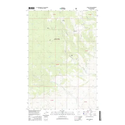
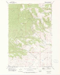 1972 Castle Town1975 Print · USGSThe Castle Mountains silver district is captured here in the early 1970s, showcasing a landscape shaped by mining and timber. Researchers can trace the Old Railroad Grade and locate old workings like the Cumberland Mines and Castle Town.2 unique versions available
 - 1993 Map of Ringling
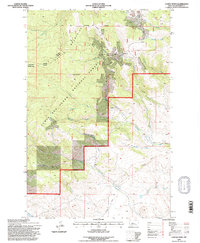
 1993 Ringling1993 Print · USGSMeagher County in the early nineties remains a landscape of high-altitude ranching and mining history framed by the Crazy Mountains. Researchers can trace the legacy of the silver boom at Castle Town and the Cumberland Mine or locate early rail sidings like Loweth and Bruno.
 - 1995 Map of Castle Town, 1997 Print
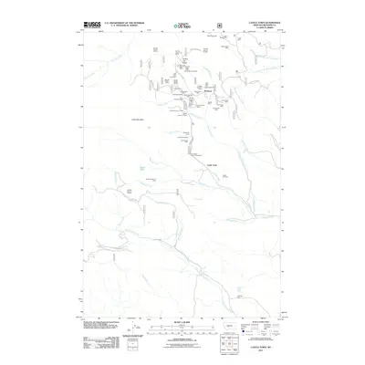
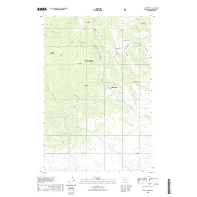
 1995 Castle Town1997 Print · USGSThe Castle Mountains mining district is captured here during the mid-nineties, showing the enduring footprint of silver-era industry. Genealogists and historians can trace the foundations of Castle Town and Robinson or locate remote sites like the Cumberland Mine and Castle Cem.2 unique versions available
 - 2011 Map of Castle Town, 2011 Print
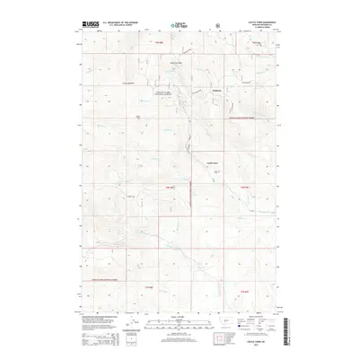
 2011 Castle Town2011 Print · USGSCovers Robinson, including Meagher County, United States, and other nearby areas
 - 2014 Map of Castle Town, 2014 Print
 2014 Castle Town2014 Print · USGSCovers Robinson, including Meagher County, United States, and other nearby areas
 - 2017 Map of Castle Town, 2017 Print
 2017 Castle Town2017 Print · USGSCovers Robinson, including Meagher County, United States, and other nearby areas
 - 2020 Map of Castle Town, 2020 Print
 2020 Castle Town2020 Print · USGSCovers Robinson, including Meagher County, United States, and other nearby areas
 - 2024 Map of Castle Town, 2024 Print
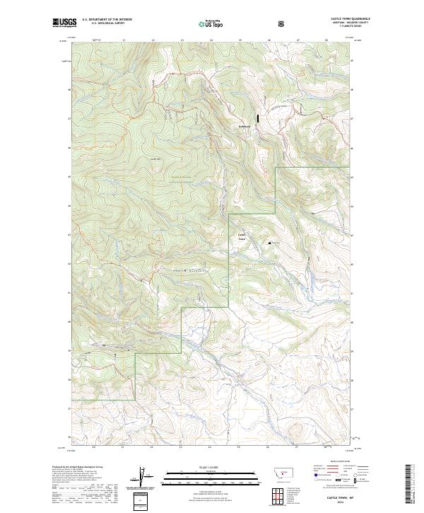 2024 Castle Town2024 Print · USGSMeagher County's high-country mining and forest lands are documented here in the modern era. Genealogists and researchers can trace the vicinity of Castle Town, find the Castle Cem, and explore landmarks like Yankee Jim Ridge or Castle Lake.
End of results
Showing maps 1-17 of 17
Top cities near Robinson
Frequently asked questions
- What are the different types of historical maps available for Robinson?
- What is the oldest map of Robinson?
- Where can I purchase historical maps of Robinson for my home or office?
- Where can I download high-res historical maps of Robinson?
- Are there historical topographic maps available for Robinson?
- Is there historical aerial imagery available for Robinson?
- Where are historical maps of Robinson sourced from?