Old Maps of Cyr, Montana for Academic Research
Study the evolution of Cyr with 10 high-resolution historic maps. Whether you're teaching, researching, or modeling changes in land use, these maps provide essential visual documentation of urban, environmental, and geographic change.
- Analyze long-term change: Track patterns in development, transportation, and natural features.
- Ideal for environmental or urban studies: Support academic projects with primary historical map data.
- Use in the classroom or lab: Educators and researchers rely on these maps to bring historical context to life.
These maps are a powerful tool for teaching, research, and visualizing how Cyr has changed over the decades.
Cyr, MT maps
(10)- 1956 Map of Wallace, 1966 Print
 1956 Wallace1966 Print · USGSWestern Montana and the Idaho panhandle meet in this mid-century survey of the Bitterroot and Cabinet Mountains. Genealogists and historians can trace the rail-and-river economy through the Northern Pacific line and settlements like Thompson Falls or St. Ignatius.3 unique versions available
 - 1959 Map of Tarkio, 1961 Print
 1959 Tarkio1961 Print · USGSMineral County's river-and-rail corridor is captured here in the late fifties, during the peak era of the transcontinental railroads. Researchers can trace the heritage of small trackside communities like Tarkio and Rivulet or locate specific historical sites such as the local cemetery and mines.3 unique versions available
 - 1960 Map of Wallace
 1960 Wallace1960 Print · USGSNorthwestern Montana and the Idaho panhandle are captured in the late fifties, showing the vast Flathead Indian Reservation and the mining districts of the Bitterroot Range. Researchers can trace the rail lines of the Northern Pacific or locate early sites like the Morning Mine and the National Bison Range.
 - 1983 Map of Stark South, 1984 Print
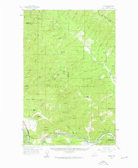
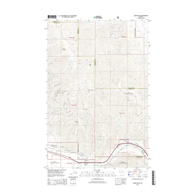
 1983 Stark South1984 Print · USGSThe Lolo National Forest interior is documented in the early 1980s, centered on the high ridge of the Ninemile Divide. Researchers can locate the Lookout Tower on Stark Mountain and trace old routes through Freezeout Gulch to the settlement of Cyr.2 unique versions available
 - 1999 Map of Stark South, 2003 Print
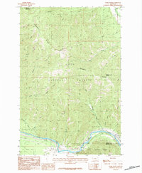
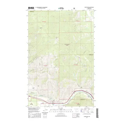
 1999 Stark South2003 Print · USGSThe Clark Fork corridor and the Lolo National Forest interior are captured here at the close of the twentieth century. Researchers can trace the rugged topography from Stark Mountain Lookout down to river landmarks like the Natural Pier Bridge and Stark.
 - 2011 Map of Stark South, 2011 Print
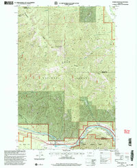
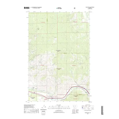
 2011 Stark South2011 Print · USGSCovers Cyr, including Missoula County, Mineral County, and other nearby areas
 - 2014 Map of Stark South, 2014 Print
 2014 Stark South2014 Print · USGSCovers Cyr, including Missoula County, Mineral County, and other nearby areas
 - 2017 Map of Stark South, 2017 Print
 2017 Stark South2017 Print · USGSCovers Cyr, including Missoula County, Mineral County, and other nearby areas
 - 2020 Map of Stark South, 2020 Print
 2020 Stark South2020 Print · USGSCovers Cyr, including Missoula County, Mineral County, and other nearby areas
 - 2024 Map of Stark South, 2024 Print
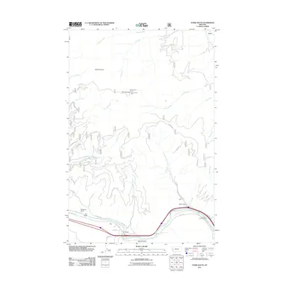
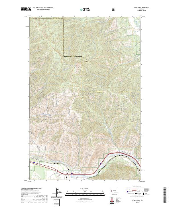 2024 Stark South2024 Print · USGSThe Clark Fork valley in western Montana remains a critical transportation corridor in the twenty-first century, anchored by the settlement of Cyr. Genealogists and hikers can trace mountain trails and forest roads like (FDR) Freeze Out Ridge leading to high points like Stark Mtn.
End of results
Showing maps 1-10 of 10
Top cities near Cyr
Frequently asked questions
- What are the different types of historical maps available for Cyr?
- What is the oldest map of Cyr?
- Where can I purchase historical maps of Cyr for my home or office?
- Where can I download high-res historical maps of Cyr?
- Are there historical topographic maps available for Cyr?
- Is there historical aerial imagery available for Cyr?
- Where are historical maps of Cyr sourced from?