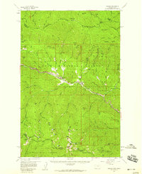
1950s Maps of Drexel, Montana
Explore 2 historic maps of Drexel from the 1950s. These maps offer a rare glimpse into what life looked like during the 1950s — showing old roads, neighborhoods, homes, and landmarks that have changed or disappeared over time.
Whether you're researching your family's past, planning a metal detecting trip, or studying how Drexel's landscape evolved across the 1950s, these high-resolution maps are a powerful tool for exploring the history of this region.
- Focus on a specific era: All maps on this page are from the 1950s, giving you a focused view of this time period.
- See what’s changed: Compare century-old streets, trails, and buildings to today's modern landscape using overlays and satellite layers.
- Research with precision: Use these maps for genealogy, historical research, land use analysis, or educational projects.
- View, download, or print: Maps are fully viewable online in high resolution, and can be downloaded or printed for your own records.
Start exploring Drexel's history through authentic maps from the 1950s. This is your window into the past.
Drexel, MT maps
(2)- 1956 Map of Wallace, 1966 Print
 1956 Wallace1966 Print · USGSWestern Montana and the Idaho panhandle meet in this mid-century survey of the Bitterroot and Cabinet Mountains. Genealogists and historians can trace the rail-and-river economy through the Northern Pacific line and settlements like Thompson Falls or St. Ignatius.3 unique versions available
 - 1957 Map of Haugan, 1959 Print
 1957 Haugan1959 Print · USGSMineral County mining and railroading are at their peak in the late fifties as two major rail lines traverse the St. Regis River valley. Genealogists and historians can locate old mountain settlements like De Borgia and trace the proximity of the Saltese Consolidated Mine to early forest service outposts like Up Up Lookout.2 unique versions available
End of results
Showing maps 1-2 of 2
Frequently asked questions
- What are the different types of historical maps available for Drexel?
- What is the oldest map of Drexel?
- Where can I purchase historical maps of Drexel for my home or office?
- Where can I download high-res historical maps of Drexel?
- Are there historical topographic maps available for Drexel?
- Is there historical aerial imagery available for Drexel?
- Where are historical maps of Drexel sourced from?