Old Maps of Haugan, Montana for Metal Detecting
Plan your next treasure hunt with 13 historic maps of Haugan. Find old homesites, ghost towns, trails, and gathering spots that may be lost to time — perfect for identifying promising metal detecting locations.
- Locate forgotten sites: Uncover places like long-lost settlements, abandoned rail lines, or gathering spots.
- Plan better hunts: Use map overlays combined with LiDAR or satellite views to narrow in on historically rich areas.
- Made for detectorists: Thousands of hobbyists use these maps to discover relics, coins, and hidden history.
Use these historic maps to boost your research and find new opportunities beneath the surface of Haugan.
Haugan, MT maps
(13)- 1918 Map of St Regis, 1946 Print
 1918 St Regis1946 Print · USGSMineral County, Montana, was a bustling corridor for mining and rail traffic during the early twentieth century. Researchers can trace the path of the Northern Pacific through St Regis or locate remote sites like the Gold Crown Mine and Gold Nugget Cabin.
 - 1919 Map of St. Regis
 1919 St. Regis1919 Print · USGSThe Montana-Idaho borderlands were a hub of mountain mining and transcontinental railroading during the early twentieth century. Genealogists and historians can locate remote settlements like DeBorgia and Henderson or trace old mining operations such as the Saltese Consolidated Mine and Gold Crown Mine.
 - 1956 Map of Wallace, 1966 Print
 1956 Wallace1966 Print · USGSWestern Montana and the Idaho panhandle meet in this mid-century survey of the Bitterroot and Cabinet Mountains. Genealogists and historians can trace the rail-and-river economy through the Northern Pacific line and settlements like Thompson Falls or St. Ignatius.3 unique versions available
 - 1957 Map of Haugan, 1959 Print
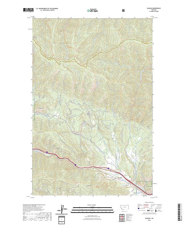
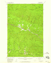 1957 Haugan1959 Print · USGSMineral County mining and railroading are at their peak in the late fifties as two major rail lines traverse the St. Regis River valley. Genealogists and historians can locate old mountain settlements like De Borgia and trace the proximity of the Saltese Consolidated Mine to early forest service outposts like Up Up Lookout.2 unique versions available
 - 1960 Map of Wallace
 1960 Wallace1960 Print · USGSNorthwestern Montana and the Idaho panhandle are captured in the late fifties, showing the vast Flathead Indian Reservation and the mining districts of the Bitterroot Range. Researchers can trace the rail lines of the Northern Pacific or locate early sites like the Morning Mine and the National Bison Range.
 - 1988 Map of Haugan
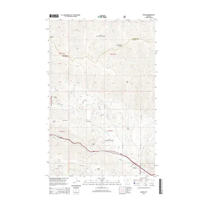
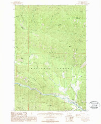 1988 Haugan1988 Print · USGSThe St Regis River valley in the late eighties reveals a landscape of mining and mountain transit. Researchers can trace the Old Railroad Grade past Haugan or locate historical workings like the Saltese Consolidated Mine and various prospect sites.
 - 1994 Map of Wallace
 1994 Wallace1994 Print · USGSThe Bitterroot Mountains and the mining heart of the Silver Valley are captured here in the mid-1990s. Researchers can locate active and historic mineral operations such as the Argentine Mine and Last Chance Mines, while tracing the Milwaukee Road through the high passes.
 - 1999 Map of Haugan, 2003 Print
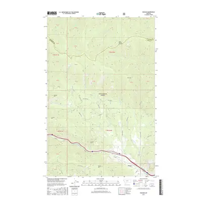
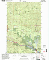 1999 Haugan2003 Print · USGSMineral County mining and forestry operations are documented in the late nineties as the town of Haugan sits along the St Regis River. Trace the locations of historic workings like the East Coeur d'Alene Mine or the Savenac Nursery.
 - 2011 Map of Haugan, 2011 Print
 2011 Haugan2011 Print · USGSCovers Haugan, including Sanders County, Mineral County, and other nearby areas
 - 2014 Map of Haugan, 2014 Print
 2014 Haugan2014 Print · USGSCovers Haugan, including Sanders County, Mineral County, and other nearby areas
 - 2017 Map of Haugan, 2017 Print
 2017 Haugan2017 Print · USGSCovers Haugan, including Sanders County, Mineral County, and other nearby areas
 - 2020 Map of Haugan, 2020 Print
 2020 Haugan2020 Print · USGSCovers Haugan, including Sanders County, Mineral County, and other nearby areas
 - 2024 Map of Haugan, 2024 Print
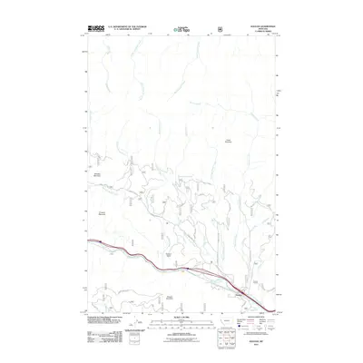
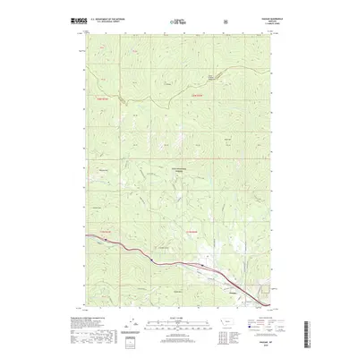
 2024 Haugan2024 Print · USGSThe small mountain community of Haugan is shown in the modern day, situated where the Saint Regis River cuts between the Bitterroot and Coeur d'Alene ranges. Trace the rail-to-trail conversion of the Milwaukee Trl Hiawatha and explore mountain roads leading to Haugan Mtn and Meadow Mtn.
End of results
Showing maps 1-13 of 13
Top cities near Haugan
Frequently asked questions
- What are the different types of historical maps available for Haugan?
- What is the oldest map of Haugan?
- Where can I purchase historical maps of Haugan for my home or office?
- Where can I download high-res historical maps of Haugan?
- Are there historical topographic maps available for Haugan?
- Is there historical aerial imagery available for Haugan?
- Where are historical maps of Haugan sourced from?