Old Maps of Westfall, Montana for Academic Research
Study the evolution of Westfall with 10 high-resolution historic maps. Whether you're teaching, researching, or modeling changes in land use, these maps provide essential visual documentation of urban, environmental, and geographic change.
- Analyze long-term change: Track patterns in development, transportation, and natural features.
- Ideal for environmental or urban studies: Support academic projects with primary historical map data.
- Use in the classroom or lab: Educators and researchers rely on these maps to bring historical context to life.
These maps are a powerful tool for teaching, research, and visualizing how Westfall has changed over the decades.
Westfall, MT maps
(10)- 1956 Map of Wallace, 1966 Print
 1956 Wallace1966 Print · USGSWestern Montana and the Idaho panhandle meet in this mid-century survey of the Bitterroot and Cabinet Mountains. Genealogists and historians can trace the rail-and-river economy through the Northern Pacific line and settlements like Thompson Falls or St. Ignatius.3 unique versions available
 - 1960 Map of Wallace
 1960 Wallace1960 Print · USGSNorthwestern Montana and the Idaho panhandle are captured in the late fifties, showing the vast Flathead Indian Reservation and the mining districts of the Bitterroot Range. Researchers can trace the rail lines of the Northern Pacific or locate early sites like the Morning Mine and the National Bison Range.
 - 1960 Map of Superior, 1962 Print
 1960 Superior1962 Print · USGSThe Clark Fork valley in the early sixties was a rugged industrial corridor defined by the Northern Pacific and Milwaukee Road rail lines. Genealogists and historians can trace the foundations of Superior or locate remote mining sites like the Iron Mountain Mine and Old Mountain Mines.2 unique versions available
 - 1985 Map of Lozeau
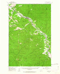
 1985 Lozeau1985 Print · USGSThe Clark Fork valley in the mid-eighties remains a rugged corridor of river-side settlements and vast timberland. Genealogists and researchers can trace the footprint of Lozeau and Westfall or locate the historic Mine and high points like Quartz Peak.
 - 1999 Map of Lozeau, 2003 Print
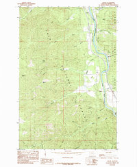
 1999 Lozeau2003 Print · USGSMineral County, Montana, is defined by the river and forest in the late nineties as this survey captures the corridor near the Clark Fork. Researchers can trace the small settlements of Lozeau and Westfall, locate a local Cem, or find historic Mine sites near Sunrise Creek.
 - 2011 Map of Lozeau, 2011 Print
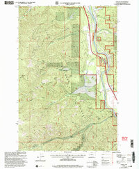
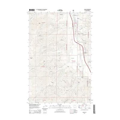
 2011 Lozeau2011 Print · USGSCovers Westfall, including Quartz, Lozeau, and other nearby areas
 - 2014 Map of Lozeau, 2014 Print
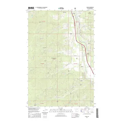
 2014 Lozeau2014 Print · USGSCovers Westfall, including Quartz, Lozeau, and other nearby areas
 - 2017 Map of Lozeau, 2017 Print
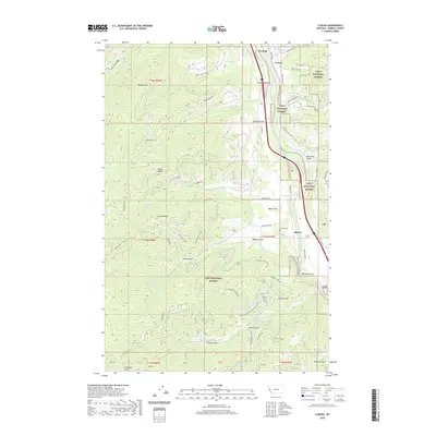
 2017 Lozeau2017 Print · USGSCovers Westfall, including Quartz, Lozeau, and other nearby areas
 - 2020 Map of Lozeau, 2020 Print
 2020 Lozeau2020 Print · USGSCovers Westfall, including Quartz, Lozeau, and other nearby areas
 - 2024 Map of Lozeau, 2024 Print
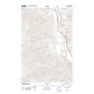
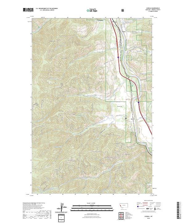 2024 Lozeau2024 Print · USGSThe Clark Fork river valley in western Montana is documented here during the 2020s, showing a landscape defined by the river and the Lolo National Forest. Genealogists and local historians can trace the riverside communities of Lozeau and Quartz, locate the Quartz Cem, and follow the historic Mullan Rd E through the canyon.
End of results
Showing maps 1-10 of 10
Top cities near Westfall
Frequently asked questions
- What are the different types of historical maps available for Westfall?
- What is the oldest map of Westfall?
- Where can I purchase historical maps of Westfall for my home or office?
- Where can I download high-res historical maps of Westfall?
- Are there historical topographic maps available for Westfall?
- Is there historical aerial imagery available for Westfall?
- Where are historical maps of Westfall sourced from?