Old Maps of Ravalli County, Montana
Explore 174 old maps of Ravalli County, spanning from 1901 to today. These high-resolution historic maps reveal how streets, neighborhoods, landmarks, and natural features evolved over time — perfect for genealogy, metal detecting, research, and local history exploration.
What you can do with these maps:
- See how Ravalli County changed over time: Compare historical maps to modern-day views to trace roads, homesites, rail lines & more.
- View detailed metadata: Each map includes creators, publishers, year, scale, and archive source.
- Overlay maps with satellite & LiDAR: Visualize the past alongside modern tools to explore terrain & human change.
- Trusted historical sources: Maps sourced from the USGS, Library of Congress, and other archives.
- Access maps your way: View online, download high-res files, or order prints for personal or research use.
Start exploring old maps of Ravalli County to uncover forgotten places, hidden landmarks, and the deep history beneath your feet.
Ravalli County, MT maps
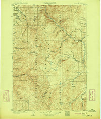
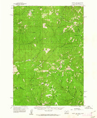
(174)- 1901 Map of Hamilton
 1901 Hamilton1901 Print · USGSCovers Ravalli County, including Hamilton, Darby, and other nearby areas6 unique versions available
 - 1903 Map of Bonner
 1903 Bonner1903 Print · USGSCovers Ravalli County, including Missoula, Bonner, and other nearby areas4 unique versions available
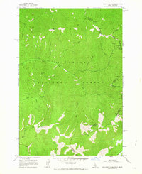
 - 1909 Map of Sapphire
 1909 Sapphire1909 Print · USGSCovers Ravalli County, including Gird Point, Granite County, and other nearby areas3 unique versions available
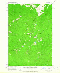
 - 1911 Map of Lolo, 1954 Print
 1911 Lolo1954 Print · USGSCovers Ravalli County, including Lolo Hot Springs, Missoula County, and other nearby areas
 - 1912 Map of Missoula
 1912 Missoula1912 Print · USGSCovers Ravalli County, including Missoula, Lolo, and other nearby areas4 unique versions available
 - 1913 Map of Lolo
 1913 Lolo1913 Print · USGSCovers Ravalli County, including Lolo Hot Springs, Missoula County, and other nearby areas2 unique versions available
 - 1947 Map of Butte, 1949 Print
 1947 Butte1949 Print · USGSCovers Ravalli County, including Missoula, Butte, and other nearby areas2 unique versions available
 - 1955 Map of Dillon, 1978 Print
 1955 Dillon1978 Print · USGSCovers Ravalli County, including Butte, Dillon, and other nearby areas2 unique versions available
 - 1956 Map of Elk City, 1963 Print
 1956 Elk City1963 Print · USGSCovers Ravalli County, including Edwardsburg, Dixie, and other nearby areas3 unique versions available
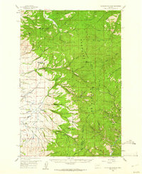
 - 1956 Map of Hamilton, 1970 Print
 1956 Hamilton1970 Print · USGSCovers Ravalli County, including Missoula, Hamilton, and other nearby areas2 unique versions available
 - 1957 Map of Dillon
 1957 Dillon1957 Print · USGSCovers Ravalli County, including Butte, Dillon, and other nearby areas
 - 1958 Map of Butte
 1958 Butte1958 Print · USGSCovers Ravalli County, including Missoula, Butte, and other nearby areas5 unique versions available
 - 1958 Map of Dillon
 1958 Dillon1958 Print · USGSCovers Ravalli County, including Butte, Dillon, and other nearby areas
 - 1959 Map of Hamilton
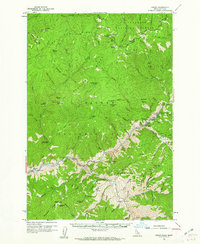
 1959 Hamilton1959 Print · USGSCovers Ravalli County, including Missoula, Hamilton, and other nearby areas
 - 1959 Map of Cleveland Mountain, 1961 Print
 1959 Cleveland Mountain1961 Print · USGSCovers Ravalli County, including Missoula County, Granite County, and other nearby areas2 unique versions available
 - 1960 Map of Butte
 1960 Butte1960 Print · USGSCovers Ravalli County, including Missoula, Butte, and other nearby areas
 - 1960 Map of Elk City
 1960 Elk City1960 Print · USGSCovers Ravalli County, including Edwardsburg, Dixie, and other nearby areas2 unique versions available
 - 1960 Map of Hamilton
 1960 Hamilton1960 Print · USGSCovers Ravalli County, including Missoula, Hamilton, and other nearby areas
 - 1960 Map of Painted Rocks Lake, 1961 Print
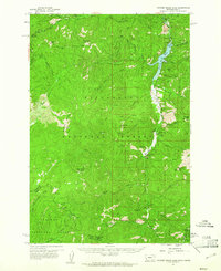 1960 Painted Rocks Lake1961 Print · USGSCovers Ravalli County, including Alta, Idaho County, and other nearby areas3 unique versions available
 - 1960 Map of Shoup, 1962 Print
 1960 Shoup1962 Print · USGSCovers Ravalli County, including Lemhi County, United States, and other nearby areas2 unique versions available
 - 1960 Map of Piquett Mountain, 1962 Print
 1960 Piquett Mountain1962 Print · USGSCovers Ravalli County, including Lemhi County, United States, and other nearby areas3 unique versions available
 - 1962 Map of Butte
 1962 Butte1962 Print · USGSCovers Ravalli County, including Missoula, Butte, and other nearby areas
 - 1962 Map of Dillon
 1962 Dillon1962 Print · USGSCovers Ravalli County, including Butte, Dillon, and other nearby areas
 - 1962 Map of Blue Joint, 1963 Print
 1962 Blue Joint1963 Print · USGSCovers Ravalli County, including Idaho County, Lemhi County, and other nearby areas2 unique versions available
 - 1962 Map of Nez Perce Peak, 1964 Print
 1962 Nez Perce Peak1964 Print · USGSCovers Ravalli County, including Idaho County, United States, and other nearby areas3 unique versions available
Showing maps 1-25 of 174
Top cities of Ravalli County
- Hamilton historical maps
- Stevensville historical maps
- Darby historical maps
- Pinesdale historical maps
- Victor historical maps
Frequently asked questions
- What are the different types of historical maps available for Ravalli County?
- What is the oldest map of Ravalli County?
- Where can I purchase historical maps of Ravalli County for my home or office?
- Where can I download high-res historical maps of Ravalli County?
- Are there historical topographic maps available for Ravalli County?
- Is there historical aerial imagery available for Ravalli County?
- Where are historical maps of Ravalli County sourced from?