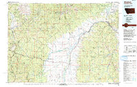
1990s Maps of Ravalli County, Montana
Explore 85 historic maps of Ravalli County from the 1990s. These maps offer a rare glimpse into what life looked like during the 1990s — showing old roads, neighborhoods, homes, and landmarks that have changed or disappeared over time.
Whether you're researching your family's past, planning a metal detecting trip, or studying how Ravalli County's landscape evolved across the 1990s, these high-resolution maps are a powerful tool for exploring the history of this region.
- Focus on a specific era: All maps on this page are from the 1990s, giving you a focused view of this time period.
- See what’s changed: Compare century-old streets, trails, and buildings to today's modern landscape using overlays and satellite layers.
- Research with precision: Use these maps for genealogy, historical research, land use analysis, or educational projects.
- View, download, or print: Maps are fully viewable online in high resolution, and can be downloaded or printed for your own records.
Start exploring Ravalli County's history through authentic maps from the 1990s. This is your window into the past.
Ravalli County, MT maps
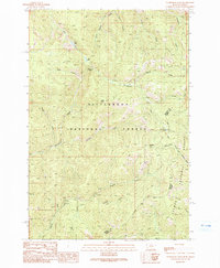
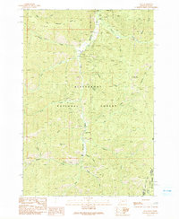
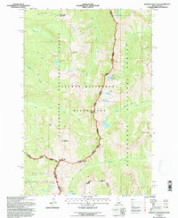
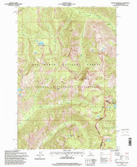
(85)- 1991 Map of Piquett Mountain
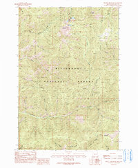 1991 Piquett Mountain1991 Print · USGSRavalli County's high wilderness is documented in the early 1990s, centered on the heights of the Bitterroot National Forest. Researchers can trace old trails and resource history through labels for prospects near Jew Mountain and alpine waters like Shelf Lake.2 unique versions available
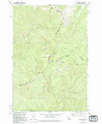
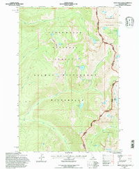
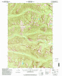
 - 1991 Map of Horse Creek Pass
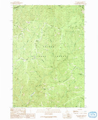
 1991 Horse Creek Pass1991 Print · USGSThe Montana-Idaho borderlands are captured here in the early nineties, showcasing a high-country wilderness defined by the Bitterroot National Forest. Researchers can trace old trails and crossings at Horse Creek Pass and locate Horse Creek Hot Springs.
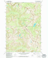
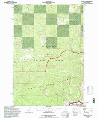
 - 1991 Map of Tincup Hill
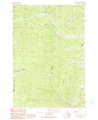
 1991 Tincup Hill1991 Print · USGSHigh wilderness along the Idaho-Montana border is captured here in the early nineties, showing a landscape defined by deep ridges and remote mining claims. Genealogists and historians can locate the Oreana Lookout, the Blue Plate Mine, and high-country trails crossing Long Tom Ridge.
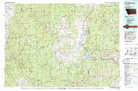
 - 1991 Map of Henderson Ridge
 1991 Henderson Ridge1991 Print · USGSThe high Idaho-Montana borderlands are captured here in the early 1990s, showcasing a landscape of remote national forests and high ridges. Researchers can locate backcountry landmarks like Henderson Cabin, the Taylor Creek Mine, and Irishmans Rock.2 unique versions available
 - 1991 Map of Painted Rocks Lake
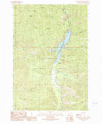 1991 Painted Rocks Lake1991 Print · USGSThe high Bitterroot country of the early nineties is centered on the recently surveyed Painted Rocks Lake and its surrounding wilderness. Researchers can trace historic pack routes like the Castle Rock Trail (Pack) and locate landmarks such as West Fork Dam and Slate Point.2 unique versions available
 - 1991 Map of Overwhich Falls
 1991 Overwhich Falls1991 Print · USGSThe high Bitterroot Divide at the Montana-Idaho border is captured here in the early 1990s, where two national forests meet. Researchers can trace remote mineral sites like Emmett and Prospect or navigate the alpine terrain near Overwhich Falls and Capri Lake.2 unique versions available
 - 1991 Map of Allan Mountain
 1991 Allan Mountain1991 Print · USGSThe high divide of the Montana-Idaho border comes into focus in the early nineties, revealing a high-country landscape of forest reserves and isolated watersheds. Trace the locations of early resource exploration at the Mine Shaft and Prospect sites or locate remote springs like Indian Spring.2 unique versions available
 - 1991 Map of Shoup
 1991 Shoup1991 Print · USGSThe Idaho-Montana borderlands at the start of the 1990s reveal a landscape of mining history and protected wilderness. Researchers can trace historic extraction sites like the Spring Creek Mines and the Gregor Mine near the banks of the Salmon River.
 - 1991 Map of Bare Cone
 1991 Bare Cone1991 Print · USGSThe Bitterroot mountains and the Montana-Idaho border come alive in the 1990s through these detailed wilderness surveys. Trace high-country routes like the Old Nez Perce Trail (Pack) Route or locate landmarks like the Bare Cone Lookout Tower.2 unique versions available
 - 1991 Map of Alta
 1991 Alta1991 Print · USGSThe Bitterroot National Forest at the Montana-Idaho border shows a landscape defined by 1980s mining and wilderness management. Trace the legacy of extraction at the Lucky Joe Mine or find early sites like Alta and the Cooper Place.2 unique versions available
 - 1991 Map of Mount Jerusalem, 1994 Print
 1991 Mount Jerusalem1994 Print · USGSThe high alpine country of the Montana-Idaho border comes alive in the early nineties, showcasing the remote crests of the Bitterroot range. Trace historic access routes along the Pack Trail to reach Canyon Lake, Bare Peak, or Jerusalem Lake.
 - 1991 Map of Blue Joint, 1994 Print
 1991 Blue Joint1994 Print · USGSThe high wilderness of the Bitterroot and Salmon national forests is captured here in the early nineties at the junction of the Idaho and Montana state lines. Researchers can trace remote high-country water sources and peaks, including Line Lake, Squaw Peak, and Two Buck Spring.
 - 1991 Map of Boulder Peak, 1994 Print
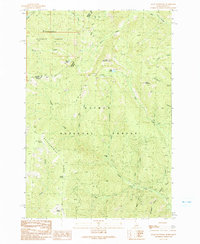
 1991 Boulder Peak1994 Print · USGSRavalli County in the early nineties remains a bastion of wild terrain and forest management along the Bitterroot River. Genealogists and historians can trace local landmarks like Krueger Ranch, the isolated Rombo Cem, and historic routes like the Nez Perce Indian Trail.
 - 1991 Map of Tin Cup Lake, 1995 Print
 1991 Tin Cup Lake1995 Print · USGSThe Bitterroot Range along the Idaho-Montana border remained a high-country wilderness in the early nineties, accessible primarily by traditional routes. Backcountry travelers and historians can trace the Pack Trail past Tin Cup Lake, Patsy Ann Falls, and the Triple Lakes.
 - 1993 Map of Philipsburg, 1994 Print
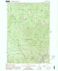
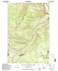
 1993 Philipsburg1994 Print · USGSThe mining and mountain country of Granite County is captured in the early nineties, showing a landscape defined by timber and mineral wealth. You can trace historical mining operations at the Black Pine Mine and Cable Mine or locate early settlements like Maxville and Southern Cross.
 - 1994 Map of Horse Creek Pass
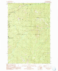
 1994 Horse Creek Pass1994 Print · USGSThe Bitterroot Mountains and the Continental Divide define the high border between Montana and Idaho as they appeared in the 1990s. Researchers can trace historic access routes like the Pack Trail and locate landmarks such as the Horse Creek Hot Springs Campground and Cathedral Rock.
 - 1994 Map of Wisdom
 1994 Wisdom1994 Print · USGSThe high mountain valleys of Southwest Montana and East Idaho come alive in the mid-1990s as the Big Hole River meanders toward the Continental Divide. Trace the grounds of the Big Hole National Battlefield or locate remote settlements like Wisdom and Gibbonsville.2 unique versions available
 - 1994 Map of Blodgett Mountain, 1997 Print
 1994 Blodgett Mountain1997 Print · USGSThe Bitterroot Range along the Idaho-Montana border is shown here in the mid-1990s as a high-altitude wilderness of granite peaks and alpine lakes. Researchers can trace remote trails and landmarks like Blodgett Mountain, Mill Lake, and the high pass at Blodgett Pass.
 - 1994 Map of White Sand Lake, 1997 Print
 1994 White Sand Lake1997 Print · USGSThe Bitterroot Range at the Idaho-Montana border is captured here during the mid-1990s, showcasing a landscape of high alpine passes and protected wilderness. Outdoorsmen and historians can trace the high-altitude routes over Packbox Pass or locate isolated waters like White Sand Lake and Parachute Lake.2 unique versions available
 - 1994 Map of Ranger Peak, 1997 Print
 1994 Ranger Peak1997 Print · USGSHigh ridges and wilderness boundaries define the Bitterroot Range during the mid-nineties. You can trace remote backcountry routes past Beaver Ridge Lookout, Siah Lake, and the summit at Ranger Peak along the Idaho-Montana line.
 - 1995 Map of Saddle Mountain, 1999 Print
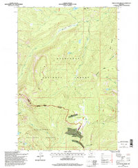
 1995 Saddle Mountain1999 Print · USGSThe high wilderness of the Bitterroot Range is captured in the mid-1990s, where the state line meets the rugged junction of three national forests. Researchers can trace remote alpine trails and water bodies like Battle Lake, Park Lake, and the significant crossing at Lost Horse Pass.
 - 1995 Map of Hunter Peak, 1999 Print
 1995 Hunter Peak1999 Print · USGSThe high wilderness of the Selway Bitterroot area is captured here in the late nineties, straddling the border of Idaho and Montana. Researchers can trace the drainages of Bear Creek and locate remote alpine waters like Bigfoot Lake and Spruce Lake.
 - 1996 Map of Stony Creek, 1998 Print
 1996 Stony Creek1998 Print · USGSGranite County’s mountain summits and forest boundaries are captured here in the mid-1990s. Researchers can trace the protected grounds of the Skalkaho Game Preserve and the drainage patterns of Stony Creek and Badger Gulch.
 - 1996 Map of Whetstone Ridge, 1998 Print
 1996 Whetstone Ridge1998 Print · USGSThe high divide of the Sapphire Mountains during the late nineties shows a landscape defined by mining history and forest boundaries. Researchers can trace the location of old workings like Kent Mine, O'Brien Mine, and the basin around Millers Mine.
 - 1997 Map of Lost Trail Pass, 2002 Print
 1997 Lost Trail Pass2002 Print · USGSThe high Montana-Idaho border comes alive in this late twentieth-century survey of the Continental Divide and its surrounding national forests. Researchers can trace the overlapping paths of the Lewis and Clark and Nez Perce national historic trails near Lost Trail Pass and Chief Joseph Pass.
Showing maps 1-25 of 85
Top cities of Ravalli County
- Hamilton historical maps
- Stevensville historical maps
- Darby historical maps
- Pinesdale historical maps
- Victor historical maps
Frequently asked questions
- What are the different types of historical maps available for Ravalli County?
- What is the oldest map of Ravalli County?
- Where can I purchase historical maps of Ravalli County for my home or office?
- Where can I download high-res historical maps of Ravalli County?
- Are there historical topographic maps available for Ravalli County?
- Is there historical aerial imagery available for Ravalli County?
- Where are historical maps of Ravalli County sourced from?