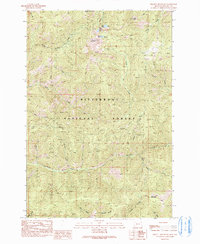
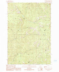
1991 Map of Piquett Mountain
USGS Topo · Published 1991About this map
Bitterroot National Forest encompasses this high-elevation terrain in Ravalli County, characterized by a complex network of drainages and glacial lakes. Centered on the massif of Piquett Mountain, the landscape is defined by steep ridges and peaks including Jew Mountain and Quartzite Mountain. Small bodies of water such as Shelf Lake, Piquett Lake, and Slate Lake are situated in the upper basins, feeding a dense system of seasonal and perennial streams like Little Boulder Creek and Overwhich Creek. Evidence of resource exploration is visible through labeled prospects and a single prospect located on the slopes of Jew Mountain. The map detail traces the primitive road and trail network that provided access to these high gulches, including Meadow Gulch and Mill Gulch, reflecting the management and recreational use of this forest area in the early 1990s.
Find a feature on this map
30 named features on this map. Tap any name to fly to it.
Don’t see what you’re looking for? This feature index may not catch every label — zoom into the map to look around manually.
Map Details
Editions of this 1991 Piquett Mountain Map
2 editions found
Other maps of this area

1956 · Elk City
USGS Topo · 1:250,000

1960 · Elk City
USGS Topo · 1:250,000

1960 · Painted Rocks Lake
USGS Topo · 1:62,500

1960 · Piquett Mountain
USGS Topo · 1:62,500

1964 · Boulder Peak
USGS Topo · 1:24,000

1964 · Piquett Creek
USGS Topo · 1:24,000

1965 · Medicine Hot Springs
USGS Topo · 1:24,000
1991 · Henderson Ridge
USGS Topo · 1:24,000
1991 · Painted Rocks Lake
USGS Topo · 1:24,000
1991 · Overwhich Falls
USGS Topo · 1:24,000