Old Maps of Anderson, Brockton District for Academic Research
Study the evolution of Anderson with 11 high-resolution historic maps. Whether you're teaching, researching, or modeling changes in land use, these maps provide essential visual documentation of urban, environmental, and geographic change.
- Analyze long-term change: Track patterns in development, transportation, and natural features.
- Ideal for environmental or urban studies: Support academic projects with primary historical map data.
- Use in the classroom or lab: Educators and researchers rely on these maps to bring historical context to life.
These maps are a powerful tool for teaching, research, and visualizing how Anderson has changed over the decades.
Anderson, Brockton District maps
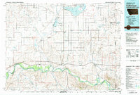
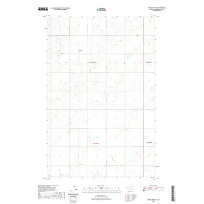
(11)- 1909 Map of Smoke Creek, 1964 Print
 1909 Smoke Creek1964 Print · USGSNortheastern Montana was still an expansive frontier at the turn of the century, dominated by the Fort Peck Indian Reservation. Researchers can trace early land use and water sources through the West Ranch and the winding course of Smoke Creek.
 - 1912 Map of Smoke Creek
 1912 Smoke Creek1912 Print · USGSThe eastern reaches of the Fort Peck Indian Reservation are captured here in the years following the turn of the century. Genealogists and researchers can trace the early livestock era at Wests Ranch or the natural hydrology of Smoke Creek and Manning Lake.
 - 1954 Map of Wolf Point, 1967 Print
 1954 Wolf Point1967 Print · USGSNortheastern Montana and the North Dakota borderlands are shown here in the mid-fifties, dominated by the Missouri River and the Fort Peck Indian Reservation. Genealogists and historians can trace the Great Northern rail line through river towns like Poplar and Culbertson or locate northern border outposts like the U S Custom Office at Raymond.2 unique versions available
 - 1958 Map of Wolf Point
 1958 Wolf Point1958 Print · USGSNortheastern Montana is shown during the mid-fifties, featuring the extensive Fort Peck Indian Reservation and the Missouri River valley. Researchers can trace the Great Northern railroad through Wolf Point or locate sites like Slab Crossing and the Coal Mine near Medicine Lake.
 - 1982 Map of Culbertson, 1983 Print
 1982 Culbertson1983 Print · USGSNortheastern Montana at the start of the 1980s reveals a high-plains landscape defined by the Missouri River and the rail lines that served its valley. Genealogists and researchers can trace the townships surrounding Culbertson, Bainville, and the Fort Union Trading Post.
 - 1983 Map of Smoke Creek SW
 1983 Smoke Creek SW1983 Print · USGSNortheastern Montana's high plains are captured here in the early eighties within the Fort Peck Indian Reservation. Local history researchers can trace the natural drainage of Lake Creek across the township lines of T30N and T29N.
 - 2011 Map of Smoke Creek SW, 2011 Print
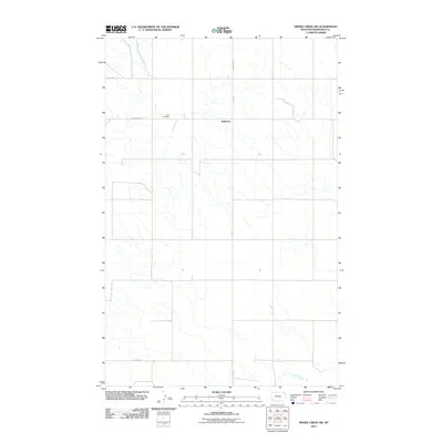 2011 Smoke Creek SW2011 Print · USGSCovers Anderson, including Brockton District, Roosevelt County, and other nearby areas
 - 2014 Map of Smoke Creek SW, 2014 Print
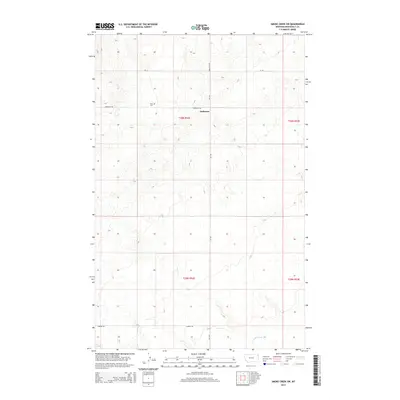 2014 Smoke Creek SW2014 Print · USGSCovers Anderson, including Brockton District, Roosevelt County, and other nearby areas
 - 2017 Map of Smoke Creek SW, 2017 Print
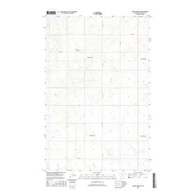 2017 Smoke Creek SW2017 Print · USGSCovers Anderson, including Brockton District, Roosevelt County, and other nearby areas
 - 2020 Map of Smoke Creek SW, 2020 Print
 2020 Smoke Creek SW2020 Print · USGSCovers Anderson, including Brockton District, Roosevelt County, and other nearby areas
 - 2024 Map of Smoke Creek SW, 2024 Print
 2024 Smoke Creek SW2024 Print · USGSRoosevelt County's rolling northern plains are documented here in the 2020s, showing the intersection of local history and modern land management. Researchers can locate the Zion Lutheran Church Cem and trace rural travel routes like Hwy 344 W and Anderson Rd.
End of results
Showing maps 1-11 of 11
Top cities near Anderson
Frequently asked questions
- What are the different types of historical maps available for Anderson?
- What is the oldest map of Anderson?
- Where can I purchase historical maps of Anderson for my home or office?
- Where can I download high-res historical maps of Anderson?
- Are there historical topographic maps available for Anderson?
- Is there historical aerial imagery available for Anderson?
- Where are historical maps of Anderson sourced from?