Old Maps of Froid, Montana for Genealogy
Trace your family roots with 9 historic maps of Froid. These high-res maps reveal old neighborhoods, homesites, landmarks, and streets — helping you uncover where your ancestors lived and how the area evolved over time.
- Explore historic neighborhoods: Identify where your relatives may have lived in the 1800s or 1900s.
- Compare maps over time: Trace the changes in streets, buildings, and landmarks for multi-generational research.
- Perfect for genealogy & ancestry research: Used by family historians and researchers to map out lineage and migration.
These maps are an incredible resource for exploring your personal connection to Froid's past.
Froid, MT maps
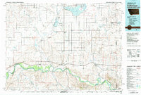
(9)- 1954 Map of Wolf Point, 1967 Print
 1954 Wolf Point1967 Print · USGSNortheastern Montana and the North Dakota borderlands are shown here in the mid-fifties, dominated by the Missouri River and the Fort Peck Indian Reservation. Genealogists and historians can trace the Great Northern rail line through river towns like Poplar and Culbertson or locate northern border outposts like the U S Custom Office at Raymond.2 unique versions available
 - 1958 Map of Wolf Point
 1958 Wolf Point1958 Print · USGSNortheastern Montana is shown during the mid-fifties, featuring the extensive Fort Peck Indian Reservation and the Missouri River valley. Researchers can trace the Great Northern railroad through Wolf Point or locate sites like Slab Crossing and the Coal Mine near Medicine Lake.
 - 1982 Map of Culbertson, 1983 Print
 1982 Culbertson1983 Print · USGSNortheastern Montana at the start of the 1980s reveals a high-plains landscape defined by the Missouri River and the rail lines that served its valley. Genealogists and researchers can trace the townships surrounding Culbertson, Bainville, and the Fort Union Trading Post.
 - 1983 Map of Froid, 1984 Print
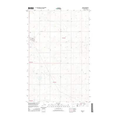
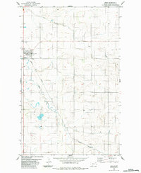 1983 Froid1984 Print · USGSFroid sits at the junction of the prairie and the rails in the early 1980s, serving as a focal point for Roosevelt County ranching. Researchers can locate Kvile Cem, South Cem, and the path of the Burlington Northern railroad alongside winding Sheep Creek.
 - 2011 Map of Froid, 2011 Print
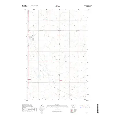
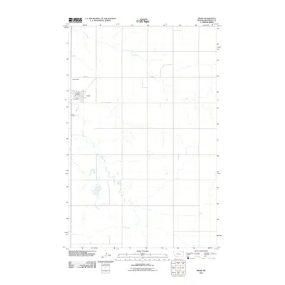 2011 Froid2011 Print · USGSCovers Froid, including Roosevelt County, United States, and other nearby areas
 - 2014 Map of Froid, 2014 Print
 2014 Froid2014 Print · USGSCovers Froid, including Roosevelt County, United States, and other nearby areas
 - 2017 Map of Froid, 2017 Print
 2017 Froid2017 Print · USGSCovers Froid, including Roosevelt County, United States, and other nearby areas
 - 2020 Map of Froid, 2020 Print
 2020 Froid2020 Print · USGSCovers Froid, including Roosevelt County, United States, and other nearby areas
 - 2024 Map of Froid, 2024 Print
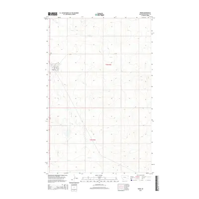
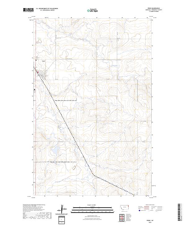 2024 Froid2024 Print · USGSThe town of Froid sits amid the High Plains of Roosevelt County in this contemporary survey of northeastern Montana. Local history researchers can locate Kville Memorial Cem and South Froid Cem while tracing the waters of Lost Creek.
End of results
Showing maps 1-9 of 9
Top cities near Froid
Frequently asked questions
- What are the different types of historical maps available for Froid?
- What is the oldest map of Froid?
- Where can I purchase historical maps of Froid for my home or office?
- Where can I download high-res historical maps of Froid?
- Are there historical topographic maps available for Froid?
- Is there historical aerial imagery available for Froid?
- Where are historical maps of Froid sourced from?