Old Maps of Volt, Wolf Point District for Genealogy
Trace your family roots with 9 historic maps of Volt. These high-res maps reveal old neighborhoods, homesites, landmarks, and streets — helping you uncover where your ancestors lived and how the area evolved over time.
- Explore historic neighborhoods: Identify where your relatives may have lived in the 1800s or 1900s.
- Compare maps over time: Trace the changes in streets, buildings, and landmarks for multi-generational research.
- Perfect for genealogy & ancestry research: Used by family historians and researchers to map out lineage and migration.
These maps are an incredible resource for exploring your personal connection to Volt's past.
Volt, Wolf Point District maps
(9)- 1915 Map of Tule Valley
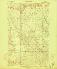 1915 Tule Valley1915 Print · USGSNortheastern Montana is surveyed just before the mid-century as the high plains landscape was defined by open grazing lands and essential waterways. Researchers can trace the original drainage patterns of the Fort Peck Indian Reservation and locate features like Tule Creek and the lone Spring.2 unique versions available
 - 1954 Map of Wolf Point, 1967 Print
 1954 Wolf Point1967 Print · USGSNortheastern Montana and the North Dakota borderlands are shown here in the mid-fifties, dominated by the Missouri River and the Fort Peck Indian Reservation. Genealogists and historians can trace the Great Northern rail line through river towns like Poplar and Culbertson or locate northern border outposts like the U S Custom Office at Raymond.2 unique versions available
 - 1958 Map of Wolf Point
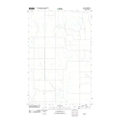
 1958 Wolf Point1958 Print · USGSNortheastern Montana is shown during the mid-fifties, featuring the extensive Fort Peck Indian Reservation and the Missouri River valley. Researchers can trace the Great Northern railroad through Wolf Point or locate sites like Slab Crossing and the Coal Mine near Medicine Lake.
 - 1983 Map of Volt
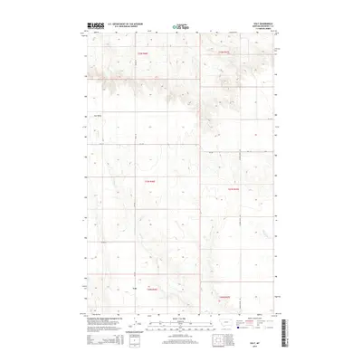
 1983 Volt1983 Print · USGSNortheastern Montana prairie life near the Fort Peck Indian Reservation is captured here in the early eighties. Researchers can locate the settlement of Volt and trace the winding Tule Creek past a local Cem and Grain Bin.
 - 2011 Map of Volt, 2011 Print
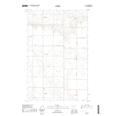
 2011 Volt2011 Print · USGSCovers Volt, including Wolf Point District, Roosevelt County, and other nearby areas
 - 2014 Map of Volt, 2014 Print
 2014 Volt2014 Print · USGSCovers Volt, including Wolf Point District, Roosevelt County, and other nearby areas
 - 2017 Map of Volt, 2017 Print
 2017 Volt2017 Print · USGSCovers Volt, including Wolf Point District, Roosevelt County, and other nearby areas
 - 2020 Map of Volt, 2020 Print
 2020 Volt2020 Print · USGSCovers Volt, including Wolf Point District, Roosevelt County, and other nearby areas
 - 2024 Map of Volt, 2024 Print
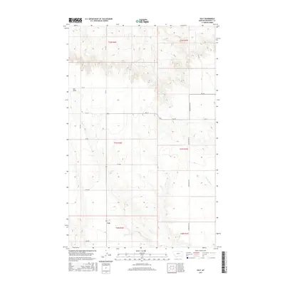
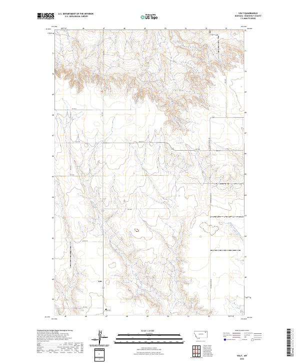 2024 Volt2024 Print · USGSNortheast Montana ranching country is documented here in recent years, centered on the rural hub of Volt. Genealogists and local historians can locate the Volt Cem and trace the drainage patterns of Tule Creek along Lustre Rd and Powder River Rd.
End of results
Showing maps 1-9 of 9
Top cities near Volt
Frequently asked questions
- What are the different types of historical maps available for Volt?
- What is the oldest map of Volt?
- Where can I purchase historical maps of Volt for my home or office?
- Where can I download high-res historical maps of Volt?
- Are there historical topographic maps available for Volt?
- Is there historical aerial imagery available for Volt?
- Where are historical maps of Volt sourced from?