Old Maps of Wolf Point, Wolf Point District for Academic Research
Study the evolution of Wolf Point with 9 high-resolution historic maps. Whether you're teaching, researching, or modeling changes in land use, these maps provide essential visual documentation of urban, environmental, and geographic change.
- Analyze long-term change: Track patterns in development, transportation, and natural features.
- Ideal for environmental or urban studies: Support academic projects with primary historical map data.
- Use in the classroom or lab: Educators and researchers rely on these maps to bring historical context to life.
These maps are a powerful tool for teaching, research, and visualizing how Wolf Point has changed over the decades.
Wolf Point, Wolf Point District maps
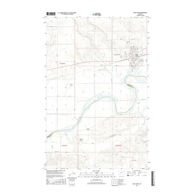
(9)- 1916 Map of Wolf Point
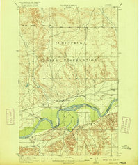 1916 Wolf Point1916 Print · USGSWolf Point and the Missouri River valley are captured here in the years before the First World War. Researchers can trace the early railroad corridor of the Great Northern and find rural landmarks like Oldtown, Macon, and the Randolph School.2 unique versions available
 - 1954 Map of Wolf Point, 1967 Print
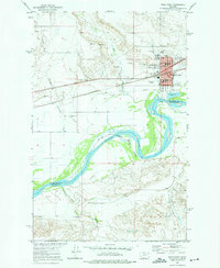
 1954 Wolf Point1967 Print · USGSNortheastern Montana and the North Dakota borderlands are shown here in the mid-fifties, dominated by the Missouri River and the Fort Peck Indian Reservation. Genealogists and historians can trace the Great Northern rail line through river towns like Poplar and Culbertson or locate northern border outposts like the U S Custom Office at Raymond.2 unique versions available
 - 1958 Map of Wolf Point
 1958 Wolf Point1958 Print · USGSNortheastern Montana is shown during the mid-fifties, featuring the extensive Fort Peck Indian Reservation and the Missouri River valley. Researchers can trace the Great Northern railroad through Wolf Point or locate sites like Slab Crossing and the Coal Mine near Medicine Lake.
 - 1972 Map of Wolf Point, 1975 Print
 1972 Wolf Point1975 Print · USGSWolf Point thrives as a river and rail center during the early seventies, positioned along the banks of the Missouri River. Genealogists and historians can trace local institutions like Northside Sch, Greenwood Cem, and the Community Hall.
 - 2011 Map of Wolf Point, 2011 Print
 2011 Wolf Point2011 Print · USGSCovers Wolf Point, including Wolf Point District, Roosevelt County, and other nearby areas
 - 2014 Map of Wolf Point, 2014 Print
 2014 Wolf Point2014 Print · USGSCovers Wolf Point, including Wolf Point District, Roosevelt County, and other nearby areas
 - 2017 Map of Wolf Point, 2017 Print
 2017 Wolf Point2017 Print · USGSCovers Wolf Point, including Wolf Point District, Roosevelt County, and other nearby areas
 - 2020 Map of Wolf Point, 2020 Print
 2020 Wolf Point2020 Print · USGSCovers Wolf Point, including Wolf Point District, Roosevelt County, and other nearby areas
 - 2024 Map of Wolf Point, 2024 Print
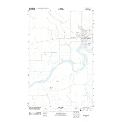
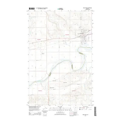
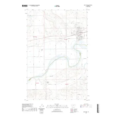
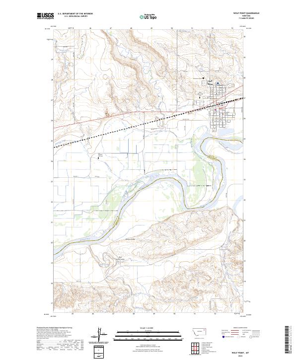 2024 Wolf Point2024 Print · USGSWolf Point and the northern banks of the Missouri River are documented here in recent detail, showing the intersection of local government and the prairie. Researchers can locate family sites at Greenwood Cem or trace the geography of Martin Coulee and Wolf Creek.
End of results
Showing maps 1-9 of 9
Top cities near Wolf Point
Frequently asked questions
- What are the different types of historical maps available for Wolf Point?
- What is the oldest map of Wolf Point?
- Where can I purchase historical maps of Wolf Point for my home or office?
- Where can I download high-res historical maps of Wolf Point?
- Are there historical topographic maps available for Wolf Point?
- Is there historical aerial imagery available for Wolf Point?
- Where are historical maps of Wolf Point sourced from?