Old Maps of Mann, Montana for Academic Research
Study the evolution of Mann with 11 high-resolution historic maps. Whether you're teaching, researching, or modeling changes in land use, these maps provide essential visual documentation of urban, environmental, and geographic change.
- Analyze long-term change: Track patterns in development, transportation, and natural features.
- Ideal for environmental or urban studies: Support academic projects with primary historical map data.
- Use in the classroom or lab: Educators and researchers rely on these maps to bring historical context to life.
These maps are a powerful tool for teaching, research, and visualizing how Mann has changed over the decades.
Mann, MT maps
(11)- 1893 Map of Huntley
 1893 Huntley1893 Print · USGSThe Yellowstone River valley and the Crow Indian Reservation dominate this late nineteenth-century Montana landscape. Genealogists and researchers can trace the early rail corridor of the Northern Pacific Railroad through Huntley and the station at Clermont.6 unique versions available
 - 1954 Map of Billings, 1963 Print
 1954 Billings1963 Print · USGSThe Yellowstone valley during the mid-fifties shows a landscape of thriving rail towns and high-mountain outposts. Genealogists and historians can trace old homesteads and mining routes near Red Lodge, Bearcreek, and along the Bighorn River.4 unique versions available
 - 1957 Map of Billings
 1957 Billings1957 Print · USGSThe Yellowstone River valley and the rugged Beartooth Mountains meet in the mid-1950s near the growing hub of Billings. Genealogists and researchers can trace rail and ranching history through river towns like Columbus, the mining heritage of Red Lodge, and the vast Crow Indian Reservation.
 - 1958 Map of Billings
 1958 Billings1958 Print · USGSMid-century Montana comes alive in this survey of the Yellowstone Valley as the regional rail and road networks reached their peak. Trace family roots and old routes near Billings, the Crow Indian Reservation, and the heights of the Beartooth Mountains.2 unique versions available
 - 1967 Map of Nibbe, 1971 Print
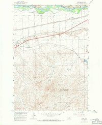 1967 Nibbe1971 Print · USGSThe Yellowstone River valley is captured here in the late sixties, showing the vital intersection of pioneer history and mid-century irrigation. Trace the Lewis and Clark Trail alongside the rail lines at Nibbe and the landmark Pompeys Pillar.2 unique versions available
 - 1989 Map of Billings
 1989 Billings1989 Print · USGSThe Billings area in the late eighties shows a major regional hub at the height of its rail and river influence. Genealogists and historians can trace the development of outlying towns like Worden and Park City or the boundaries of the Crow Indian Reservation.
 - 2011 Map of Nibbe, 2011 Print
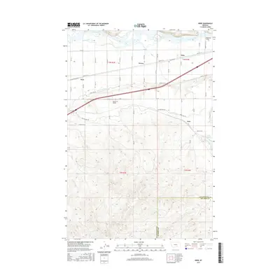
 2011 Nibbe2011 Print · USGSCovers Mann, including Newton, Anita, and other nearby areas
 - 2014 Map of Nibbe, 2014 Print
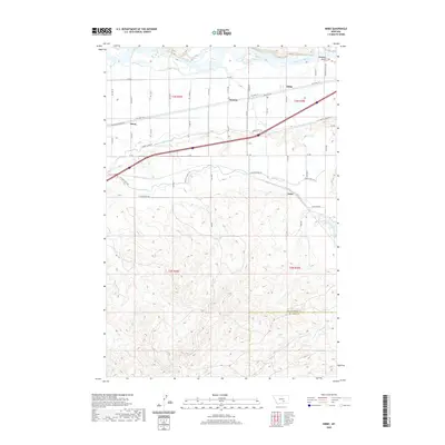
 2014 Nibbe2014 Print · USGSCovers Mann, including Newton, Anita, and other nearby areas
 - 2017 Map of Nibbe, 2017 Print
 2017 Nibbe2017 Print · USGSCovers Mann, including Newton, Anita, and other nearby areas
 - 2020 Map of Nibbe, 2020 Print
 2020 Nibbe2020 Print · USGSCovers Mann, including Newton, Anita, and other nearby areas
 - 2024 Map of Nibbe, 2024 Print
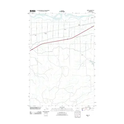
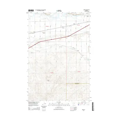
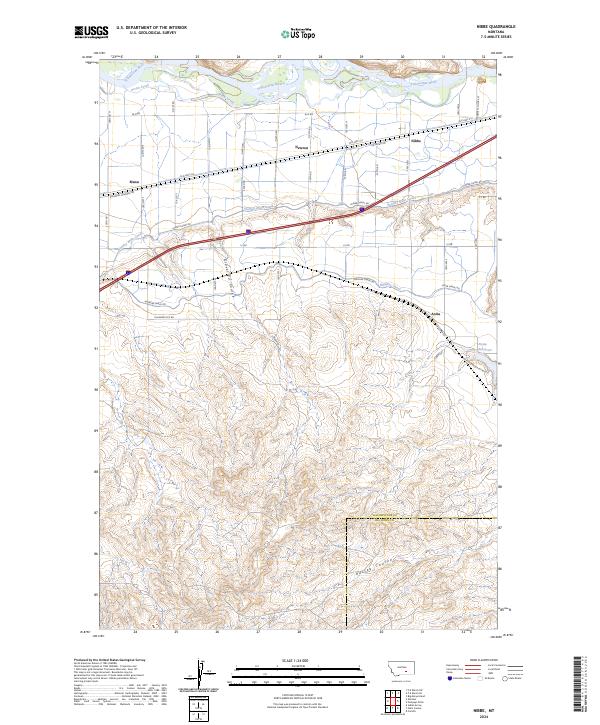 2024 Nibbe2024 Print · USGSThe Yellowstone River valley is captured here during its modern agricultural era, showing the intricate irrigation systems south of the river. Genealogists and historians can trace local family land near Nibbe, Anita, and Newton or study the terrain around Barley Coulee.
End of results
Showing maps 1-11 of 11
Frequently asked questions
- What are the different types of historical maps available for Mann?
- What is the oldest map of Mann?
- Where can I purchase historical maps of Mann for my home or office?
- Where can I download high-res historical maps of Mann?
- Are there historical topographic maps available for Mann?
- Is there historical aerial imagery available for Mann?
- Where are historical maps of Mann sourced from?