Old Maps of Adams County, Nebraska for Hiking & Exploration
Hike through history with 91 historic maps of Adams County. Explore old trails, ghost towns, and forgotten backroads — perfect for outdoor adventurers and local explorers.
- Rediscover forgotten places: Map out old mining camps, roads, and footpaths that no longer exist on modern maps.
- Layer with modern tools: Combine with LiDAR or satellite views to plan hikes through historical terrain.
- Made for exploration: Popular among hikers, overlanders, and local history lovers.
Use these maps to find adventure and explore the hidden past of Adams County.
Adams County, NE maps
(91)- 1894 Map of Kenesaw
 1894 Kenesaw1894 Print · USGSRailroad development and the complex channels of the Platte River dominate the Nebraska landscape in the 1890s. Genealogists and historians can trace the early town plats of Kenesaw and Juniata or locate the historic Wood River Bridge.
 - 1896 Map of Wood River
 1896 Wood River1896 Print · USGSCentral Nebraska at the close of the nineteenth century is defined by its massive river islands and burgeoning rail towns. Local historians can trace early prairie commerce through the rail lines connecting Wood River, Shelton, and the distinctive Sugar Bowl terrain.4 unique versions available
 - 1897 Map of Red Cloud
 1897 Red Cloud1897 Print · USGSSouthern Nebraska and the Kansas borderlands were being transformed by heavy rail expansion in the 1890s. Genealogists can trace family farmsteads near Red Cloud and Minden, or follow the Republican River to see the early layouts of Riverton and Franklin.4 unique versions available
 - 1898 Map of Superior
 1898 Superior1898 Print · USGSSouthern Nebraska and northern Kansas were dominated by a growing rail network in the late nineteenth century. Genealogists can trace family roots through early settlements like Superior, Nelson, and Guide Rock, or locate vanished tracks of the Kansas City and Omaha R. R.3 unique versions available
 - 1898 Map of Grand Island
 1898 Grand Island1898 Print · USGSCentral Nebraska is captured in the late 1890s as a bustling rail and agricultural crossroads centered on the Platte River. Genealogists and historians can trace early settlements like Doniphan and Harvard or the grounds of the Insane Asylum outside Hastings.4 unique versions available
 - 1955 Map of Grand Island, 1967 Print
 1955 Grand Island1967 Print · USGSCentral Nebraska is seen here during a period of industrial and agricultural growth, centered on the vital Platte River corridor. Researchers can trace the mid-century footprints of the U S Naval Ammunition Depot and the Cornhusker Ordnance Plant.3 unique versions available
 - 1957 Map of Grand Island
 1957 Grand Island1957 Print · USGSCentral Nebraska and Northern Kansas are shown here during a period of massive hydraulic and military expansion in the mid-fifties. Researchers can trace the development of the Harlan County Reservoir and the massive wartime legacy of the Cornhusker Ordnance Plant.
 - 1958 Map of Grand Island
 1958 Grand Island1958 Print · USGSSouth-central Nebraska thrived as a rail and industrial hub during the late fifties, shaped by the braided Platte River. Genealogists and historians can trace rail lines like the Union Pacific RR through towns such as Kearney or locate the sprawling Cornhusker Ordnance Plant.
 - 1962 Map of Denman, 1963 Print
 1962 Denman1963 Print · USGSThe braided Platte River channels define this Nebraska landscape in the early sixties as agricultural irrigation and modern highways transformed the valley. Genealogists and rail historians can trace the paths of the Union Pacific and Chicago Burlington and Quincy through Denman and Kenesaw.3 unique versions available
 - 1962 Map of Prosser, 1963 Print
 1962 Prosser1963 Print · USGSThe braided channels of the Platte River and the Union Pacific rail line defined life in rural Adams and Hall Counties during the early sixties. Researchers can trace family history through sites like Hayland, School No 87, and Concordia Cem.2 unique versions available
 - 1969 Map of Hastings East, 1971 Print
 1969 Hastings East1971 Print · USGSThe prairie east of Hastings in the late sixties is dominated by a sprawling defense landscape and rail corridors. Trace the infrastructure of the U S Naval Ammunition Depot (Abandoned) or locate family sites like St Pauls Ch and Inland Cem.
 - 1969 Map of Lawrence, 1971 Print
 1969 Lawrence1971 Print · USGSLawrence and its neighboring rural communities are captured here in the late sixties at the junction of the Nebraska grain railways. Genealogists and local historians can trace family locations near St Stephens, Rosemont, and Oak Creek Cem.
 - 1969 Map of Blue Hill, 1971 Print
 1969 Blue Hill1971 Print · USGSBlue Hill sits at a historic railroad junction in 1960s Nebraska, where the Burlington Northern line crosses the plains. Genealogists can trace local roots through Trinity, Walker, and Blue Hill cemeteries or follow the waters of Little Blue.
 - 1969 Map of Trumbull, 1971 Print
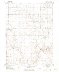 1969 Trumbull1971 Print · USGSNear the intersection of four Nebraska counties in the late sixties, this survey shows a thriving agricultural hub shaped by rail and river. Researchers can pinpoint School No 33, the Greenwood Cem, and the village of Trumbull along the Burlington Northern.
 - 1969 Map of Holstein, 1971 Print
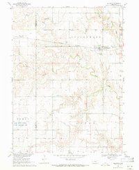 1969 Holstein1971 Print · USGSThe rural landscape of Adams and Kearney Counties comes into focus during the late sixties, centered on the railroad town of Holstein. Genealogists and historians can trace local cemetery sites like Morseville Cem and Logan Cem or locate the Jensen Lagoon National Wildlife Management Area.
 - 1969 Map of Hastings West, 1971 Print
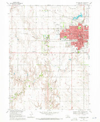 1969 Hastings West1971 Print · USGSHastings was expanding westward in the late 1960s, balancing its growing suburban residential grid against its deep-rooted rail and agricultural ties. Researchers can trace the massive Hastings State Hospital complex and local landmarks like the Crosier Monastery and Highland Cem.3 unique versions available
 - 1969 Map of Roseland, 1971 Print
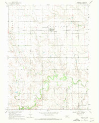 1969 Roseland1971 Print · USGSAdams County farming life and the vital rail corridor of the late sixties are centered here around Roseland. Family historians can trace local landmarks like Silver Lake Cem, the Mennonite Cem, and the path of the Little Blue River.
 - 1969 Map of Campbell, 1971 Print
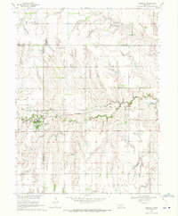 1969 Campbell1971 Print · USGSThe village of Campbell and the surrounding agricultural townships of south-central Nebraska are captured here in the late sixties. Researchers can trace the Burlington Northern rail line and locate several rural burial grounds like St Ann Cem and Koch Cem.
 - 1969 Map of Bladen, 1971 Print
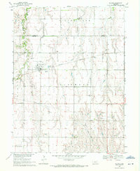 1969 Bladen1971 Print · USGSThe village of Bladen is captured in the late sixties along the Burlington Northern line. Genealogists can locate family sites at East Lawn Cem, Plainview Cem, and Cloverton Cem scattered across the prairie.
 - 1969 Map of Hastings NW, 1971 Print
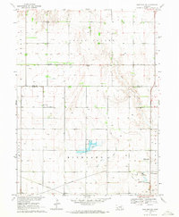 1969 Hastings NW1971 Print · USGSAdams County farmland meets the Big Blue River in the late sixties as the regional landscape undergoes modernization. Genealogists and historians can trace the Union Pacific rail line past Highland Ch, Rosedale, and the Kernan Lagoon.2 unique versions available
 - 1969 Map of Juniata, 1972 Print
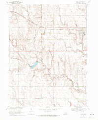 1969 Juniata1972 Print · USGSAdams County's agricultural heartland is captured here in the late sixties, showcasing a landscape of sprawling fields and prairie drainage. Researchers can trace family roots at Juniata Cem and locate the small settlement of Assumption near the winding Thirtyone Mile Creek.
 - 1969 Map of Ayr, 1972 Print
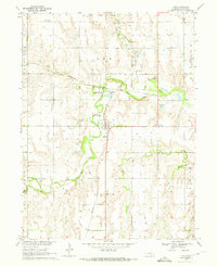 1969 Ayr1972 Print · USGSAdams County's agricultural heartland is documented here in the late sixties as the village of Ayr remained a vital rail and river crossing. Researchers can trace family roots at Mt Pleasant Cem or follow the Old Railroad Grade and the banks of the Little Blue River.
 - 1969 Map of Kenesaw, 1972 Print
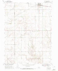 1969 Kenesaw1972 Print · USGSAgricultural life in Adams County during the late sixties is centered on the railroad town of Kenesaw. Genealogists and local historians can trace family ties at the Kenesaw Cem and Shiloh Cem, or locate the isolated Grave site near Cottonwood Creek.
 - 1969 Map of Pauline, 1972 Print
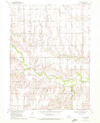 1969 Pauline1972 Print · USGSThe rural agricultural landscapes of south-central Nebraska are captured here in the late sixties, centered on the Little Blue River valley. Genealogists and local historians can trace the foundations of Pauline and locate landmarks like Hanover Ch and School No 75.
 - 1983 Map of Hastings East, 1984 Print
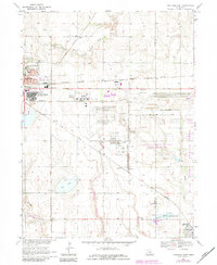 1983 Hastings East1984 Print · USGSHastings and the Adams County countryside are captured here in the early eighties, showing a landscape defined by rail and military history. Genealogists and local historians can locate Mount Sinai Ch, Parkview Cem, and the small community of Glenville.
Showing maps 1-25 of 91
Top cities of Adams County
- Hastings historical maps
- Kenesaw historical maps
- Juniata historical maps
- Blaine historical maps
- Roseland historical maps
- Holstein historical maps
See more
Frequently asked questions
- What are the different types of historical maps available for Adams County?
- What is the oldest map of Adams County?
- Where can I purchase historical maps of Adams County for my home or office?
- Where can I download high-res historical maps of Adams County?
- Are there historical topographic maps available for Adams County?
- Is there historical aerial imagery available for Adams County?
- Where are historical maps of Adams County sourced from?