1970s Maps of Arthur County, Nebraska
Explore 5 historic maps of Arthur County from the 1970s. These maps offer a rare glimpse into what life looked like during the 1970s — showing old roads, neighborhoods, homes, and landmarks that have changed or disappeared over time.
Whether you're researching your family's past, planning a metal detecting trip, or studying how Arthur County's landscape evolved across the 1970s, these high-resolution maps are a powerful tool for exploring the history of this region.
- Focus on a specific era: All maps on this page are from the 1970s, giving you a focused view of this time period.
- See what’s changed: Compare century-old streets, trails, and buildings to today's modern landscape using overlays and satellite layers.
- Research with precision: Use these maps for genealogy, historical research, land use analysis, or educational projects.
- View, download, or print: Maps are fully viewable online in high resolution, and can be downloaded or printed for your own records.
Start exploring Arthur County's history through authentic maps from the 1970s. This is your window into the past.
Arthur County, NE maps
(5)- 1971 Map of Bear Hill, 1973 Print
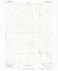
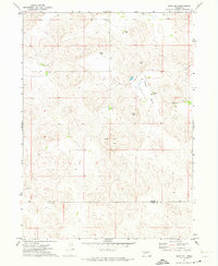 1971 Bear Hill1973 Print · USGSThe Nebraska Sandhills on the border of Arthur and Keith counties are captured here in the early 1970s. Researchers can locate remote family operations like McKeag Ranch and Enfield Ranch or trace the geography of Indian Valley.
 - 1971 Map of Packard Ranch, 1973 Print
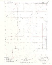 1971 Packard Ranch1973 Print · USGSThe Nebraska Sandhills in the early seventies reveal a landscape defined by generational cattle operations and high-plains isolation. Researchers can trace family land at the Packard Ranch, Larsen Ranch, and School No 4 tucked into Thoelecke Valley.2 unique versions available
 - 1971 Map of Spotted Horse Valley, 1973 Print
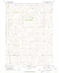 1971 Spotted Horse Valley1973 Print · USGSThe ranching country of the Nebraska Sandhills is captured here in the early seventies at the Arthur and Keith county line. Genealogists and local historians can trace family operations like the Vasa Ranch, Williams Ranch, and the site of School No 55.
 - 1971 Map of Williams Ranch, 1974 Print
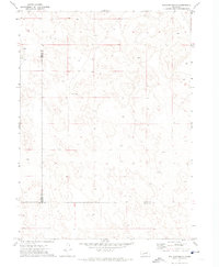 1971 Williams Ranch1974 Print · USGSCattle ranching in the Nebraska Sandhills is documented in the early 1970s at the junction of three counties. Genealogists and researchers can trace local land use through family-named sites like Williams Ranch and Orr Ranch alongside numerous remote water Well locations.
 - 1972 Map of Bucktail Lake, 1975 Print
 1972 Bucktail Lake1975 Print · USGSThe Nebraska Sandhills in the early seventies reveal a world of isolated cattle operations and seasonal waters. Genealogists and land historians can trace family holdings like Bucktail Ranch, Lawler Ranch, and the drainages of W Birdwood Creek.
End of results
Showing maps 1-5 of 5
Top cities of Arthur County
Frequently asked questions
- What are the different types of historical maps available for Arthur County?
- What is the oldest map of Arthur County?
- Where can I purchase historical maps of Arthur County for my home or office?
- Where can I download high-res historical maps of Arthur County?
- Are there historical topographic maps available for Arthur County?
- Is there historical aerial imagery available for Arthur County?
- Where are historical maps of Arthur County sourced from?