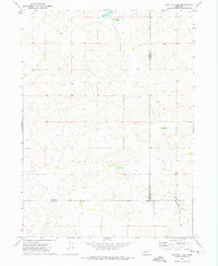
1972 Map of Bucktail Lake
USGS Topo · Published 1975About this map
Bucktail Lake and its surrounding ranch lands define this interior portion of the Nebraska Sandhills during the early 1970s. The landscape is marked by the distinct operations of Bucktail Ranch, Green Valley Ranch, and Lawler Ranch, reflecting a sparsely populated region where large-scale cattle ranching is the primary economic driver. Mapping efforts from the U.S. Geological Survey capture the intersection of Arthur, McPherson, and Keith counties, a remote area where water resources are critical for survival. The presence of Well 3406 and the headwaters of W Birdwood Creek illustrate the reliance on groundwater and seasonal drainages in this high-plains environment. This survey provides a precise record of section lines, fence boundaries, and unimproved trails that supported the rural logistics of the era.
Find a feature on this map
9 named features on this map. Tap any name to fly to it.
Don’t see what you’re looking for? This feature index may not catch every label — zoom into the map to look around manually.
Map Details
Editions of this 1972 Bucktail Lake Map
This is the sole edition of this map. No revisions or reprints were ever made.
Other maps of this area

1897 · Ogallala
USGS Topo · 1:125,000

1898 · Paxton
USGS Topo · 1:125,000

1900 · Ogallala
USGS Topo · 1:125,000

1901 · Paxton
USGS Topo · 1:125,000

1949 · Arthur
USGS Topo · 1:62,500

1949 · Flats
USGS Topo · 1:62,500

1950 · Flats
USGS Topo · 1:62,500

1950 · Arthur
USGS Topo · 1:62,500

1954 · North Platte
USGS Topo · 1:250,000

1956 · North Platte
USGS Topo · 1:250,000