
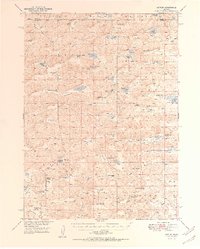
1950 Map of Arthur
USGS Topo · Published 1950About this map
The village of Arthur serves as the focal point for this 1950 survey of the Nebraska Sandhills, a landscape defined by expansive valleys and localized watering holes. The settlement pattern is characterized by widely dispersed family operations such as the A Walz Ranch, Lute Ranch, and Eymann Ranch, illustrating the vast distances inherent to cattle ranching in Arthur and Grant Counties. Water management is central to life here, evidenced by numerous flowing wells and uniquely named bodies of water like Bean Soup Lake, Claw Hammer Lake, and Sand Puddin Lake.
Find a feature on this map
53 named features on this map. Tap any name to fly to it.
Don’t see what you’re looking for? This feature index may not catch every label — zoom into the map to look around manually.
Map Details
Editions of this 1950 Arthur Map
2 editions found
Other maps of this area

1897 · Ogallala
USGS Topo · 1:125,000

1898 · Paxton
USGS Topo · 1:125,000

1900 · Ogallala
USGS Topo · 1:125,000

1901 · Paxton
USGS Topo · 1:125,000

1948 · Carr Lake
USGS Topo · 1:62,500

1948 · George Lake
USGS Topo · 1:62,500

1948 · Spring Valley
USGS Topo · 1:62,500

1949 · Arthur
USGS Topo · 1:62,500

1949 · Flats
USGS Topo · 1:62,500

1950 · Flats
USGS Topo · 1:62,500